Sunday, 27 December 2009

Waitakere Ranges Regional Park: Pararaha Stream and surrounds


Although spending the first 20-odd years of my life in Auckland the Waitakere Range, to the west of the city is an area I have not explored.


Where in Auckland do you find a Topographical Map?

As a Wellington resident and tramper over the past decade, I have been startled by the number of lost persons requiring assistance from search and rescue in this area. At times it seemed like it was a rite of passage for being an Aucklander to get lost in the Waitakere Ranges!! On Boxing Day I visited four different outdoor equipment stores on Auckland’s North Shore in an effort to buy some topographical maps of this area. To my disgust most of these stores did not stock topographical maps at all, looked at me strangely when I used a big long word like “topographical” and referred me to the bookstore that could offer me no more than a a street directory for my car or a globe for my desk!! The one store that seemed to fully understand the word “topographical” mostly had maps of the sections of the Mt Aspiring and Fiordland National Parks that are well tracked, but in the lower half of the South Island.


Fortunately they were able to find a single copy of “NZTopo50-BB30ptBB31”. However, due to the peculiarities of the new NZTopo50 grid, even though this map includes some the adjacent BB31 map it still contains over 70% sea. This gave me coverage for about one third of the range, in the south-western corner of the Waitakere Ranges Regional Park.

Pararaha Stream and Surrounds

Trip Data:
Distance: 10.8 km 1,089 Calories
Time: 4:03 22min/km
Elevation: Ascent: 1696m Descent: 1685m
Ride Data: Garmin Connect Player
Location: Auckland, NZ 27 December 2009

Buck Taylor Track

My nephew, Jamie and I headed down the Buck Taylor Track from the Lone Kauri Rd

carpark. This track begins as a very broad, well cut walking track at the carpark before becoming narrower, muddier and steeper tramping track with the easily negotiated rocks, tree roots and slippery clay during the descent down into Pararaha Bay. Approac

hing the bay there is a junction offering the worthwhile 10 minute side-trip to the lagoon. At 2.4km or 46 minutes from the road-end we reached the black sand dunes between a sizable lagoon and the beach with crashing waves from the Tasman Sea. With numerous dragon-fly munching away on small insects we decided to have a quick munch on some snack bars too.


The track signposts along this coastal area all marked the soon to be opened Hillary Trail, which will offer the first documented multi-day tramping route in the Waitakare Ranges.

Pararaha Stream

From the beach, travelling past the side-trip junction and towards the Muir Track a crossing of the Pararaha Stream is reached about 10 minutes along the track. Shortly after this stream crossing we could hear Kereru in the bush on the true left-side of the Pararaha Stream.  1.1km/20 minutes along the Muir Track the Les Ward Shelter and Pararaha campsite (permit required) is reached. From the shelter you can drop down to the picturesque Pararaha Stream where initially you can follow a well worn, but not official track present on the true-left side of the stream before disappearing as we negotiated the stream past some wonderful swimming hills and pretty terraced waterfalls. Even better was both combined so I could not resist the chance for a quick swim on the warm day in pool under one of the terraced waterfalls.


About 500m/40 minutes from the Les Ward Shelter we reached large boulders and a larger waterfall. The valley was narrowing to become canyon-isque and after climbing the second set of boulders, which had a log jam over moving water leading the next series we decided it was best not to proceed directly up the stream.

Besides, I would have been in so much trouble with my sister if I got my nephew and I trapped in the middle of a canyon

Looking at the surrounding terrain, and considering the well trodden track further downstream I thought there may have a trail up a gully to our left, on the true right of the Pararaha Stream but on this occasion I failed to see where it left the stream. Now home, and with access to broadband, my blindness becomes completely evident from this page on tramper.co.nz:

At a deep pool 30 minutes from the campsite, a track climbs out on the true right. This track clambers steeply past a larger waterfall to a striking pair of kauri. Above the fall, the stream eases off, and a couple more deep pools are avoided by tracks on the true left. Watch for these: they are very easy to miss.

Muir Ridge Track Odlin Timber Tracks

After wandering through the beautiful Pararaha Stream, following the tracks back to the car were certainly nowhere near as memorable.


The Muir Track is exactly how all uphill tramping tracks should be. Short, sweet and straight up! A 260m climb from the shelter in 27min/1.1km. At the top you reach a track junction with Gibbons Track to the SE and Walker Ridge track to the NE both offering less steep travel.

Walker Ridge Track

The Walker Ridge track offers fast, generally flat travel for 50min/2.7km to pt378, “Orange Peel Corner” junction with the Huia Ridge (NE) and Odlin Timber  (NW) Tracks.

Odlin Timber Track

The Odlin Timber Track (45min/2.5km) is mostly downhill from “Orange Peel Corner” although it climbs up steps from the point at which the top of the Pararaha Stream. It reaches the road shortly before the carpark travelling marginally inside the bush parallel to it for the last 150m. The “Odlins 2” campsite it passes looks like a nice spot, although so near the road-end I am neither sure how much it is used or where “Odlins 1” is located.


That said, the Auckland Regional Council seem unsure of where “Odlins 2” is located, given their location description:

Odlins 2 Campground
Small tent sites, tramping access from Lone Kauri Rd.
   Camping site
   Bookable: Yes
   Directions: Park at car park on Lone Kauri Road. Walk 2.8 km up Odlins Timper Track.
   Grade: Back Country Site
   Camping mode: Small tent sites

Ummm, correct me if I am wrong, but I believe that this is beyond the Odlins Timber track? It is only 2.5km long :). I’m pretty sure that the campsite is 1.7km from the road-end near where the track crosses the Cowan Stream? Perhaps the council could not find a topographical map either :D.



Saturday, 28 November 2009

A spluttering and deflated Lake Taupo Cycle Challenge 2009

I knew I was going to be struggling to pull out an always sought after PB around the Lake this year. Not only were my times in the lead-in events far below my PB’s from prior years (which always disappoints me), but I had picked up this awful cough and cold that everyone seems to have the moment. Well, perhaps not quite everyone, but it is certainly prevalent with every bus or train I catch at the moment.

Ride Data:
Distance: 156km 7,543 Calories
Time: 6:06:06 25.6 km/h
Elevation: Ascent: 1704m Descent: 1718m
Ride Data: Garmin Connect Player
Location: Taupo, NZ 28 November 2009
Craig's Taupo Results
2006 5:34:38
2007 4:58:36
2008 5:34:54
2009 6:06:06


As I coughed and spluttered my way up the hills that make up the first half of the race. Some time taken pondering if I would make the finish. I persevered on and was fortunate to have two other riders around me that seemed to be ending up in the same place regardless of incline or road surface. This always gave the ability to surge back onto the bunch as we fell a short way off the back approaching the crest of each hill.


With a steady south-westerly breeze blowing at 30-40km/h there wasn’t exactly no wind, but among those in the bunches it seemed those whom had ridden in the Tour of the Wairarapa two weeks ago had failed to notice it :>. Complaining of the breeze could be heard from numerous cyclists whose hometowns were not listed as Wellington on their race numbers :).


Having never before had a puncture during a cycle event I was mortified and deflated after only 68km - on the top of the Waihaha hills. Not only do I not get punctures during events, but this was an evil and slightly unusual front-wheel puncture! (Rear-wheel punctures being the norm due to higher weight loads on the wheel)


From analysing the data from my Garmin Edge 705 I was able to ascertain that it took 8:40 to:

  • Curse at the fact I had a puncture
  • Remind myself that I do not get punctures
  • Pull out my tools
  • Curse the fact that I had a puncture
  • Check for sharp objects in the tyre lining
  • Swap the tube
  • Cuss to myself some more about the fact I had a puncture
  • Re-inflate the tyre.

While the Garmin does indeed collect much data, like all technology it has its limitations and cannot distinguish between the productive time spent actually changing the tyre and the unproductive time spent cursing the fact that I had an evil puncture.


Once moving again my motivation was totally lacking and with some rain around Kuratau I really could not be bothered and rode gently and continued moaning to self about getting the puncture. All up, including all the cursing and reduced motivation a puncture is probably an extra 20-30 minutes of time on the road during an event like this.


With 50km to go I picked up a sizable bunch to travel along SH1 at good speed, giving me a few glimmers of hope that I could at least make it in under 6 hours. Unfortunately, the rumours of a specially built cyclist-only tunnel under Hatepe Hill were proven false. T

With evil cough and an evil puncture I finished in my “personal worst” time of six hours and six minutes and six seconds. Ugh! 6-6-6!

Sunday, 15 November 2009

Tour of the Wairarapa 2009 - ‘twas a fraction windy

It could only be described as ominous as I drove past wind warning signs on thw way over the Rimutaka Hill, en-route to the start of the Tour of the Wairarapa. The registration area at the Lakeview School was more sheltered than the surrounding areas. It was humourous when one of my work colleagues who had entered the event declared:

At least its not too windy

Well matey the rest of us don’t use our bicycles in the pursuit of the activity known as Storm Chasing. Perhaps you would like to head stateside and chase some real storms?

Ride Data:
Distance: 112km 5,328 Calories
Time: 4:26:26 25.2 km/h
Elevation: Ascent: 984m Descent: 932m
Ride Data: Garmin Connect Player MapMyRide
Location: Masterton, NZ 15 November 2009
My Tour of The Wairarapa Results
2006 3:18:13 (100km@30.3)
2007 2:42:47 (100km@36.9)
2008 4:19:57 (112km@26.1)
2009 4:26:26 (112km@25.2)


He of course had the last laugh by finishing a long, long way in front of me. Obviously not too much of a breeze for him. Phew, I kept within an hour – just!


Like in 2008, the date of this event clashed with Toast Martinborough. To avoid traffic, the course was relocated to the 112km version from Masterton, out to Dreyers Rock, looping around Alfredton and Eketahuna back to Dryers Rock before the return to Masterton.


I began the race in a bunch over the first 40-odd kilometres and we were travelling between a comfortable 35km/h or a struggling 20km/h depending on the angle of the wind. Mostly an interlaced mixture of heinous crosswinds and evil headwinds, with rare but appreciated brief tailwinds. The weather station at nearby Castlepoint picked up a gust at 139km/h during this time which verified it was not just our imaginations making this an epic ride. The road over this section is very coarse chipseal, with some areas of delamination making for rough ride. I was definitely appreciating a smoother ride this year having upgraded from an aluminium frame to the carbon of my Specialized Roubaix.


As has been the case with my riding of late, I was unable to hang-on to the bunch as we hit the hills from Alfredton to Eketahuna. Following the descent Into the wind I was unable to bridge the gap spent some 10km following the bunch by 50-100m. I was desperate to rejoin the bunch and find some respite from the wind. Sadly, I didn’t have enough in me to bridge the gap :(.


From a self-diagnosis point of view, I’m certain that I have sub-consciously grinding up the hills rather than “spinning” with a high cadence. This is something I am going to have train back into me for 2010. Have been well of the pace this year!


Thankfully once reaching Eketahuna there were more tailwinds, and smoother road surfaces. This ensured that while I was tired, and had no bunches for drafting the second 56km was no slower than the first.


I eventually made the finish, almost seven minutes slower than last year. It was certainly more enjoyable riding in the gale-force wind than on a broken wheel last year. There were numerous times during the event where I had to make substantial steering corrections in the fresh and gusty breeze. It was great to hear that there were no injuries to any competitors during this event. I suspect the presence of the ever imminent threat of being blown to the next province ensured our fellow riders maintained their concentration and kept the rubber side down.


Sunday, 8 November 2009

Martinborough Charity Fun Ride 2009 – I’m slow this year

I really disappointed myself with my time in my fourth annual ride in the Martinborough Charity Fun Ride. Yes, I was sore from last weeks epic in the Coromandel but really I’m plain not fit enough this cycling season. Not only was it not a PB, but it was a awfully slow PW (Personal Worst)!.
Ride Data:
Distance: 113km 5,416 Calories
Time: 4:06:43 (PW by 14 minutes) 27.4 km/h
Elevation: Ascent: 1,132m Descent: 936m
Ride Data: Garmin Connect Player
Location: Martinborough, NZ 8 November 2009
Craig's MCFR Results
2006 3:52?
2007 3:36:04
2008 3:45:51
2009 4:06:43

I was unable to remain in bunch while ascending even these benign hills. I am stunned how much my hill climbing has completely deserted me this year. It is vividly clear that this is the main element that I will need on in training. I have never been an ultra-thin, borderline anorexic able to boast of superior power to weight ratios when climbing hills. But, I am certainly used to being a lot stronger on the hills than I currently find myself. Lots and lots of training to do! Ugh! The dreaded hill repeats!!

Unfortunately with a breeze around, I was not able to make it back to the bunch after the descents. This left me far too much work to do and I was just wasn’t fit enough for it. It is not looking up for a good lap around the small pond of Lake Taupo in a few weeks :(.

Saturday, 31 October 2009

2009 Kuaotunu 2 (K2): Ouch, I feel broken now


Last year I bent a chain-link on the first hill in this event. In 2009 I was sure I could do better and get that PB. I started strongly (for me) but couldn’t say so much for the rest of event :>. This is a very hard and torturous course with all ample climbing that brings awesome scenery with it. I rate this as the best organised and marshalled event that I have entered.


in a nutshell everything is perfect aside from the fact that I am no good at it. 


Broken me, was 8 seconds quicker than I was last year when I bent a link in my chain. Lets call it work in progress :). I think that even for slow climbing me, sub-8 hours is achievable. That said, I am still a long way from that! My average speeds are well down on my PB’s in most events at the moment and something I need to prioritise rectifying!


Ride Data:
Distance: 185.01km 8,919 Calories
Time: 9:37:32* (New PB by 8 seconds) 19.2 km/h
Elevation: Ascent: 2,559m Descent: 2558m
Ride Data: Garmin Connect Player MapMyRide
Location: Whitianga, NZ 31 October 2009

With the annual town rotation in this well organised event, the 2009 edition started from Whitianga.  Undoubtedly the hardest quarter of the event with three categorised hills over this 43km on the way to Coromandel Town:

  • Kuaotuna (150m, category 2)
  • Myundermans (145m, category 1)
  • Whangapoua (380m, Hors Categorie)

There was a nasty looking crash that was being cleaned up by St John on the descent of the category 2 Kuaotuna Hill. It is never to nice to see riders off their bikes and spread over the terrain - especially this early in an event.


Even with all this climbing I did manage to find myself riding mostly with riders in the group that started just ahead of me. I was very happy to be passing through Coromandel Town in about 1:52. Some 28 minutes ahead of the time this section took me last year and I was elated to be well on track to finish under my stated goal of under eight hours.


When thinking of the Coromandel – Thames section there may be a tendency to think of the flattish, long coastal section around to Thames. However, the first 20km of this section begins with what I must describe as the “forgotten hills” of this event. The innocuous hills of

  • Manaia (141m, category 3)
  • Kereta (228m, category 4)

can be felt in your legs following the hills of the previous 43km.  This collection of hills certainly could not be described as “gently rolling”.


Unfortunately I  must have leaned too far or done something weird on the ascent of Kereta. I have never ever been so sore on my bicycle before. I pinched something in my back, just above my right hip and was barely able to move. Still not sure how I managed this. I couldn’t help but think how I climb an equivalent hill on the way home from work every night!! Many brief pauses were in order as I struggled on. As Lance Armstrong said:

Pain is temporary
Quitting is forever

And this was to be motto rolling through my head for the next several hours as I still had 120km or so to ride on. In agony, I found myself isolated from bunches and while very scenic it did seem like the headwind the whole way back to Whitianga from here.


As I look to improve my time in future events this is the section that I am sure I can improve on. Get in a bunch, and knocking off 30-50 minutes from this section should not be too difficult!


Estimated section differences to 2008: 2009 2008 Difference
Whitianga to Coromandel Town (43km): 1:52:19 2:21:01 -28:42
Coromandel Town to Thames (53km): 2:51:41 2:44:48 +7:04
Thames to Tairua (53km): 2:36:30 2:30:00 +6:30
Whitianga to Coromandel Town (43km): 2:17:01 2:02:02 +14:59


Now my sore back was not in quite so much agony, a further 30km of flatish riding down the road at Thames. The small bump of Kopu – Hikuai ahead of me to ascend before dropping into Tairua.

  • Kopu – Hikuai (425m, category 5)

Although sore, this bump seemed far easier to ascend than last year. I put this down to a 425m hill when you have already 160 kilometres is going to feel harder than when you have only ridden 100! I certainly had a heavy head wind on the descent, with my maximum speed only getting  to about 70km/h. A good 30km/h down on last years rapid descent :(.


Feeling tired, the area known as Broken Hills sure were breaking me. This is a section of innocuously tiny hills that are easily forgotten about as you dream of a fast descent straight into Tairua, but no it is about another 30km/h from the bottom of Kopu - Hukuai into Tairua.


Heading into Tairua I start swapping places with a rider from Auckland. Once we were over our final major bump

  • Pumpkin Hill (240m, category 3)

we tried to give each other some drafting as we rode like crippled old men I am sure it didn’t look too classy. Thanks to the volunteers at the water stop with the jellybeans at the top of Pumpkin, and for stopping with some more as you drove back to Whitanga :). Much appreciated!!


I am not sure what was the most depressing as I struggled to the finish line:

  • Feeling sore, broken and slow?
  • Watching all the cars with bicycles on roof, or towbar already heading home?

But then, the number of cars I saw travelling from the finish with empty bicycle racks made me question if anyone behind me was still going to make the finish. The fear of being the Lanterne Rouge kept me going.


In hindsight, a ride as hard as this it could be worth adding a Lanterne Rouge award for this event in the future.


Will have to be a full year of training before taking this on again next year!


Sunday, 11 October 2009

Tour of Waikanae 2009

This year I rode the Tour of Waikanae for the first time. I felt unfit, slow and unprepared but my work colleague Phillip successfully co-erced me into entering. With a flat battery in my car and a glorious day of weather I decided to try and catch up on training - by cycling 60km from Wellington to Waikanae for the start instead of driving.

Ride Data:
Distance: 97.35km 4,674 Calories
Time: 3:33:26 27.4 km/h
Elevation: Ascent: 271m Descent: 273m
Ride Data: Garmin Connect Player MapMyRide
Location: Waikanae, NZ 11 October 2009


The event itself consisted of four 25km laps around Waikanae with a long stretch with hair-pin turn out to Peka Peka and back.

Things were going well for me on the first lap at least until going around the hair-pin and when the bunch I was riding with really put the “gas” on. I wasn’t fit enough to match it as my heart rate leapt over 180bpm. Unfortunately and once I was isolated from the bunch there seemed no way back. It was one of those days where the wasn’t km exceptionally strong but at the same time it was enough that without the help of drafting the resistance was too much to make up the gap and catch back on.


Each of the four laps I progressively got slower which showed both my lack of fitness and the extra 60km I had ridden. All the same, 60km there; 100km in the event and a further 60km home again was a solid workout for the day. Hopefully the fitness gained will help with the rest of the spring and early summer cycling events coming up.


Sunday, 26 July 2009

Craig vs The Tour

The MapMyRide Le Tour Challenge had me out riding everyday in winter for the first 16 stages of the real Tour de France. Unfortunately, I missed the last five stages with an out of town wedding, and the gentle Wellington breeze gusting at 130km/h, which I felt was slightly excessive to be cycling in. Perhaps I am getting soft, letting the elements stop me getting outside to play?


Certainly, without the reward of logging in each morning to see where I came the previous day I probably wouldn’t have been out there putting those miles in at that time of year. The lure of this competition was awesome motivation.


I had climbed up to 85th in the rankings before inevitably falling down to 186th with no activity logged during stages 17-21.


I never worked out any obvious ways to “game” the system, to ensure better results for myself. My best results were on the mountain stages. I am sure that this merely relates to the lack of flat terrain to cycle on in Wellington rather than my hill climbing abilities at this moment in time. I was delighted with my best placing of 32nd on stage 7.


After a long period of doing more climbing on average than the real tour, as the real Tour hit the mountains I found myself falling narrowly behind on a metres climbed per 100km travelled basis. Including my commuting it was narrow victory to the ProTour – with 1159 metres climbed per 100km travelled to my 1135m/100km.


Craig Vs The Tour
Distance Ascent Ascent/100km
Tour de France: 3324km 38,533m 1159m/100km
Craig
(All riding July 4-26):
812.76km 9223m 1135m/100km
Craig
(Le Tour Challenge):
493.94km 4150m 840m/100km

Friday, 10 July 2009

Craig vs The Tour – Stages 1 to 5

The Tour is well underway with five stages completed. I have also completed five stages in the Versus-MapMyRide RoadID Le Tour Challenge. It has been a lot of fun and has certainly seen my mileage suddenly increase regardless of dark and cold of the southern winter.


It is always nice to find some sort of measurement in which you succeed. At this point, and before the Tour de France hits the mountain stages I am exceeding the tour on an altitude gained per 100km travelled basis. Ahh, the gently rolling Wellington hills :).


Craig Vs The Tour Stages 1-5
Distance Total time Ascent Ascent/100km
Tour de France: 511.55km 15:07:49 3,422m 669m/100km
Craig
(Le Tour Challenge):
96.59km 3:47:46 805m 833m/100km
Craig
(All riding since July 4):
269.48km 11:27:03 2,921m 1098m/100km


Surprisingly only 36% of my total ride distance has counted towards the Le Tour challenge so far. One instance of MapMyRide not liking the XML file data from my Garmin Edge 705, although Garmin Connect had no problems with the same data. Last Sunday’s ride also did not count, because it was still Saturday in the EST timezone in which the contest is operating.


I have been having a lot of fun in the Le Tour Challenge, currently placed 117th out of 9000 or so riders. I have no idea how their virtual model works out the results, but enjoy checking the results every morning :). But best of all I am having lots of fun spending more time out on my bike – even if it is winter.

Tuesday, 7 July 2009

NZ Open GPS Routing Maps with your Garmin Edge 705 – as easy as cut and paste!

The Garmin Edge 705 is a great device. Although I ordered mine through a New Zealand Garmin dealer, it only came with Pacific Highway base map set. The screen wasn’t nearly as riveting as I knew it could be! A quick look for the an upgrade micro-SD card, with pre-loaded Garmin City Navigator maps, but at NZ$195 I quickly lost interest. I am already the proud owner of over 200 printed, 260 series New Zealand topographical maps so I didn't want to purchase the same information all over again! As we all so often do in this, the Information Age, I turned to my good friend Mr Google.

In New Zealand we are truly blessed to have the New Zealand Open GPS Maps Project. This project produces an electronic map set including routing information for navigating New Zealand roads. This is also updated very frequently, so changes due to new roading projects appear very quickly. So, don’t be shy about downloading updates to the “gmapsupp.img” file at regular intervals in the future.

To add all the streets in New Zealand and support Navman style, turn-by-turn directions and navigation features:
  1. Purchase a micro-SD card. Note, this is a micro-SD. Do not purchase a micro-SDHC card. While these are the exact same dimensions and will fit snuggly in your Garmin device, it will not be able to read from it. Here is one I purchased from Dick Smith Electronics at lunch time.
    [Note: Subsequent to this original post, firmware verion 2.90 was released with support for SDHC cards]
    garmin-sdcard
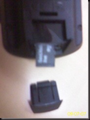
  2. Insert the Micro-SD Card. It lives in the slot at the bottom, underside of your Garmin Edge 705. [Please excuse camera phone blur and lighting effects – there is nothing folding over in the right-hand side]garmin-sdslot
  3. Connect to your Garmin Edge 705 to your PC, via the USB data cable.
  4. Two new driver letters will appear in My Computer, in the example below the internal Garmin memory is set as drive I:, and the micro-SD card is set as drive letter J:.garmin-driveltrs
  5. Create a new folder on your micro-SD card, name it “Garmingarmin-newfldrgarmin-namefldr
  6. In your favoured web-browser visit http://www.nzopengps.org/public/Direct%20gmapsupp/. This is a data file for Garmin GPS’s pre-built by the New Zealand Open GPS Maps Project. Download the compressed .zip file containing it. In this case “20090619 gmapsupp.zipgarmin-gmap-dnld
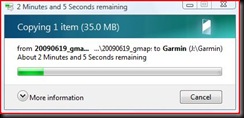
  7. Open your downloaded file, and copy and paste the data file to the Garmin folder that was created in step 5.garmin-openzipgarmin-copygarmin-paste garmin-copying
  8. You now have the 35Mb “gmapsupp.img” file on your Garmin Edge 705 (yay). This is Garmin speak, for supplementary map. Your Garmin Edge 705 will automatically look for the file when starting up.garmin-copied
  9. Now disconnect your Garmin Edge 705 from your computer. It is best to use the windows safely remove hardware icon to ensure all data has been written to your device first.garmin-safely-removegarmin-removenow 
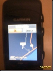
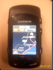
  10. So now, instead of only seeing motorways and cities like this:garmin-beforeYou can see all the suburbs….garmin-suburbsThe streets…garmin-streets And find useful things, like an ATM…garmin-atms A wonderful new world of navigation possibilities is all yours…


Sunday, 5 July 2009

Sunday Ride: Khandallah, Round the Bays (Mt Crawford), Makara

Ride Data:
Distance: 71.45km 3617 Calories
Time: 3:07:58 22.8km/h
Elevation: Ascent: 581m* Descent: 590m*
  * I'm think the Garmin read low today?
Ride Data: Garmin Connect Player MapMyRide
Location: Wellington, NZ 5 July 2009

‘twas a bleak morning but thankfully the moisture was more on the road rather than falling from the sky as we were out riding today. It was once again one of the days that I could have so easily spent the day on the sofa. Certainly on days like this, participating in a local riding group certainly helps the motivation to get out and ride.


We, the Onslow Tarbabies took in a few of Wellington’s gently rolling hills today with Mt Crawford, Brooklyn, Raroa Rd/Kelburn, Makara all ascended, followed by the steady climb up the Takarau Gorge and Ohariu Valley to Johnsonville.


We split into three bunches for the days riding – fast, slow and development squad. I placed myself in the slow bunch and we soon on our way. From Khandallah to the summit of Mt Crawford we were about five minutes than a fortnight ago, and I found myself toward the back of the group on the ascents this time. I have much fitness to gain if I am going to get anywhere near by personal best of 4:58:36 for this years Lake Taupo Cycle Challenge. Thankfully, still plenty of time to put in the training, or pretend to :).


The ride was going pretty smoothly, although with dampness around my cadence sensor was on the blink again. Does anyone else have this problem with their Garmin cadence sensor’s in the wet?. That was until Greg picked up a puncture as we were approaching Owhiro Bay. Scott and I played domestique and dropped back to support our team mate. Once we had got back to support him we played the foreman’s role with folded arms watching over him. So quickly, it changed to the self-supporting randonneuring form of cycling :). With the support of the two foreman, Greg soon had his spare tube in place and inflated as the development squad passed us.


We caught about half of the development squad on our way up Happy Valley to Brooklyn, and the rest at the pre-arranged re-group point, just before turning into Owhiro Road and the climb up to Kelburn. At the top of Kelburn I succumbed to peer pressure and extended our ride through Karori and Makara with five others. For some reason the ascent up Makara seemed harder than normal today. By the time we reached the steady climb up to Johnsonville I was falling off the pace :(, and also found my bike getting a little nosier from the dampness washing the remaining lube from the chain. Thanks for waiting for my non-performing hide at the top Marty & Ange :).

Saturday, 4 July 2009

Tour de France; Le Tour Challenge and other competition fun!


Well, the excitement of the Tour de France is now before us. Some awesome competitions going on. I will be trying to get out on my bike everyday during the Tour de France for the MapMyRide contest. The Garmin Edge 705 is going to busy collecting all of those stats for uploading to MapMyRide.


The VERSUS-MapMyRide.com Le Tour Challenge gives cyclists of ALL LEVELS a chance to compete in the 2009 Tour de France in your own hometown against Lance and the other top pros for tens of thousands of dollars in incredible prizes!  Some of the amazing prizes up for grabs include bikes from Parlee and Cervelo, and a Grand Prize Trek Travel Trip to watch the final stage of the Tour in Paris!*

The Le Tour Challenge is simple:
1. SIGN UP at http://www.MapMyRide.com/tdf
2. RIDE your bike on the day of a stage
3. SUBMIT YOUR RIDE
4. We'll COMPUTE your Virtual Time and give you an ENTRY into the daily prize drawing
5. Win PRIZES and JERSEYS
6. COMPETE in as many stages as you'd like!

I'm still not quite sure, what kind of prize a trip to the Tour de France is when

* airfare not included

Still sounds like it is going to be a whole lot of fun in any case. Besides, you need an American postal address to win anything. This is awesome, as I will be stateside shortly after the Tour de France is complete. I'll be giving FedEx just enough time to make it with the loot.


It will be very interested to see how competing virtually works. So many variables to decide who wins on virtual time? Plenty of hills here in Wellington. How will they be accounted for? Can I look forward to a polka-dot jersey?


Meanwhile, locally roadcycling.co.nz has a competition of their own up, with the first price and sweet ride with a BMC Racemaster up for grabs (pictured right).


And in Wellington,  On Yer Bike have a 10km indoor time trial contest running.


Do the On Yer Bike 10km

Indoor Time Trial

Ever pretend that you're about to win the Tour de France prologue while churning it out on your indoor trainer?  From July 5-28th you can live that dream in public.  While the Tour de France is running we are holding an indoor time trial contest at the Vivian Street store.  You race on your own bike, it costs $2 to enter, and at the end of the month the fastest man and woman on the leaderboard split the total prize pool.  Drop in anytime, or if you'd like to know more (or need some encouragement) call us or drop us an email.


But the real challenge for me is going to be resisting all the yet to be announced sales in the local cycle stores for the Tour de France time period. Can I resist? Or will they win and extract the cash and mothballs from wallet?

Thursday, 2 July 2009

Rain, winter, rocks and armadillo tyres

  • What tyres to use for training and commuting?
  • Change to a different tyre for special events/charity rides?
  • Life expectancy of cycle  tyres?
  • Which tyres for which conditions?
With road cycling tyres costing anywhere from $40 to $150, these are questions worth asking. I'm still figuring them out for myself..

Of course, a simpler situation would be to never ride over rocks, glass, nails and any other debris on the roads. Can't always be avoided it seems :(.

To quote Wikipedia:
Thin-walled tires, especially those used in road racing bicycles are particularly susceptible to puncture by road debris, such as thorns, and small pieces of glass that would not affect tires with more substantial tread. The equipment needed to repair or replace a bicycle innertube is comparatively minimal, and frequently carried by cyclists.
Yep, no doubt the king of the annoyances of a road cyclists existence!

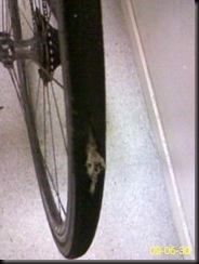
For a long time I have been riding on Specialized All Condition Armadillo Elite tyres. I have logged about 3,500km on my most recent pair. The front is still good (some rotation may have been an idea?), but the back tyre was getting toward the worn through state. This is unusual for me, I usually get a gash or slit in a tyre well before this point. This being the reason I have been using the armadillo tyres of commuting, training and if raining duDamaged Armadillo tyre with inner tube intactring one off events or charity rides.There is absolutely no doubt that the armadillo lining prevents punctures from sharp objects piecing or cutting through the tyres. Almost as if to prove a point, I accidentally rode over a rock  and shredded what was left of the rubber on the tyre. Surprisingly, the inner tube remain inflated and the tyre lining in tact. I was fully expecting a "snake bite" and was surprised to maintain inflation. Upon dismounting I discovered the carnage on what was my somewhat worn, but now unusable rear tyre. I am very satisfied, and cannot question the durability and robustness of the armadillo tyres.  Are these the most "bomb-proof" tyres on the market?

On New Zealand roads rain or shine, light or dark, 3,500km is a long durable life for a rear tyre. With other tyres I have used I invariably  end up with a sliced tyre or a whole through the sidewall.

While the armadillo tyres being harder to penetrate or slice, they do not prevent other causes of punctures. I have had a few "snake bites" when I have inadvertently ridden over rocks and debris on the edge of the road. Particularly at night when visibility is reduced. Conventional wisdom is that under-inflation is the usual cause of "snake bites", but at 90-110 psi I don't think this should have been the case. Regardless, I seem to average one every few hundred kilometres, and generally while commuting when traffic lines leave me at the roads edge along with rocks and other debris. On the bright side, I never had a puncture during an event with the armadillo tyres, although I had one at the start line of the Lake Taupo Cycle Challenge in 2007.


During dry weather for events or charity rides, I have found a preference to ride on Continental Grandprix 4000 S "Black chilli" tyres. These are an absolute pleasure to ride on. Like every tyre they claim to have good rolling resistance, and I can say I have more speed in these tyres when free-wheeling down the same hills - quite possibly something in the claim? But the smooth ride comes at quite a cost if you slice the tyres while commuting.

I was a little short of cash, so for the half the cost I have fitted some Maxxis re-fuse tyres. Like the armadillo's, these tyres have a kevlar belt to increase puncture resistance, but not around the tyre wall, and also not with the enhanced kevlar processes that Specialized explain in the video above, and presumably patented all to themselves. I'm interested to see the both comparative durability, and the "feel of the ride" for these tyres in a training and commuting setting . In theory, without the kevlar in the tyre walls, thus less stiffness there should be a slightly smoother ride. You just don't know until you try.  Hopefully I can find something between the durability of the armadillo's and the smooth ride of the black chillis? The Continental Ultra Gatorskin seems like a good option to consider in the future as well.

The armadillo tyres are certianly not come cheap, but if you are looking for something that is durable and unlikely to cut open then they are probably just what you might be looking for.  The standard addage probably applies once again:

Buy cheap, buy twice

Below is a table summarising my own choices from my own bad puncture luck on which tyres use I would consider using in different conditions. Not really expecting to find anything that will support all conditions perfectly, but you can only be optimistic :). Obviously, not far from comprehensive as I am still very new to road cycling. I'll keep it updated over time. The Maxxis Re-fuse are currently half the financial outlay as the other three tyres listed so far..

Tyre Commuting Training Events/Charity Rides
Specialized Armadillo Elite Excellent Excellent Ok, may be a little slow?
Continental Grandprix 4000 S Not recommended If dry and clean Excellent
Maxxis Re-fuse Evaluating Evaluating Evaluating
Continental Ultra Gatorskin Sidewalls prone to slicing Sidewalls prone to slicing As sidewalls are penetrable, may as well ride a better performing tyre
I have used various other tyres which have, well FAILED to meet my requirements for NZ conditions, resulting in a short useful product life and rapid tyre destruction. I can barely remember the exact make and model as they got so little use. Particularly brutal have been lightweight racing tyres without kevlar or other protection. These are typically sold on new bicycles, even when they are ridden in New Zealand conditions.


Updated: 16/7/2011 - Gatorskins are made of cheese. See http://craig.mcgregor.gen.nz/2011/07/do-gatorskin-tyres-have-sidewalls-made.html

Sunday, 28 June 2009

Lake Taupo Cycle Challenge: Tips

Craig's Taupo Results
20065:34:38
20074:58:36
20085:34:54
2009See you there?


My blog statistics, tell me that from search engine keywords that bring you here, there are lots of you out there looking for training tips for your first-time entering the Lake Taupo Cycle Challenge. In the spirit of e-democracy, and as I start looking ahead to my fourth ride around the Lake (entries open next week, on July 1st) I thought I remember the things I have learned thus far.

Accommodation


Accommodation can be very hard to come by for this busy event. Plan and book early! Early, usually means before entries open on 1 July.

Training


Yes, do some. Even better, do lots :>

I initially thought of titling this post "Lake Taupo Cycle Challenge:Training Tips", but I have never been a particularly strong trainer. I just ride and tramp lots over winter and then turn up in November :). You may find a lot of very helpful advice for training elements in Amy Taylor's book Lake Taupo Cycle Challenge Guide.

This is definitely area in which I am seeking rapid improvement. I'll be sure to share anything I find particularly effective here.

Equipment and clothing


I read in Amy's book:

"Buy cheap, buy twice"


My own experiences have shown me, not only the truth of this phrase but the increased orders of magnitude that must be applied when considering cycling and tramping equipment. The important thing for both is to realise what your goals and intentions for using the equipment are. You need to make a choice that is fit for that purpose. Go to a cycle shop and get advice. Avoid those Red Shed or Woolies specials.

There is no need to go overboard with your equipment, but you need to make sure what you use is suitable for a riding reliably for a really long way. It needs to be sized and fitted. It needs to be comfortable for a long time in the saddle and it needs to align with what your goals might be for the event.

Train in the same equipment you intend using for your solo challenge. Obtain and and fit it early. For clothing you want to make it doesn't cause chaffing. If you find this out half-way around the Lake its too late! For the bike, you need to make sure it is comfortable, that you are confident at handling it and know where to find the gear you are looking for climbing the hills, or trying not to get dropped by the bunch. Don't forget that there are usually sales to found during the Tour de France - a time when cycling has a high profile and cycle shops are usually trying to move out last years, but still brand new models at that time.

Nutrition


If you don't eat, you lose!

Make sure you get practice drinking and eating while riding. You need to ride 160km over the rolling hills, and food is energy. Unfortunately many people including myself find it difficult to eat while exercising, or riding rapidly around Lake Taupo. Eating in particular can seem unnatural or difficult. I takes some getting used to. When I first started doing endurance cycle rides I found this hard, and sometimes I felt like I was going to hurl it back up after eating. It takes practice. Learn what foods you are able t consume while riding. Open plastic wrappers before the start - hard to do on the move.
As a cyclist, I believe in the banana

I'm also a fan of the humble pie - ask someone-else for nutritional advice.

Bunch riding


Many new to road cycling events have never ridden in a bunch before, and often feel uneasy or apprehensive at thought of it. You will come to love the sheer pleasure of riding in a peloton. The effortless riding in the vacuum, the engineless, swarm like sound of the peloton moving along the road. Truly one of life's delights.

There is a lot of advice around the web for cycling in bunches. e.g. from the event organisers, and your local cycling groups. I strongly recommend entering some fun-rides in your area prior to the event so that you are used to riding in close proximity to other cyclists.
Maintaining friendships in the bunch
  • Ride in straight line
  • Do not use your brakes unnecessarily
  • Don't let a gap open in front of you (this might make people behind you get dropped from the bunch)
  • Take your turn in front - if you struggling to keep up, it could be a short turn
  • Maintain a consistent speed when leading
  • Don't cross wheels - stay behind the person you are following, do not cross wheels. If the bunch is two abreast, you should also be parallel to the person next to you.


  • The ride: 160km Lake Taupo Cycle Challenge


    As you can see from my results (top,right) I have found some variability in three times around the lake so far. The ride starts with a lot of climbing. As you will see from the height profile below, aside from the famed Hatepe at 130km, all the climbing is over by 90km mark. The first 50km of climbing determines the fate of whom you will be riding with, and the speed of the bunches for the last 100km. To do a good time it is important to start well! There is an oxymoron between the need to start quick, and the need to not blow out on these early hills with so much riding yet to come. The goal is of course, to finish and finish well, and not to send yourself into cardiac arrest. In general, after waiting in the starting area, your fellow event entrants start quickly and settle down at about the 40km mark. You really want to stay with people riding the same speed as you, so you need to start hard too, but don't over do it. Learning your own limits will present a good challenge.

    The hills ensure that the bunches break up a fair bit on the climbs. You need to keep an eye ahead, and be careful that riders in front of you don't let the bunch you want to be in get away!! It is usually best to try and be in the front third of the bunch so that this does not happen to you.

    In the section from Turangi to the base of the Hatepe hill there is much time to be made if you can be riding in a bunch that is sharing the load. A bunch here (and a little more fitness) saw my 2007 time being a sharp improvement on 2006 and 2008.

    The famed Hatepe will usually split the bunches completely. Its infamy is more related to the 130km you have already ridden, rather than the difficulty that this climb would present in isolation. There are usually plenty of spectators on the hill providing plenty of motivation to keep going.

    I have never found myself in a bunch for the last 20km to the finish in Taupo. Hatepe hill is a great separator and from there it is often riding by yourself, or in sporadic clumps of 2-8 riders. This may well be different for those that are strong enough finish an hour in front of me.

    Friday, 26 June 2009

    Invite: Moonlight Southern Crossing - Take II

    Hi All,

    Fingers crossed for snow on tops and then good clear skies. I'm gearing up for another attempt at a Moonlight Southern Crossing. Looking for a good weather window for one of the nights between 4-8 July.


    Moon Rise/Set   Illumination%:
    July 3:1:41pm/3:37am85.8% @ 9:11pm
    July 4:2:22pm/4:47am92.1% @ 10:02pm
    July 5:3:10pm/5:44am96.6% @ 10:53pm
    July 6:4:03pm/6:36am99.2% @ 11:44pm
    July 7:4:59pm/7:21amFULL from 9:22pm
    July 8:5:58pm/8:00am100% @ 12:33am
    July 9:6:57pm/8:34am98.8% @ 1:20am
    July 10:7:56pm/9:03am95.8% @ 2:04am

    Source: www.timeanddate.com


    Let me know if you're keen. Post a comment, or tweet me.

    Would aim to leave Otaki Forks toward Field Hut, at about 3pm on a clear day between 4-8 July.

    Craig.

    Tuesday, 23 June 2009

    New thoughts on cycle lanes

    Following some (car) road trips outside of town this year (to cycle events of course :)). I find myself of the growing opinion that we need slow vehicle (or vulnerable vehicle lanes), not cycle lanes.

    We're all special, but that is because we are people. Not because we are cyclists.


    As a motorist myself, I do not understand why so many motorists will stop for a dog, or a sheep but if its a human they think "mow 'em down".


    This seems to apply equally campervans, mopeds and farm tractors etc as much as cyclists.

    It seems that the more cycle lanes there are, the more it seems to support the incorrect motorist notion that cyclists do belong on the road (ever) - even where no such facilities exist. No amount of Cycle Lane infrastructure will fix the underlying of problem of the inequality and disrespect of being treated as 2nd class, facing daily assassination attempts and underlying attitudes of motorists that cyclists do not belong there.

    Not to forget that existing cycle lanes have a nasty, and dangerous habit of ending when you need them. The most dangerous part is at the intersections, or narrow corners where the cycle lanes typically abruptly terminate (e.g. the Petone round-about in Wellington).

    A better example in Wellington is the ~1m gap behind the new traffic island from Evans Bay Parade, turning left into Cobham drive. Its not even a cycle-lane on either side but it nicely gets you through the intersection, away from traffic and into the shoulder of the busy road. Brilliant. Thankyou WCC :).

    Instead of long cycle ways, fix the really dangerous part - intersections by adding enhanced features at intersections for vulnerable road-users (like cyclists).


    How about replacing passing lanes with slow vehicle lanes?

    Motorists need to know that cyclists and other slow or vulnerable vehicles do not like having faster moving vehicles behind them, as much as motorists may not like having cyclists or slower vehicles in front of them. How about, some reverse psychology so that motorists have a higher assurance that a slow vehicle will let them past as soon as the opportunity presents itself, rather than the existing motorist assumption of birthright to pass slow moving vehicles regardless of dangers presented by on-coming traffic, blind corners, crests of hills etc.

    Anyway, that is my rant for the evening. Any thoughts?

    Craig.

    Sunday, 21 June 2009

    Sunday Ride: Round the Bays (Mt Crawford), Wilton, Khandallah

    Ride Data:
    Distance:51.79km2475 Calories
    Time:2:21:1722km/h
    Elevation:Ascent: 758mDescent: 752m
    Ride Data:Garmin Connect PlayerMapMyRide
    Location:Wellington, NZ21 June 2009

    This morning, I broke with my solo training traditions and for the first time, went for a group ride with the Onslow Tarbabies. The Onslow Tarbabies are a road-cycling group based in Wellington which focus on fitness and riding technique rather than super-competitive racing.

    I signed up to their Yahoo group which then started sending me e-mails about their rides. On Friday morning, I received the details of the weekend's ride.

    Hi People
    I am down to lead the ride Sunday. Plan is around the Bays option Makara. Route plan is set out below for your information. Forecast look ok'ish possibility of some minor rain.
    ...
    If you are new to the Tarbabies please stick with a Red and green jersey and learn the Tarbabies ethos, please.
    ...
    See you Sunday (if its not pouring with rain).

    cheers
    Gary


    City & the Bays, OPTION Makara
    ... followed by detailed route description ...


    Thats easy enough. Just turn up. Oh, and make sure my alarm is set for the earlier than usual start. I woke in a brief moment of panic as I checked my tyre that had tyre for cuts after being punctured in the dark the previous night. And, still plenty of air in the tube - yay :). Raced through the supermarket for a couple of snacks on the way, before heading back to the starting location in Khandallah. I listened to the obligatory safety briefing and raised my hand when asked if anyone was along for the first time. The group leader (Gary) introduced hiimself and the group was split into fast, medium and slow bunches. As my first time I naturally opted for the slow bunch. There was also a first-timers rule that we do not have to lead the bunches until they see how the group works. I presume this is to make sure that the emphasis is on keeping the bunch together and having fun, rather than pushing the bunch or shooting out in a breakaway. This of course suited me fine as we set off into a stiff ~45km/h southerly and I would get to hide in the bunch for the entire ride. Excellent :).

    The pace in this group was generally what I would probably describe as a good recovery or intro pace, depending whether you are new to road cycling or not. I understand that often they have Fast, Medium, Slow and Development bunches - with the latter catering for people new to cycling or, training for their first ride around Lake Taupo. What I really noticed how much effort I put in when hill climbing in a group compared to when riding solo. I think when riding by yourself you may not realise how gentle you can be on yourself in such situations. On the way up Mt Crawford, the first significant climb of the ride I saw my heart rate shoot for the sky.

    I was pleased to have a chance to catch my breath at the top of Mt Crawford while the whole bunch completed the climb. One down, two ~150m climbs to come. A steep descent into Worser Bay, around to Seatoun and through the Pass of Branda. As we went through Branda we were greeting by a wall of wind from the southerly directly off Cook Strait. But, it was a marvelous view down to the snow capped mountains of the Kaikoura Ranges in the South Island. Tempting to get my tramping boots and head for the hills!

    On our way toward to Lyall Bay we lost two members of our bunch, seeking repairs to one bike after its front wheel briefly jammed in a drain gate. This resulted in a broken spoke and thankfully no crashes. Only a bruised wallets, not bodies.

    In the camaraderie of riding in a bunch, rather than solo it seemed to take no time to get around to Owhiro Bay and the steady climb up to Brooklyn, a quick descent down Owhiro Road before the slightly more demanding climb up Raroa Road. Pretty soon we found our way to the Monteith's Pub in Khandallah for coffee. Well, not all of us. I resisted my coffee addiction and with a hot chocolate. 9 days since coffee and counting!

    Had a great time riding in the group. See you all again soon :).

    Saturday, 20 June 2009

    Increasing cadence from "grinding" to "spinning"

    As a solo weekend warrior cyclist, I rely on blogs and books for my training tips. The consensus seems to be that an ideal cadence for a "weekend warrior" should be 92-95 pedal revolutions per minute. Growing up carrying weight on bicycles as a paperboy, then as a postie I was very much a grinder. When I first used a cadence meter, the Cateye Strada showed me pedaling with a cadence of a mere 72-75 revolutions per minute. Ever since, I have been trying to increase my cadence. Once a higher cadence rate is natural, try and match that with the few remaining remnants of strength from my past life. i.e. Before I graduated from University and into the desk and chair complete with self-contained air-conditioned box.

    For surely,
    Strength + Cadence = Power -->> more speed (yay)


    In October last year, the information addicted boy that I am, I invested in a Garmin Edge 705 fitness GPS. Now I have all the data that I could hope to analyse :). Well, not quite - I don't have a power meter. But then these difficult economic times are not the time for a second mortgage to make such an investment. Now comparing cadence of recent ride data with my first few rides with the Garmin Edge 705:


    Sample of average ride cadences:
    • November 2008:
      • 81/minute
      • 80/minute
      • 76/minute

    • May/June 2009:
      • 90/minute
      • 88/minute
      • 92/minute
      • 90/minute


    No doubt there, that I am now in the "spinning" zone (85-120/minute). In theory, this is supposed to mean less muscle fatigue (yay) and improved blood flow =
    faster recovery.
    The unanswered questions remain:
    1. Will I actually be faster riding with a more orthodoxed cadence rate?
    2. Am I mixing any strength with my new found higher cadence rate, for surely:
      Cadence + Nothing = Cadence -->> not necessarily more speed (boo)


    In Wellington right now, we are in the depths of a very Antarctic feeling winter. With no light before or after work, riding in the dark does not suit just comparing times with summer. Not to for get windy Wellingtons famous resistance training.

    My desire for more speed also means I need to ride with people faster than me to ensure that I challenge myself to get quicker and quicker. To this end, I am going to stop training exclusively by myself and join the Onslow Tarbabies on the Sunday morning rides. Yes, riding group, means no more 10am, or afternoon starts. Yes, I hear you chuckling at the thought of wintery morning starts from me- but you're the same people that are in disbelief at my entire week and counting without coffee.

    P.S. I have finally caught up on cycling event blogs for the past season :). I have backdated some of the posts to when they actually happened, rather than when they were posted :>.

    P.P.S. Four years of tramping trips yet to be mapped and posted. This will take a while...