Showing posts with label Tararuas. Show all posts

Tuesday, 29 October 2013

Kime Hut Temperature Experiments

This past weekend, I was on a tramping trip with the WTMC and we passed through the “new Kime Hut” twice due to the gale force winds turning us back at Mt Hector. Yes, another failed attempt at the Neill-Winchcombe Ridge.

These were of course my first visits to the “new Kime Hut”. It is located above the bushline, without any source of fuel for a fire. Without any heating it was bitterly cold inside and as an alpine hut, so I decided to repeat a past experiment of measuring the temperature inside and outside the hut. Each time leaving the thermometer away from body heat for 5-10 minutes before taking a reading.  From these measurements I learned that every trampers hope that the new Hut would be warmer have been dashed. If “old Kime Hut” was “The Fridge” then “new Kime Hut” must surely be “The Chiller”. I certainly do not possess scientifically calibrated equipment, and the table below is based on very few samples. However, it does show a clear pattern - that the new Hut has not broken from the heritage and legend of the infamously cold Hut that is recently replaced.


“old Kime Hut” 1978-2013
“new Kime Hut” 2013-…
"Old" Kime Hut (5 June 2009)
6 June 2009
NewKimeHut-MikeM
26 October 2013 (Photo by Mike)
Outside temperature at 0230:
–0.8C
Inside temperature at 1120:
4.2C
Inside temperature at 0240:
0.4C
Outside temperature at 1132:
4.7C
Difference:
1.2C warmer inside
Difference:
0.5C colder inside
Outside temperature at 0930:
0.8C
Inside temperature at 1340:
4.9C
Inside temperature at 0940:
1.6C
Outside temperature at 1346:
5.2C
Difference:
0.8C warmer inside
Difference:
0.3C colder inside
Body heat in hut:
1 person
Body heat in hut:
4 persons

You can find my original post from 2009 here: http://craig.mcgregor.gen.nz/2009/06/tararua-forest-park-kime-by-moonlight.html

Sunday, 10 February 2013

I’m a “Super Randonneur” again..


The Super-Randonneur award is awarded for the completion of 200km/300km/400km/600km rides within a Randonnuering year (Nov 1 – Oct 31). It is also the qualifying requirement for many 1200km events, which was my primary motivation. This is the second time I have completed a Super-Randonneur series, the previous time being while qualifying for Paris-Brest-Paris in 2011. Here is the 2011 medal, I’ll need to wait a while to see what the 2013 edition looks like.


Randonneuring (or Audax) rides have a low profile in New Zealand, which is a shame because we have found some nice rides, in very scenic areas. If you would like me on any of these rides give me a yodel or see http://www.kiwirandonneurs.org.nz


400km – Marlborough Mayhem

Riders: Craig (22h36m); Rita (AB)

Time-limit: 27 hours


It is often argued that 400km brevets are the hardest to complete due to being longer than a 300km, but not reducing the average speed enough for a sleep break like a 600km brevet. So, naturally that is what I started with, jammed into the Christmas crunch, was our Marlborough Mayhem 400km brevet. With a desire to qualify for  1200km ride further afield later in the year, I promptly rescheduled my flights home for Christmas and booked a ferry across Cook Strait and back again.


As I rode up the long false flat that is the Wairau Valley the misty morning cleared albeit, not enough to allow us to see the mountain vistas of this area. As St Arnaud approached the false flat was replaced by real climbing as we made our way up to this alpine village. With Elaine's cafe which I frequented on many a past tramping trip no longer trading, I bought a snack from the general store, before heading to Kawatiri Junction and up over the Hope. It was soon obvious that I was not a climber as I struggled up the steep pitches.


I had a brief flat patch, with zero energy and feeling mildly faint just before reaching Nelson and had to stop for an emergency snack on the cycle way, just moments away from Nelson. I must say that I was very impressed with Nelson's  integrated, and signposted cycle network.


Leaving Nelson required climbing the Whangamoa Hill, with sea fog set in on a warm and humid night. There was another bump before dropping into the Rai Valley and onto Havelock well after the shops had closed for the night.


I waited a few minutes for Rita to arrive but unfortunately it getting too late, and tiring, she chose to abandon and take a 20km shortcut back to Picton via the hillier route on Queen Charlotte Drive. Meanwhile I proceeded the flatter, but more distant route via Rapura Rd, although I will admit that I did sneek in a much needed needed a ten minute snooze to manage my tiredness en-route back to Picton.


300km – Round the Tararuas

Riders: Craig; Simon; Tim – All 17h51m

Time-limit: 20 hours


After Christmas I returned home to Wellington and was joined by Tim and Simon. We were able to meet Paris-Brest-Paris ancien Ed Allen for a snack at our first control in Carterton. Before the devastating heat of the afternoon kicked in, with the thermometer well over 30 degrees for most of the day. In Wellington we think it hot if it reaches 20 degrees! This led to us many time consuming rest-stops to eat more ice-creams, in all contributing to over four hours off our bikes.


600km – Picton – Westport – Picton

Riders: Craig (38h57m); Rita (AB)

Time-limit: 40 hours


It briefly looked like we may have had up to five riders for the 600, but after late withdrawals, it was just ride organiser Rita and myself.

Two days beforehand we swapped the route around so that more services would be open, and the overnight rest stop at Murchison could be at 382km instead if 440km. This seemed like a good idea - until getting our bikes at 5am on Saturday morning and riding into a headwind up the long false flat that is the Wairau Valley. At the top at St Arnaud we were a mere 40 minutes ahead of the time limit, so it was starting seem a tad tight even at this early stage. Time for fruitful hours of sleep was already seeming unlikely.


We met up with Kiwi Randonneurs stalwart Duncan and Tony in Murchison, where after 290km into the headwind Rita decided it wasn’t much fun and chose to abandon. As for me, this was the only 600km ride I had available for qualifying so I pushed on into wind and rain down the beautiful Buller Gorge to Westport, where all businesses decided to celebrate my arrival at 9pm by either closing or ceasing to be serving anymore food. So, it was nuts and snackbars on a concrete step outside New World (thanks for the extra snacks Duncan – was looking grim).


Then it was a climb up to Murchison for a 90 minute sleep in the motel before setting off over the Hope and into Nelson. No sign of the rain of the Buller from the night before as a sun shone and the temperature soared, especially felt when climbing over the Whangamoa Hill. The strategic placement of a control point at Pelorous Bridge for a good pie, didn’t quite work out as all I wanted was anything frozen to help cool me down before the final push around Queen Charlotte Drive and back to Picton.


200km – Taranaki Spin

Riders: Andrea (12h30m); Craig (12h30m); Rita (8h45m)

Time-limit: 13h30m


This was “multi-sport” weekend for Kiwi Randonneurs, with Rita backing up from a half-ironman the day before, and myself from an ascent of Mt Taranaki. I mostly rode with Andrea who was visiting from Brazil, although I wasn’t sure if I was going to finish when I broke two spokes near Stratford. Thankyou ‘Z Stratford’ for the loan of some tools, which enabled me to loosen the in tact spokes so the wheel would turn between the forks and enable me to complete the ride, and my Super Randonneur Series.


Our route was a variation on the Round the Mountain which would have only been 150km. Ironically, some of the best riding was in the quiet rural roads, and the scenic finish along the New Plymouth Coastal Walkway (a shared path) which had been added to bring the distance up to the required 200km.


Sunday, 3 June 2012

Neill-Winchcome U-turn

Date: 2-3 June, 2012

Punters: Alayne, Alistair, Craig, Debbie, Kaleb, Phillip & Weimin from the Wellington Tramping & Mountaineering Club.


Unfortunately some trips do not go as well as one hopes. I had looked forward to this trip for months with the Neill-Winchcombe ridge being a major point of missing red-line on the map on my lounge wall. The best trip on the schedule I proclaimed. In different conditions it certainly could have been.


The Neill-Winchcombe ridge is a less travelled ridge which connects Cone Ridge to Mt Hector. Whereas most visitors to this part traverse the Southern Crossing traveling north to south from Otaki to Kaitoke (or Waiohine Gorge), the Neill-Winchcombe joins Mt Hector and provides a path toward the east. Our intentions were to start from Waiohine Gorge, stay at Cone Hut on Friday night, ascend Cone and the travel west along the Neill-Winchcome Ridge to Mt Hector and descend down to Kime Hut on Saturday. Then traverse the Tararua Peaks to Neill Forks on Sunday before returning to the van at Waiohine Gorge on Monday.


After a night walk on Friday night, we arrived at an occupied Cone Hut at which half our party stayed in the hut while Alistair, Phillip and myself camped out in good weather. As we departed camp on Saturday the skies were clear and no wind was present. By the time we reached Cone, we were walking in clag with limited visibility but very little wind. We entered the forest and followed the forested ridge with a brief open patch at Neill. The travel along the marked route on this track was constantly up and down with the odd rock scramble for good measure.


We did not cover this ground as fast as I had hoped, but this didn't become a problem until we reached Winchcombe. The wind was howling in from the west. Walking upright was becoming somewhat of a challenge and we soon found ourselves crawling along the ridge toward pt1378 tightly grasping the tussock. With fading light, gale-force winds and the ridge narrowing toward razorback we chose to turn back for the safety of the bushline for a night of unscheduled fly camping. Unfortunately without a water supply the array of gourmet food carried on our backs had to return with us on Sunday morning while Saturday nights dinner was limited to snackbars and chocolate.


We certainly were not the first party caught in the position, however unlike us according to other blogs I have read  many have camped nearby a tarn for water supply in this area.


All trips are easier with hindsight, and I should have woken the party to leave earlier on Saturday morning and I certainly underestimated the time traveling along the undulating Neill-Winchcombe ridge. I do think that in winter with less daylight, and few bailout options to a cosy hut or a fantastic campsite it may well be a better option to approach this ridge from Mt Hector, thereby being in the bushline later in the day, or if the weather changfes.


As for my red-line, there remains a frustrating 1.2km gap between Mt Hector and .1398 which will be resolved by a future successful completion of this trip.

Sunday, 25 July 2010

Tramp: The Moonlight Southern Crossing

After a few false starts on the fourth? attempt I finally completed the Moonlight Southern Crossing. Prior attempts having been thwarted by weather and well, a sheer lack of Moonlight.

Trip Data:
Distance: 37km  
Time:

12:56:51 (moving)

21:40:31 (elapsed)

Elevation: Ascent: 2,357m Descent: 2,224m
Trip Data: Garmin Connect
Location: Tararua Range, NZ 24 July 2010

It is hard to say exactly what it is that gives this trip its magical appeal. Perhaps it is the statistical unlikelihood of having a clear night in the Tararua Range during the middle of winter? Let alone underneath the full moon! The Tararua’s are renowned for their imperfect weather,  as Geoff Spearpoint observed in his book “Waking to the Hills”

Weather plays a major part in Tararua affairs, mist normally covering the tops for 250 days of the year. Southerlies bring the snow and freeze them; westerlies bring the rain and wet them; and the northerlies blow until it is a marvel there is anything left.

I had arranged to do this trip with Mike and Sam, and we were all watchful of the weather forecasts and weather model information in the week leading up to July's full moon. The best weather looked like it would be on Sunday evening, but the storm passed through quicker than expected over Friday night, Saturday was a cracker of day.


Sam and I hatched a very approximate plan over the telephone which optimistically featured the fastest times we had travelled over each section of the route. Oooopps. Not the best way to estimate time! At least walking straight through, without staying in any huts saved me from having to splash out on the recently increased price for a new annual hut pass.


Flat battery number one: After seven weeks of being an incredibly fuel efficient Subaru - stationary on my driveway! The battery was dead and would not turn the motor over. Thankyou awesome neighbour Ken for helping me out so we could go tramping! I must say I do prefer to walk or to cycle, but must make sure I the car moves out of the driveway at least occasionally!


I collected Mike and Sam enroute to Otaki Forks. Oooopps battery issue two: I had not replaced the batteries in my SPOT after removing them before flying back from the USA recently.  Sorry - no digital breadcrumbs for the worrying family at home. No problem as long as we do not need that SOS button!


Shortly after crossing the bridge over the Waiotauru River we saw Spencer, whom I had not seen for a couple of years. He reported ice on top; crampons recommended; couldn't get into Kime Hut as it is frozen over. We noted that regardless of the not so balmy conditions he had reported that he had travelled without an ice-axe. After a quick chat Spencer kindly drove my car back to Wellington to save me the effort of returning to Otaki Forks to collect it!


A few minutes before reaching Field Hut darkness encroached as we travelled for our last few minutes in the bushline with the use of our headlamps. Once beyond Field Hut and above the bushline the moonlight provided enjoyable conditions under a beautiful night sky.


With Mike on the trip and his knowledge of astronomy we were able to celestials the prominent celestial body in the sky to our west. All without needing to refer to Wikipedia to pretend to be smart. Now above the bushline we had Venus as a prominent celestial body to the west.


The lack of snow was notable as we walked across Table Top. At this time it was difficult to co-relate with Spencer's crampons recommendation. There were a few patches of firm snow as we crossed Dennan followed by thin layers of snow leading to Kime Hut. There was substantially less snow than when I was here last year, however, on this occasion it was much nearer to frozen and a lot more slippery.
 

IMG_7757

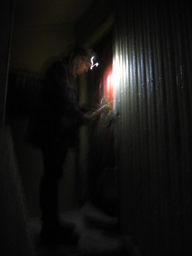
Upon reaching Kime Hut the door was frozen shut, just as Spencer had warned.  Sam used his ice-axe to remove the frozen ice from the large metal latch to gain entry. I was pleased to have thought ahead by carrying extra fluid with the Kime Hut water tank frozen solid, which was always going to be likely at this time of year.


Departing Kime it was onward and over Field Peak (which counter-intuitively is nowhere near Field Hut of course). Once reaching the descent of Field Peak on it's southern side it was icy and slippery. Once again, just as Spencer had advised. My ice-axe has been on many more trips than it's been required in the past. Tonight it was essential to assist my rather less than assured footing on this mixture of ice and rock.
 IMG_7757

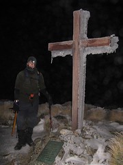
There was some cloud about when we reached the summit of Hector and the memorial cross, but not enough to block the light of the moon, or as Mike would prefer to correct me, the light of the sun reflecting from the moon.


As we descended Hector and made our way through the Beehives, the track itself was a little treacherous having formerly being wet, but now was frozen solid. Where possible we walked on the safer route over the tussock alongside the frozen track. Where rock covered in 'black-ice' was the only option my steps were far more tentative, as I grovelled through with my ice-axe held by clenched iron-fists. This made progress pretty slow. Ideally there would either be lots of snow to make crampons ideal, or no snow at all. The mixture of snow and rock as tricky, particularly on


Once over Atkinson there was a lot less ice around as we continued around the Dress Circle and over Aston, now with Jupiter clearly visible to the south east. Once at the top of Alpha where there was no snow or ice at all. We spent a few moments relaxing on top of Alpha. Enjoying the night sky and the still air which is so rare in the Tararuas Range.


We approached Alpha Hut quietly, but found it empty on this glorious evening.  Without needing to worry about disturbing others, we had a reasonably long rest an a snack before departing a little after 4am. We were already a long way behind our intended, and optimistic time but only had the Marchant Ridge left between us and our destination at Kaitoke.


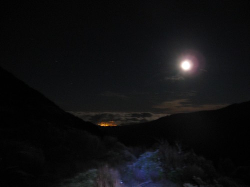
The Marchant Ridge an area of geography that often subject to much slander among trampers. I have often felt this is this isn't necessarily justified. Many trampers lament the lack of views on this goblin forest coated ridge, yet the goblin forest of the nearby Cone Ridge celebrated. With the Marchant so often described with, well lets just say with many short err, "adjectives". The current topographical map BP33 shows eight spot heights along this ridge, with a mere150m of altitude descended between the first last of these. It certainly seems to be with some justification that many describe this ridge as:

'Uphill in both directions'.

However, I believe that the real reason ridge is so despised is because it is both long and at the end of epic journeys. The Marchant Ridge often being the final stretch of a  Southern Crossing or an 'SK' and it is some 15km long. The mind says you are nearly there, but in reality you are not. The route from Alpha Hut to Kaitoke along the Marchant Ridge covers 40% of the total distance over the Southern Crossing route!
 IMG_7781


On this occasion, I stepped in a hole somewhere near the 'top' of Marchant Ridge. After wincing and limping for a few strides, at which time I felt like rolling over the ground screaming like a girl, I just kept walking. The further we went the more my knee swelled. I was unsure if I had an injury, or if a less ambitious trip would have been more desirable after not having been out tramping for a while.  I just kept on moving. The sun was rising by the time we reached the open area on Marchant that was created by a fire here some years ago.  and eventually we found our way to Kaitoke over 21 hours after leaving the car in Otaki.


This was a much slower trip than we had optimistically anticipated. That said the GPS data that Mike collected suggests we only spent about 13 hours actually moving - the rest of the time Mike and Sam must have been waiting for me? While they *did* spend a lot of time waiting for me, I’m not sure it was quite accurate!


Thankfully about a week later the swelling in my knee came down and I can once again see my knee cap – phew!.

Thanks Mike for the photos and GPX file. You can read more about this trip on Mike’s blog at http://www.windy.gen.nz/index.php/archives/487#more-487

And thankyou for leading the trip Sam :)

Friday, 26 June 2009

Invite: Moonlight Southern Crossing - Take II

Hi All,

Fingers crossed for snow on tops and then good clear skies. I'm gearing up for another attempt at a Moonlight Southern Crossing. Looking for a good weather window for one of the nights between 4-8 July.


Moon Rise/Set   Illumination%:
July 3:1:41pm/3:37am85.8% @ 9:11pm
July 4:2:22pm/4:47am92.1% @ 10:02pm
July 5:3:10pm/5:44am96.6% @ 10:53pm
July 6:4:03pm/6:36am99.2% @ 11:44pm
July 7:4:59pm/7:21amFULL from 9:22pm
July 8:5:58pm/8:00am100% @ 12:33am
July 9:6:57pm/8:34am98.8% @ 1:20am
July 10:7:56pm/9:03am95.8% @ 2:04am

Source: www.timeanddate.com


Let me know if you're keen. Post a comment, or tweet me.

Would aim to leave Otaki Forks toward Field Hut, at about 3pm on a clear day between 4-8 July.

Craig.

Saturday, 6 June 2009

Tararua Forest Park: Kime by Moonlight

From Kime by Moonlight


With the full moon visible in the clear blue afternoon sky, snow on the top of the Tararuas I left work early. Could I finally get over the Southern Crossing under the moon? For so long I had waited for the full moon, clear skies and snow all at once. I had to make the most of the opportunity.

I packed my things together and headed for Otaki Forks. As I departed over the new Waiotauru footbridge I was on my way. I almost felt disorientated as I walked along the track "improvements" and past the digger used in their construction. I had been over this track tens of times before but, it now seems as wide than the Otaki Gorge Road that leads here.

There were no concerns about freezing on this windless evening, and wearing a layer too many of polypro I was soon sweating my way up to Field Hut. The carnage and tree falls from the previous time I was here has been cleared from the track, but the remaining patches of thin tree canopy from that storm were notable.

After a short break at Field Hut the ascent continued. I was soon on Table Top under the full moon and mostly clear sky. I was still hopeful of finding some snow as up to this point it has been noticeably absent. Approaching Dennan, I was finally into the snowline at about 1200m. I was having a great time in the snow under the moon. It was awesome. In the excitement and heavy snow I managed to via away from the established track, with, like my politics a slight left-hand bias. After a brief right-hand correction I was back on the established track and found the ice covered waratah posts marking the route.

While approaching Bridge Peak, the clag was thickening and by the time I reached Kime Hut, the moon was barely penetrating through the clag. I stopped at Kime Hut for a brew, optimistically hoping the clag would clear, before ascending Mt Hector.

With the tap frozen I was boiling snow, which was relatively rapid as I was only cooking for one. In larger groups I have found this much more time consuming in the past. After drinking my tea, the clag was even thicker so it was to be here that I would hunker down for the night.

Wellington trampers often refer to Kime Hut affectionately as "The Fridge". Many claim it is warmer outside the hut than inside it.


Arriving here in the middle of the night, surrounded by snow and with myself as sole occupant it seemed a good time to test this theory. Keeping my Casio Protrek watch away from my own body heat so as to accurately use its thermometer function. It is not warm inside Kime Hut, however, it is about one degree warmer than outside.


Outside 2:30am: -0.8 C
Inside 2:40am: 0.4 C
Outside: 9:30am: 0.8 C
Inside: 9:40am: 1.6 C


When departing on Saturday morning, there was virtually no visibility so I was sure to take a compass bearing before heading back down to Otaki Forks. In fact, it was darker than much of the time I had traveled under the moon the night before.

While I did not get across the whole Southern Crossing as I intended, I sure had a great time in the snowy winter wonderland. Try again, during the full moon next month?
Date:5-6 June 2009
Intended Route:Southern Crossing via Field Track; Southern Crossing; Marchant Ridge
Actual Route:Otaki Forks to Kime Hut via Field Track & part of Southern Crossing
Time taken:22km/8:59
Otaki Forks to Field Hut5.9km/2:18
Field Hut to Kime Hut I was sloooow5.2km/2:52
Kime Hut to Field Hut5km/1:57
Field Hut to Otaki Forks5.9km/1:51
Total ascent:2,470m
Total descent:2,384m
Maximum altitude:1,444m

You can find more detail at Garmin Connect.

Friday, 1 August 2008

Tararua Forest Park: Penn Creek/Table Top

It has been far too long since my last post. I have not been out tramping a recently, the last time was in the first weekend of August, where we managed to get out between severe storms that created a lot of carnage in the Tararuas. Having been too slack to pen my account on this trip,  below you can find Fraser's version that he e-mailed me, and some of his friends who thought that the weather was too severe to head for the hills.

You may also like to read Mike's account of the same trip.

Fraser writes:

After eating a bowl of soup and drinking an ale in Byron's Resort on Otaki Beach (that had no power due to the storms having blown the power lines down), I set off to meet the WTMC trampers. On my way to meet the WTMC people, I found two people and their dogs wandering about in the dark on the gravel part of the Otaki forks road. I asked them the situation, and they said that they'd been wandering in the dark for two hours, that there were major slips on the road and I would not be able to continue. They also said that anyone that wanted to tramp would need spikes and be in serious trouble due to the weather. Due to their distressed state, I gave them a lift back to Otaki Beach, calling Craig to inform him what was going on. Cellphone reception was very poor, so I had trouble talking. It turned out that the people I'd picked up were very stoned from smoking oil spots in the hut, and knew nothing about tramping, so after much hero worship for saving them a long walk (and a cheeky spot!), I returned to meet the trampers. 

They were parked up just before the slip, and because I was late I had to change out of my work clothes and pack properly all in a couple of minutes. We began tramping with head torches a little before eight, and it was very hard to communicate to the trampers what I had heard from the people I had picked up due to the mild conditions and the fact that there was only one slip. Once I managed to tell them them what had been said, there was much laughter about us 'needing spikes' on the hill. Our party consisted of a dour Scotsman named Pete, (who comes from somewhere that sounds more like a cough than a placename) ; Mike from Treasury (somewhat reminiscent of the character Choo Choo from the cartoon Top Cat), and Craig McGregor, who was tramping for "red lines on the map". The first night's walk felt like little more than a walk in the park, yet we reached Field hut after eleven due to the elemental chaos that had been unleashed on the hill in the days before. Spectacular scenes abounded... At one point, more than forty trees had fallen onto the trail, which was blocked in several places. Mike and I appointed ourselves pathfinders, and used night tramping experience to find the best ways to follow the track. The other party of trampers that had gone ahead of us had become disoriented and walked half an hour in the wrong direction, meeting me coming up the hill. It seemed they had accidentally turned around only a minute or two away from the hut. In some places around Field Hut, the earth and trees looked as if a giant hand had crushed everything together, creating a huge mess of earth and trees. Everyone bedded down at Field hut that night, keen for a good night's rest. 

On the next day and after the two trampers who were going mountaineering had left, we decided that the best destination would be Penn Creek Hut to see if the river was too swollen for us to cross into the mountains. We set out Penn Creek Hut. Craig decided the river was too swollen to cross, and we were too lazy to tramp to Kime hut (also known as the freezer) so we spent the rest of the day hanging out at the hut playing cards and generally joking around. We pondered such philosophical statements as 
"You know, those who know enough to be able ignore D.O.C signs are usually competent enough to handle ignoring D.O.C signs... While there are those who are insane enough to think that they know enough to ignore D.O.C signs... They're weeded out by a process of natural selection." - Mike McGavin
I cut apart an awful feminist paperback novel to make a deck of very interesting cards, which provided such hilarious quotes as "The doctor opened his surgical bag, removed a scalpel, and began to cut away the man's pants". We ate well (Craig made Tiramisu!)  and slept for twelve hours while heavy rain pounded on the roof.

On the third day, one of the small streams we had crossed to get to the hut had been replaced by a raging torrent of white water and doubled in depth. We decided it would be best to climb through the dense bush to tabletop using compasses and maps to navigate our way. I led the way up the hill, and came upon a 'tramper's superhighway' which turned out to be pig tracks, and took us up to six hundred meters in a little more than an hour. After this, the forest gave way to dense Tararua leatherwood, which we forged a path through taking ridiculous amounts of time. We came to the trig of Tabletop in high winds and very thick fog, and quickly found the track to Field hut at around two thirty. The track after Field Hut was spectacular in daylight. Two hundred year old trees had been uprooted and blown by the winds.The track was covered in foliage, and Mike and I split off from Craig and Pete to move at a 'fast pace' to meet the other party back at the van, getting overtaken and beaten to the van by half an hour : }. The fog had cleared, and the way back to Otaki forks had some really good views. You guys missed a really good tramp. 

We tramped for about nine hours today, and I'm feeling pretty relaxed and good. Don't know about next week. I recommend tramping in the western Tararuas due to the changes in the forest from the storms. Very exciting stuff!

-Thanks for the awesome tramp guys,
-Fraser

Sunday, 27 April 2008

Tararua Forest Park: Northern Crossing

24-27 April 2008 - Northern Crossing

The trip plan declared:
One big day and two half-days - Thursday night, camp near the confluence of the Ohau and Blackwater Stream. Friday, up the South Ohau, Yeates, Arete and Waiohine Pinnacles to Tarn Ridge Hut.....
Punter responds:
Getting from there (campsite) to Tarn Ridge in a day at this time of year is a pipe dream in all but perfect weather - but I think perfect weather justifies the push

After a train journey and taxi we were soon at at the Ohau road-end where we discovered that Murray's torch did not work. Murray being from a tramping club named after such a fine range of mountains would have been perfectly fine without the sense of sight I'm sure. Regardless of this our efforts began to repair his torch. Somehow a shred of paper had managed to get jammed deep within its barrel, and as paper does not conduct electricity prevented the batteries from touching the contact points to power the torch. After trying various objects to remove the paper from keys to twigs to walking poles, a loose piece of No.8 wire was found and did the trick, genuine kiwi style. Meanwhile, on behalf of Placemakers Alistair was busy marketing his $9.95 head torch. After an amazing 25 minutes of faffing we began walking our way along the track up the Ohau river and quickly found out way to a brillant campsite in a little under an hour. It was a beautiful night so there was no need to pitch our flys and we slept under the trees to avoid any dew.

Sarah in the South Ohau
Come 5:30am, Craig instantly arose to fulfill his duty as trip leader and get the brew. We were on our way up the Ohau river by 6:30am. Our feet were wet well before 7am as we followed this scenic route up to the site of the new South Ohau Hut (currently under construction). We spent a small amount of time talking to the builders and began our ascent up the steep Yeates 500 with a startled look "Tarn Ridge tonight? You're keen".

Following a steep 500ft ascent up the Yeates track it soon "flattened" out to be merely undulating as we made our way to Te Matawai Hut and a well earned early lunch. Debate ensued as to how long it would take us from Arete to Tarn Ridge via the Waiohine Pinnacles. Estimates varied between and optimistic 2.5 hours (Alistair), we'll be there at 5pm (Sarah) and a pessimistic 3.5 hours (Craig). Meanwhile, Murray remained non-committal.

Our stomachs fully laden we made our way up the relentless climb to Pukematawai, over Arete and dropped down to the brand spanking new Arete Bivouac, which appears to have been moved a few hundred metres further south. Times for the sweepstake for the travel time from here to Tarn Ridge Hut continued to be discussed. Murray finally became committal and agreed with Alistair. Regardless of the banter we managed to make our way past Lancaster and to the Waiohine Pinnacles. In the excellent conditions we were walking in, these "Pinnacles" were only in principal as they were easily traversed with only one point which required an uncomfortably long stretch. If only each other landmark of XYZ Pinnacles were so easily traversed. As we stopped for a slight pause Alistair stopped his stopwatch and declared,
"You can only count time on the shoe".
Craig responds,
"Only if your name is Maui and you can slow the sun"
As we approached Tarn Ridge Hut the beard of Huey began to roll in. Still no sign of Huey flapping his broad, wind generating wings so all was good. And the time we arrived at Tarn Ridge Hut? 5pm. Must have been perfect weather!!
Tarn Ridge Hut
At Tarn Ridge Hut we arrived to a bench stacked full of apparently abandoned food. After some short debate about whether to have rice or fresh potatoes with our Spiced Lamb for dinner, the fresh potatoes naturally won over, especially for Alistair and Murray who set about preparing the mashed potatoes to go with the meal. With so much food around, we had no choice but to help clean up the hut so we had a few tins of allegedly spicy baked-beans for as additional sustenance while we preparing the meal. As we sat down to eat our fine meal two torches began to shine outside the hut, as Alistair received the glare from wife Sarah as she said, "I told you!!" and Alistair being left with no choice but to respond "Yes, you told me" to avoid the otherwise inevitable repetition. All was quiet as Murray, removed the three LPG cannisters that he had "borrowed" from his pack and returned them to the bench. As Alistair was ready to apologise profusely, and offer our rice he quickly realised these were not hunters back to enjoy a huge meal at all. In fact, it was his mathematics lecturer from his varsity days and his partner. Stress was over as we continued to eat our meal as were heard about the travel down to the hut from Mitre in the dark.
Craig, on top of Mitre
Not having a lot of distance to cover, we had a slight sleep in before Craig fulfilled his duty as trip leader and got the brew on. Our plan for the day was to walk over Girdlestone, up to Brockett. Drop our packs so that Craig & Murray could bag Mitre and Peggys Peaks and head down Table Ridge to Cow Creek. As a beautiful day had dawned Alistair proposed that we split. Craig and Murray would go over Brockett, Mitre and Peggy Peak with Alistair and Sarah heading over Adkin, the Three Kings and Baldy with us all arriving at Mitre Flats, by which time Craig & Alistair would have both completed bagging each of the peaks over 1500m in the fine Tararua Range.
Sarah & Alistair had a bit more ground to cover so Craig & Murray gave them a short head start while they swept out the hut. It also gave Murray the chance to once again fill his pack with free LPG cannisters. Taking in the views it was an easy two hours up to Mitre, and about the same down to Mitre Flats Hut. Coming down from Peggy Peak was like SH1 with party after party on their way up the hill to bag Mitre Peak before dropping back down to the hut. Surprisingly, with all these groups walking past not one of them was completing a Northern Crossing in the reverse direction to ourselves. With plenty of time to burn as we were taking the shorter route, we took the time to speak to each party on their way through. Some appeared incredibly surprised at our distance traveled but we were happy to take the accolades whether deserved or not. I think these same people would be surprised how much ground they would cover themselves if they tramped a little more regularly.
We arrived to a packed Mitre Flats Hut, with the best of the surrounding campsites already occupied. I told people our friends we arriving around 3pm and we'd probably head up to, or on the way to Cow Creek tonight. Come 3:30pm, with people asking me where my friends were I consulted the map briefly before remembering that Alistair wouldn't have left anytime for lunch. He can stop his watch, but not the sun after all. About 4:30pm, Sarah & Alistair emerged. Clearly too nackered to go any further, and a mere hour of daylight remaining we pitched a fly, and set about preparing another fantastic meal.
Having personally mixed the spices prior to the trip himself, Craig was sure not to disappoint as the beans did on the preceding evening. Shortly before the meal was ready to serve, Alistair inspected Craig's cooking and said "Thats going to have some kick to it". Craig just smiled. Sarah instantly declared herself a curry wiss, and asked for extra cucumber riata to help wash it down. A sizable Kumara chickpea curry was served. Not only was Murray from a tramping club named after this fine mountain range but, he was our guest so we could not send him away hungry. We continued to load his plate up until he was ready to pop.
Campsite, near Mitre Flats Hut
Following our meal we talked to a few other trampers in the hut. Alistair saw someone-else wearing the head torch as he, and said "Hey, you got your headtorch from $9.95 from Placemakers like me". "It was Christmas present from my father". "Good value for ten bucks" said Alistair. We eventually noted this other headtorch had a couple of features Alistair was missing. Must have been at least $14.95, mate. Alistair mentioned the great value of his $9.95 Placemakers headtorch approximately another 237 times before we had, had enough and went to sleep.

As is Tongue & Meat custom, trip leader stretched a good 40cm to start the brew and by 7am we were on our way on the track up the true right of the Waingawa River. It was fairly fast travel until three of us were attacked by wasps. Meat eaters those wasps, so all three of us fine Tongue and Meats were stung, while Murray was left alone. Following a quick break with an intake of antihistamines and sugar we soon picked up Peggys Stream, and followed it away from the track back into the Waingawa River. A scramble up the bank on the other side and we were on our way up the Donald Spur to Te Mara. It seemed as though Murray has done the least compass work prior to this trip. We loaned him a map and compass and designated him as chief navigator as we we made our up to join the Blue Range Track. It was good and quick travel even without a marked route up this bush covered spur, although near Te Mara there is a lot of plastic tape and some old permalats leading back to the Blue Range Track.

The Blue Range track was broad and easy. We had a bite to eat and waited for our taxi at Kiriwhakapapa. And waited. And waited. Uh oh! We asked some campers if they could give us a lift, "Sorry, we've been drinking too much to drive" and some others said sure we're just packing up. Our observations were, perhaps by midnight. We started walking in search of phone. Every property seemed unoccupied and for sale. Thankfully we found someone working on their lifestyle block. "We haven't moved in yet so we do not have a landline". We were offered a ride which we naturally accepted. Once back into Masterton, and cell phone coverage Craig discovered he had three voice messages from the taxi company which were of little use from the valleys of Mitre Flats and Kiriwhakapapa. Still, it was a fine trip and we found our way back to Masterton rail without too much difficulty.


Approximate travel times: