Saturday, 4 September 2010

OTB ITT: “Surf to Summit” (Makara Beach to Johnsonville)

With a beautiful day to open the first Saturday of spring Frank kindly organised a time-trial from Makara Beach to Johnsonville.


Makara Beach to Johnsonville Elevation Profile

Ride Data:
Distance: 14.12km 861 Calories
Time:

35m 25s

23.9 km/h (46.6km/h MAX)

Elevation: Ascent: 274m Descent: 59m
Cadence: Avg: 91 rpm Max: 111 rpm
Heart rate: Avg: 86% est. max Max: 95% est. max
Ride Data: Garmin Connect / RideWithGPS
Location: Wellington, NZ 4 September 2010


Not being a strong climber and with a net ascent over the route I was a tad apprehensive about the distinct possibility of riding badly but registered for the ride anyway. 


While not a time to set the world on fire, with the benefit of competition I rode up to Johnsonville in 35m27s, a remarkable 8 minutes faster than my previously recorded training times over the same route.


We began our time-trials in reverse, seeded order which had me 7th out of 21 riders. Not sure whether complaints of net ascent aided my seeding or not. I started strongly into the wind and after a few kilometres began passing those that had started ahead of me. At 10km (of 14km) I was up to third on the road (if I counted correctly) but any possible thoughts of being of first being to the line soon evaporated as a succession riders whizzed straight pass me between the 11th and 12th kilometres.


Had a great afternoon and am looking forward to finding more improvement. Thanks again for organising the ride Frank :).


No doubt we’ll have more ITT’s over the same route. Have a target to beat to find the PB now. Now, if I only I can get riding up those hills a bit quicker…


Sunday, 29 August 2010

The Feilding Festival of Cycling: 90km Recreational Ride

Scheduled in late winter, the Feilding Festival of Cycling offers a great chance to blow out a few cobwebs before the spring Fun Ride season begins. This event offers a range of rides beginning with a critierium on Saturday, followed by Sunday’s Graded Road-race 90km and recreational rides of 90km, 50km and 20km. This leaves plenty options for all mixtures of fitness and ability. I entered the 90km recreational ride which followed an “Out and Back” course up a 30km false flat/gentle climb followed by 15km of rollers to  Peep-o-Day and return.
Feilding Festival of Cycling Elevation Profile

Ride Data:
Distance: 91.48km 4,207 Calories
Time: 3h 16m 25s
Out: 1h 52m 21s
Back: 1h 24m 05s
27.9 km/h (61.3km/h MAX)
Out: 24.5km/h
Back: 32.6km/h
Elevation: Ascent: 1,094m Descent: 1,086m
Cadence: Avg: 91 rpm Max: 114 rpm
Ride Data: Garmin Connect / RideWithGPS
Location: Feilding, NZ 29 August 2010
I was feeling tired as I drove up from Wellington and stopped to purchase the obligatory triple-shot mocha. At this time it was absolutely teeming down with rain and without my raincoat in the car I was almost ready to take the soft option and turn around and drive home again. During the coffee stop, the weather improved along with my mood and by the start of the event the rain had just stopped falling and the weather essentially just got better as the day went on.

Once again I could not find enough speed straight off the line to move through the pack and ride amongst the leading group. In these recreational rides it can be useful to be able to start hard and fast to be in the correct group when it settles down 10-15km into the event, of course this must be done in fine balance as not to blow out and struggle in the latter half of the event. We were able to get a group organised  into a good rotating pace-line. Unfortunately after a mere 15km this group fragmented as we began riding up the 30km long false flat. At this point a group of six got away off the front of this group and were generally in my sights but I was unable to catch them until that group also fragmented near the turnaround point when I caught each rider one by one.

With no benefit of drafting I thought I rode well alone on the return journey. Admittedly after the first few rollers it was all downhill, but there was a cross wind into my right shoulder.  In a really weird kind of way, I found it satisfying to pass a guy in $10K worth of fast aero kit on the crest of the last roller on the way back and made it through 30km of straight, flat to downhill road without being caught.
I resolved that the next person I see make such poor use of great kit like that should give it to me!
Whilst aero kit isn't of so much use climbing, he should have easily caught me. Cycling is an equipment sport and you can buy up to about a 4% speed improvement. 

I picked up a few more places in the last few kilometres and crossed the line strongly, and felt good enough to possibly hold that pace for another 90km? Endurance is feeling good right now. Not bad after a mild struggle to stay awake at the well on the drive to the start!

Thankyou to all organisers, volunteers, sponsors and of course for the tyre that I won at the spot prize draw that followed the event :D.


Saturday, 21 August 2010

Onslow Tarbabies Team Trial

My first team trial didn't get off to the best of starts when I, well failed to find the start. In the spirit of:

"I read on the internet it must be true"

I am going to blame Google Maps for this geographical embarassment. I previously haimaged no care as to where Burnham Wharf was and apparently Google could say the same! I was a little confused in failing to find any of the fine Onslow Tarbabies as I looked around the various wharfs/jettys/studios around Shelley Bay. Which incidentally is nowhere near Burnham Wharf, nor the little flag where Google maps alleges Burnham Wharf is located. 


I was about to ride around the bays on my lonesome when Jo and Liz came riding past screaming out my name saying “your on our team”. From a standing start I set off in their pursuit as we worked to get our three team member paceline working appropriately. Jo took the role as team captain and gave out the instructions:

Keep rotating short rotations and YOU take longer at the front.

I presumed that "YOU" meant me. In the early stages I found it tricky keeping the pace right with instructions from behind me "too fast". We eventually got our pacing in sync by the time we reached the airport tunnel. We were around the Lyall Bay roundabout and returned through the airport tunnel before we saw the next team in pursuit. Could we hold them off all the way back to wherever that Burnham Wharf place is???

Ride Data:
Distance: 27.88km* 821 Calories
Time:

32m 25s

32.6 km/h

39.5 km/h MAX

Heart-rate: Avg: 94% of MAX Max: 98% of MAX
Cadence: Avg: 96 rpm Max: 111 rpm
Ride Data: Garmin Connect / RideWithGPS
Location: Wellington, NZ 21 August 2010
* This is shorter than the real distance because I missed the start due to geographical embarassment

In penance for missing the start, I spent a solid amount of time leading our team back. Jo was having to work hard to get back on as she lost ground looking over her shoulder for the other two teams chasing us down. They were in sight with a few kilometres to go. I did my best to help keep us ahead, but for the last kilometre or so with a new tune could be heard behind me: Faster, faster. I lifted my cadence as best I could. I had lead out for some way and was starting to feel my legs. Didn’t have too much left for a sprint at the line. Competiveness pulled me through and we made the finish without being chased down, making us the winners on handicap. The handicapping was very accurate with all three teams finishing within a minute of each other. I had a lot fun in this ride. Both riding as a team and levelling the field through well set handicaps made for a great ride.


Will be great if we can get a few more teams rolling next time?


Sunday, 25 July 2010

Tramp: The Moonlight Southern Crossing

After a few false starts on the fourth? attempt I finally completed the Moonlight Southern Crossing. Prior attempts having been thwarted by weather and well, a sheer lack of Moonlight.

Trip Data:
Distance: 37km  
Time:

12:56:51 (moving)

21:40:31 (elapsed)

Elevation: Ascent: 2,357m Descent: 2,224m
Trip Data: Garmin Connect
Location: Tararua Range, NZ 24 July 2010

It is hard to say exactly what it is that gives this trip its magical appeal. Perhaps it is the statistical unlikelihood of having a clear night in the Tararua Range during the middle of winter? Let alone underneath the full moon! The Tararua’s are renowned for their imperfect weather,  as Geoff Spearpoint observed in his book “Waking to the Hills”

Weather plays a major part in Tararua affairs, mist normally covering the tops for 250 days of the year. Southerlies bring the snow and freeze them; westerlies bring the rain and wet them; and the northerlies blow until it is a marvel there is anything left.

I had arranged to do this trip with Mike and Sam, and we were all watchful of the weather forecasts and weather model information in the week leading up to July's full moon. The best weather looked like it would be on Sunday evening, but the storm passed through quicker than expected over Friday night, Saturday was a cracker of day.


Sam and I hatched a very approximate plan over the telephone which optimistically featured the fastest times we had travelled over each section of the route. Oooopps. Not the best way to estimate time! At least walking straight through, without staying in any huts saved me from having to splash out on the recently increased price for a new annual hut pass.


Flat battery number one: After seven weeks of being an incredibly fuel efficient Subaru - stationary on my driveway! The battery was dead and would not turn the motor over. Thankyou awesome neighbour Ken for helping me out so we could go tramping! I must say I do prefer to walk or to cycle, but must make sure I the car moves out of the driveway at least occasionally!


I collected Mike and Sam enroute to Otaki Forks. Oooopps battery issue two: I had not replaced the batteries in my SPOT after removing them before flying back from the USA recently.  Sorry - no digital breadcrumbs for the worrying family at home. No problem as long as we do not need that SOS button!


Shortly after crossing the bridge over the Waiotauru River we saw Spencer, whom I had not seen for a couple of years. He reported ice on top; crampons recommended; couldn't get into Kime Hut as it is frozen over. We noted that regardless of the not so balmy conditions he had reported that he had travelled without an ice-axe. After a quick chat Spencer kindly drove my car back to Wellington to save me the effort of returning to Otaki Forks to collect it!


A few minutes before reaching Field Hut darkness encroached as we travelled for our last few minutes in the bushline with the use of our headlamps. Once beyond Field Hut and above the bushline the moonlight provided enjoyable conditions under a beautiful night sky.


With Mike on the trip and his knowledge of astronomy we were able to celestials the prominent celestial body in the sky to our west. All without needing to refer to Wikipedia to pretend to be smart. Now above the bushline we had Venus as a prominent celestial body to the west.


The lack of snow was notable as we walked across Table Top. At this time it was difficult to co-relate with Spencer's crampons recommendation. There were a few patches of firm snow as we crossed Dennan followed by thin layers of snow leading to Kime Hut. There was substantially less snow than when I was here last year, however, on this occasion it was much nearer to frozen and a lot more slippery.
 

IMG_7757

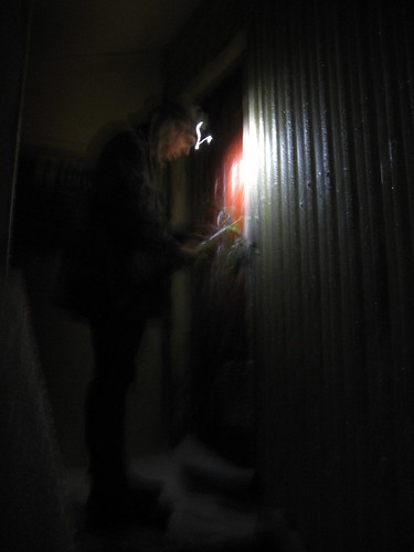
Upon reaching Kime Hut the door was frozen shut, just as Spencer had warned.  Sam used his ice-axe to remove the frozen ice from the large metal latch to gain entry. I was pleased to have thought ahead by carrying extra fluid with the Kime Hut water tank frozen solid, which was always going to be likely at this time of year.


Departing Kime it was onward and over Field Peak (which counter-intuitively is nowhere near Field Hut of course). Once reaching the descent of Field Peak on it's southern side it was icy and slippery. Once again, just as Spencer had advised. My ice-axe has been on many more trips than it's been required in the past. Tonight it was essential to assist my rather less than assured footing on this mixture of ice and rock.
 IMG_7757

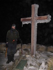
There was some cloud about when we reached the summit of Hector and the memorial cross, but not enough to block the light of the moon, or as Mike would prefer to correct me, the light of the sun reflecting from the moon.


As we descended Hector and made our way through the Beehives, the track itself was a little treacherous having formerly being wet, but now was frozen solid. Where possible we walked on the safer route over the tussock alongside the frozen track. Where rock covered in 'black-ice' was the only option my steps were far more tentative, as I grovelled through with my ice-axe held by clenched iron-fists. This made progress pretty slow. Ideally there would either be lots of snow to make crampons ideal, or no snow at all. The mixture of snow and rock as tricky, particularly on


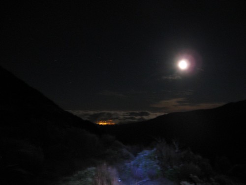
Once over Atkinson there was a lot less ice around as we continued around the Dress Circle and over Aston, now with Jupiter clearly visible to the south east. Once at the top of Alpha where there was no snow or ice at all. We spent a few moments relaxing on top of Alpha. Enjoying the night sky and the still air which is so rare in the Tararuas Range.


We approached Alpha Hut quietly, but found it empty on this glorious evening.  Without needing to worry about disturbing others, we had a reasonably long rest an a snack before departing a little after 4am. We were already a long way behind our intended, and optimistic time but only had the Marchant Ridge left between us and our destination at Kaitoke.


The Marchant Ridge an area of geography that often subject to much slander among trampers. I have often felt this is this isn't necessarily justified. Many trampers lament the lack of views on this goblin forest coated ridge, yet the goblin forest of the nearby Cone Ridge celebrated. With the Marchant so often described with, well lets just say with many short err, "adjectives". The current topographical map BP33 shows eight spot heights along this ridge, with a mere150m of altitude descended between the first last of these. It certainly seems to be with some justification that many describe this ridge as:

'Uphill in both directions'.

However, I believe that the real reason ridge is so despised is because it is both long and at the end of epic journeys. The Marchant Ridge often being the final stretch of a  Southern Crossing or an 'SK' and it is some 15km long. The mind says you are nearly there, but in reality you are not. The route from Alpha Hut to Kaitoke along the Marchant Ridge covers 40% of the total distance over the Southern Crossing route!
 IMG_7781


On this occasion, I stepped in a hole somewhere near the 'top' of Marchant Ridge. After wincing and limping for a few strides, at which time I felt like rolling over the ground screaming like a girl, I just kept walking. The further we went the more my knee swelled. I was unsure if I had an injury, or if a less ambitious trip would have been more desirable after not having been out tramping for a while.  I just kept on moving. The sun was rising by the time we reached the open area on Marchant that was created by a fire here some years ago.  and eventually we found our way to Kaitoke over 21 hours after leaving the car in Otaki.


This was a much slower trip than we had optimistically anticipated. That said the GPS data that Mike collected suggests we only spent about 13 hours actually moving - the rest of the time Mike and Sam must have been waiting for me? While they *did* spend a lot of time waiting for me, I’m not sure it was quite accurate!


Thankfully about a week later the swelling in my knee came down and I can once again see my knee cap – phew!.

Thanks Mike for the photos and GPX file. You can read more about this trip on Mike’s blog at http://www.windy.gen.nz/index.php/archives/487#more-487

And thankyou for leading the trip Sam :)

Saturday, 17 July 2010

Onslow Tarbabies Individual Time Trial (ITT)


Like the recent OTB Criterium, Mossy again worked his magic and ably assisted by Digger organised a time-trial for our members. Even for those, like me who aren’t quite fast enough to “race” but like to pretend all the same. :).


Whilst great claims can be made about rain-proof courses it is the middle of winter in Wellington right now and I must admit that I had my doubts about the allegedly non-rain affected course.

Event takes place even if wet. The course is not exposed and not affected by rain.
Ride Data:
Distance: 17.6km 821 Calories
Time:

32m 25s

32.6 km/h

39.5 km/h MAX

Heart-rate: Avg: 94% of MAX Max: 98% of MAX
Cadence: Avg: 96 rpm Max: 111 rpm
Ride Data: Garmin Connect / RideWithGPS
Location: Wellington, NZ 17 July 2010

… If only Mossy could organise the weather as well as the races?


This was the first tine I had ever ridden in a time-trial and at 18km it was contrast of extremes both in the weather, as well a the riding from my last event, the Grand Tour: Highland Double Century under the Californian sun.


The course was three laps of a 6km circuit. The first-half was more-or-less flat with a southerly tail-wind, whilst the second-half lap had a few minor bumps to accompany the return head-wind.


My laps got progressively slower, with recorded lap times of 10m29s; 10m51s and 11m05s.


Lap three began with Scott charging past me as if I was at home sitting on a stationery trainer. Perhaps he had thought it was a handicap race? Whether it was time-trial or handicap he certainly left us all in his wake (both figuratively and physically) on this amphibious day.  I could feel my legs as the final lap progressed, and the rain in my eyes after removing my completely fogged sunglasses certainly didn’t during this, my final and slowest lap. Unfortunately toward the end of this lap John F, and John H both passed me to convincingly destroy me against the clock having started 2 and 3 minutes behind me respectively.


Heart-rate Zones:
Zone 1: 0 min
Zone 2: 0 min
Zone 3: 0 min
Zone 4: 1 min
Zone 5: 30 min

Riding the short time-trial was at a vastly higher level of intensity than I usually ride with in the long endurance rides I typically participate in. Hopefully this will help me increase my capacity to ride harder during the pending spring endurance rides. Aside from the first few pedal strokes, I was riding with both high cadence, and heart-rate with the ticker running in “Zone 5” the entire time – great workout!


I recorded a time of 32m25s today for an average speed of 32.5km/hr. ‘twas atrocious weather, but as always I would have liked to have been a little quicker. To achieve that I'm going to have to add a lot more intensity to my training. Hopefully we’ll have another ITT soon so I have an opportunity to seek improvement.


Date 17th July 2010
Weather Steady rain, light southerly,
Temp approx 10deg C
Route Liverton Road, Upper Hutt
Name Start Lap 1 Lap 2 Finish Net Time

Kara

15:13

15.23.28

15:34.33

15:45.37

32:37

Jackie

15:14

15:24.32

15:35.34

15:46.33

32:33

Craig

15:15

15:25.29

15:36.20

15:47.25

32:25

Mike

15:16

15:26.35

15:37.13

15:47.52

31:52

Chris

15:20

15:30.08

15:40.34

15:51.02

31:02

John H.

15:17

15:26.45

15:36.48

15:46.45

29:45

John F.

15:18

15:27.34

15:37.30

15:47.23

29:23

Tim

15:21

15:29.51

15:39.13

15:48.24

27:24

Scott

15:19

15:27.48

15:36.46

15:45.47

26:47