Pages

Saturday, 27 November 2010

Twice Around the ‘Pond’–The Lake Taupo Cycle Challenge Enduro

Often referred to as a pond by cyclists that have been ridden around it many times, Lake Taupo is New Zealand’s largest lake with a surface area of 616 square kilometres. I have previously ridden around ‘the pond’ four times, one lap in each of the past four years. For me, the 2010 Lake Taupo Cycle Challenge featured a stolen bicycle, a brand new Trek and two enjoyable laps of ‘the pond’.

It was a disrupted lead in after my Specialized Roubaix Expert was stolen just 12 days prior to the event. Thankfully AMI resolved the case promptly, albeit at second-hand value and not replacement value of the bicycle. Capital Cycles gladly accepted my “emergency visa”  to top up the insurance and had me going on a new Trek Madone 5.2 quickly. They were also kind enough to loan me the factory wheels while they built some strong and durable Mavic Open Pro’s with a full compliment of spokes and Dura-Ace hubs. I was lucky to work like this done at the last minute immediately before the Lake Taupo Cycle Challenge, New Zealand’s largest cycling event. These wheels are more suited to my sturdy frame and the ultra-distance endurance cycling goals I have over the next twelve months. Capital Cycles finished building the wheels on Thursday morning, so I only had a chance for 10km commute home before travelling up to Taupo the following morning.
Ride Data:
Distance: 315.47km 15,078 Calories
Time: 12h42m50s (elapsed)
12h10m53s (moving)
24.8 km/h (avg)
25.9 km/h (avg moving)
75.5 km/h (max speed)
Elevation: Ascent: 3,512m Descent: 3,516m
Cadence: Avg: 86 rpm Max: 123 rpm
Ride Data: Garmin Connect / RideWithGPS
Location: Taupo, NZ 27 November 2010

On Thursday evening I tried to swap the light and fast but not particularly puncture proof Bontrager tyres that came with the bike. Will be handy tyres next time I ride a shorter race or perhaps a criterium. Unfortunately, while I am usually able to change tyres without the use of tyre levers, this tyre and rim combination was simply too tight for my bare hands. With my tyre levers still in the toolbag on my stolen bicycle, the best of  intentions to be prepared in advance came to nothing and I was buying tyre levers at the event hours before my 1:30am start.


With a stiffer frame on the new Trek compared to the stolen Specialized I opted for 25C instead the “standard” 23C tyres. This allowed me to run the tyres at lower pressure without risking a pinch flat. 95-100 PSI both feels better over chipseal and offers lower rolling resistance than at 115-120 PSI I usually run at with 23C tyres. With the chip-sealed roads in New Zealand I am surprised the use of wider tyres for the many of us over 90kg is not standard practice. You may wish to read the excellent article "Tyre Pressure and Load by Jan Heine” which appeared in Adventure Cyclist in March 2009. Thinner tyres are not always faster.

My replacement Ayup headlamp mounts had not arrived from Australia before I left Wellington (In hindsight they had arrived just seven minutes after I left!). Thankfully my work colleague Phil was able to loan me a mount to use, which I fitted when he arrived at the cabin next door. I matched the Ayup light with a Cateye HL-EL530 headlamp to meet the dual lighting requirements for Audax rides. It also gave me a combination of a rechargable system with long battery life, and an backup system that could run off off-the-shelf batteries. Both have a good run times and are bright enough to be used alone for night-time road riding. The EL530 has a small concentrated bright spot, with plenty of less lit, but acceptably right area around it.to see all you need.  The Ayup lights are smaller, yet brighter and offering a far broader and consistent coverage area. The Ayup system offers better lighting, but the EL530 runs on four easily purchasable AA batteries.

With the bicycle complete, I had enough time for about two hours sleep before it was time to get up and head down to the 1:30am start. Tiredness was not a problem for me when I woke. I was excited to get out for a good long ride and see how my nice new Trek would perform. On arrival at Redoubt St, there was a lot of broken glass about but thankfully I did not hear any tyres puncture from it.

I started near the back of a field of about eighty of riders. At 1:33am we were off. To my astonishment as we rode through the initial 16km of predominantly ascending to the highest point I was still holding comfortably in the main bunch. If you are a regular reader my web-log you will be aware that I am quite used to being dropped on climbs. Whether it was training, the enforced 12 day break or the new bicycle I was adamant my new Trek was a “Rocket Ship”’!


The “Rocket Ship” verdict was confirmed through the night as I continued to stick with the bunch up, up, up and over Waihaha, Kuratau and Waihi Hills. I tried to jump the bunch to give myself time to get my brevet card signed at the Turangi Truck Stop. Ultimately, this effort was futile. Even a stop of just a few minutes, is a lot of time on the road. At 30km/h it was a matter of losing 500m per minute to the bunch. With no-one else stopping here I was obviously the only one in this bunch riding as a 300km Brevet to qualify for the Paris-Brest-Paris in August.

The remaining ride through to Taupo was mostly in solitary, although there were a few moments with two other riders. Unfortunately were unable to find speeds that we were able to ride together at. Once through to the Caltex in Taupo in a handy 5h45m. I had a short break, getting my brevet card signed, putting on a clean shirt and swapping two empties for two more bottles of perpetuem. I put some sun block on too, but by the finish it was obvious that “some” was not even nearly enough! Thanks Mum and Dad for meeting me at the controls with my pre-made drink bottles and things.

I passed through Taupo to start my second lap at about 7:30am and instantly was inundated with one lap riders with fresh legs riding straight past me. It was almost impossible to hold the bunches because someone with fresh legs would undoubtedly lead a new wave of attacks at the slightest sign of an incline. With one lap already in my legs I was feeling much more in the mood to ride in a consistent speed and effort zone than for following attacks and accelerations.

The hills sure seemed harder during the second lap. Was it just from having more work in my legs? Had the darkness flattened them during the night? Does heat make them this much harder?

The first 3/4 of the second lap was a procession of riders attacking each other and passing me. After the stopping at Turangi Truckstop for the second-time to get the third row of my brevet card signed there was a dramatic difference in the one lap riders I was riding with. With the stronger one-lappers well through now I was now leading packs, passing one-lappers with cramp or sleeping in any piece of shade they could find. This was surely the hottest day of the year? By Hatepe, I was cooking myself and a brief stop in the shade before riding up the hill past numerous other riders, some of whom needed to use the ‘two-foot’ gear. I am convinced that the key issue with Hatepe hill is not only that it occurs late in the ride, but that there is little shade, maximum sunshine and it can be stinking hot riding up here. At in 140km (or 300km) already ridden in the legs, and this non-mountainous hill suddenly feels like a wall.

Once over Hatepe I focussed on efficiency, ensuring to keep my head down and arms narrow downhill ensuring good speed without needing to pedal. This gave me excellent recovery and I was back to full power on the pedals to cross the finish line in 12h42m looking fresh, strong and ready for another lap!

More distance is certainly coming up. This ride counted as the 300km qualifier for the Paris-Brest-Paris. I now need to focus on the 400km and 600km qualifiers and then onto the 1200km epic in France in August 2011.


Sunday, 7 November 2010

Tour de Manawatu 2010

The Tour de Manawatu has a couple of short steep climbs early on, on the way out of Ashhurst. After this there is a long but incredibly gradual climb and fall with one other lump before the finish back in Palmerston North after 116km. This sort of course would normally suit me, but today I was backing up from consecutive 200km epics with the GWALoop and the K2 from previous two weekends, and the Tour of the Bay the weekend before them.. This was weekend four from four and for me it was one of those days where if I had not entered in advance and paid an entry fee I may well of not turned up to ride and stayed home for a sleep in.

Tour de Manawatu Elevation Profile


Ride Data:
Distance: 115.47km 5726 Calories
Time: 3h47m35s 30.4 km/h (60.4km/h MAX)
Elevation: Ascent: 933m Descent: 929m
Cadence: Avg: 91 rpm Max: 119 rpm
Ride Data: Garmin Connect / RideWithGPS
Location: Palmerston North, NZ 7 November 2010
I was managing to hold my own on the initial part of the climbs which denotes significant hill climbing improvement from the past. Unfortunately, I had a combination of four different riders either dropping their chains or getting punctures immediately in front of me on the way up the hill. The net effect of this was the same as my past hill climbing experience – losing touch with the bunch by the top. Ultimately this mattered little. I didn’t have a great deal of power in my legs today. Riding my fourth event in as many weeks was catching up with me so with tired legs I rode it out in generally solo riding through to the finish.

Saturday, 30 October 2010

K2 2010

The K2 is one of the hillier single day rides that one can find, yet even as incredibly slow hill climber I find it to be one of my favourite events over a wonderfully scenic, 185km coastal course.

Ride Data:
Distance: 184.8km 9292 Calories
Time: 8h08m 22.68 km/h (87.26km/h MAX)
Cadence: Avg: 78 rpm Max: 144 rpm
Ride Data: Summary data only. GPS data borked on this ride sigh
Location: Coromandel, NZ 30 October 2010
Being a hilly course I haven’t really performed on the course in the past so I entered in the last and slowest group (9). With a three minute gap between each starting group. Approaching the start of the group 9 start a quick calculation in my head made me realise that I was going to have take a whole hour from my previous two rides in this event to be finished before the prize giving began! Today, I was delighted after taking a full an hour and half from my previous two rides in this event.
On the first hill (Manaia) I passed a rider who had the unfortunate mishap of having already broken their chain (and derailleur hangar?).  On the way up the second hill of Kerata, Brent whom I had met the previous week on the GWALoop  caught up with me. It was not a surprise for me to see him ride straight past me as we travelled uphill. However I saw him stopped as I flew down the other side of the hill with my chin on the handlebar stem. I never saw him again until the final climb over Whangapoua where I learned he had punctured coming over the top of Kerata.
I then spent most of the ride along the coast to Thames in a large group, but to be honest the rotations were not particularly smooth and at times even scary. I reached Thames about 50 minutes quicker than I did in 2008 making it my fastest ride over this leg. With the rotation of the starting towns, this first leg this year so fresh legs no doubt helped me gain the my personal best time for the leg.
Once through Thames, it was the climb up the Kopu-Hikuai Hill (425m) for the highest point on the ride. This is a gradual, rather than steep ascent and I unusually found myself near the front of the group that gradually disintegrated on the way up to the summit. I was mostly riding on my own, or in small clusters of riders for the rest of the ride from here. I reached Tairua 2h11m after leaving Thames, now 2 from 2 for personal bests for each leg. I was now on target to be about an hour ahead of my previous best time for the whole ride. Finishing before prize-giving began was now obviously not going to be an issue :).
Estimated section differences 2008 / 9 & 10 2008 2009 2010
Coromandel Town to Thames: 2:44:48 2:51:41 1:54:22
Thames to Tairua: 2:30:00 2:36:30 2:11:36
Tairua to Whitianga: 2:02:02 2:17:01 1:41:35
Whitianga to Coromandel Town: 2:21:01 1:52:19 2:21:12
9:37:51 9:37:31 8:08:45
Improved form followed me over Pumpkin Hill and down to Whitianga, placing me another 20 minutes ahead of my previous best for this leg. 3/3 for leg personal bests. Undoubtedly, a PB for the whole ride coming right up.
With the revolving start beginning at Coromandel this year, it left the hilliest section to last. The Whangapoua Hill was far more challenging having already ridden 170km! For some reason my GPS data was corrupted on this ride and unreadable afterwards. All evidence of my use of the ‘two-foot’ gear is thereby erased forever! Finishing with the climbs of Kuotuna; Myundermans; Gentle Annie and then Whangapoua really hit the legs and this was the only sector that I did not ride a personal-best sector in.
All up, I took about 90 minutes off my previous times in this event, and had my best time for 3 of the 4 individual legs that make up the event.. 8h8m was good for me on a hilly course. The moderate climbing efforts have improved greatly, the steep climbs need some work yet. Once it reaches a certain level of steepness I am grinding it out far too slowly. This may require more strength training.
Can I find a sub-7h30m in 2011?

Saturday, 23 October 2010

The 204km Gisborne–Wairoa Loop (GWALoop)

At a distance of 204km, GWALoop is the longest supported single fun ride in New Zealand. The course is very rurally scenic with most of the motorised traffic encountered generated from the event itself via relay teams moving bicycles and supporting the team around the course. 
Ride Data:
Distance: 204km 9954 Calories
Time: 8h31m28s 23.8 km/h (74km/h MAX)
Elevation: Ascent: 2,419m Descent: 2421m
Cadence: Avg: 80 rpm Max: 117 rpm
Ride Data: Garmin Connect / RideWithGPS
Location: Gisborne, NZ 23 October 2010
There are a couple of sizable hills, which are always a challenge for me as “clydesdale” rider. Having now ridden the course, these hills probably were not as big they appeared when studying the elevation profiles in advance of the event. The event rides around the loop in a clockwise direction which is sensible as not only does it mean that the ascents are generally more moderate, and the descents steeper but the the first section on the busier state highway 2 is completed early in the morning before there is any traffic to encounter.

With 204km to cover and three hills in the last quarter of the ride I was surprised at the speed that most left the startline with a cracking pace over 40km/h. I knew I would not have the legs if I kept that up and soon found myself in a group of four riders that were able to rotate and work together. Unfortunately I was dropped after a 50km on the way up the 490m high Wharerata Hill. This meant a lot of solo riding until a relay rider wearing a ‘LOOK Pro team shirt’ caught up to me help me along. We soon caught up with Brent from Toronto. After 107km ‘LOOK’ pulled out to swap with his relay partner and Brent I rode together until about 140km when like most/all? riders in this event Brent proved to be a far better climber than I and I couldn’t stick with him up to Tinorito.

GWALoop Elevation Profile

At Tinorito I stopped briefly to refill my water bottles and ground my way up the 430m high hill. There was some respite from hill climbs for the following 20km with a 230m net descent before the climbing back up to 400m at the Kiteroa Hill. At about 185km there is a rapid descent back down to 85m, although one of the corners needed care due to bouncing over rough seal.

Once at the bottom it was back into the wind that has turned 180 degrees during the day with a further 12km solo slog into the wind. Just after a rubbish truck stalled in front of me I was able to reach the finish line in 8h31m28s, at which point I was pleased to be camping at the Showgrounds Motor Camp with just a few metres to crawl to find my things and get into a hot, clean shower!

There is some debate among riders as to whether the K2, or the GWALoop is the harder ride. I think it comes down to if you are not a strong hill climber K2 will be harder, but if you a good climber but not as strong after a long day in the saddle then the GWALoop may be harder with an extra 20km of road travelled and a lot of coarse chip-seal on the road surface.


Sunday, 17 October 2010

Tour of the Bay

The 2010 Tour of the Bay was a ride of differing weather with beautiful Hawkes Bay sunshine in Hastings and dampness in the hills. Seems to be a nice course. I would like to come back and maybe get more views over the top next time?

I started reasonably strongly but could soon feel a few of the wines in my stomach after a mere 25km. I had been staying with a few of the guys from the Onslow Tarbabies whom had introduced me to a different form of “carbo-loading” than I was used to the night before. This was very normal to these seasoned veterans, but as for me The Hawkes Bay wines were tasty but, whilst not being a tea-totaller I am a seldom drinker and usually I stick the brews which may have been kinder to my belly. Meanwhile, this was normal for these seasoned campaigners.  
Ride Data:
Distance: 108.72km 9292 Calories
Time: 3h53m24s 27.9 km/h (66.7km/h MAX)
Elevation: Ascent: 857m Descent: 850m
Cadence: Avg: 90 rpm Max: 115 rpm
Ride Data: Garmin Connect / RideWithGPS
Location: Hastings, NZ 17 October 2010

After the climb up Clarksons Hill and my usual uphill loss of the bunch I rode alone for a short time before riding small paceline for four heading heading toward Tikiokino. I thought we were travelling well but we were soon chased down by a large bunch that caught us after about 50km. This bunch circulated well until it fragmented a bit over a long undulating section where I dropped off the back at about 75km. After a quick descent, I slogged my way into the wind back to the finish.

Tour of the Bay Elevation Profile

This year I have twice ridden days over 300km, but today I was happy to make the finish at a mere 110km.

Sunday, 3 October 2010

Lake Wairarapa Fun Ride 2010

The Lake Wairarapa Fun Ride, organised by the Wellington Veterans Cycling Club traverses a relatively gentle course without a lot of climbing and at just 80km long offers a good option for the first ride of the spring fun rides to blow out the cobwebs from winter.
Ride Data:
Distance: 80km 4,268 Calories
Time: 2h 20m 21s 34.2 km/h (54.3m/h MAX)
Elevation: Ascent: 226m Descent: 224m
Cadence: Avg: 86rpm Max: 110rpm
Heart rate: Avg: 81%of est. max Max: 95% est, max rpm
Ride Data: Garmin Connect / RideWithGPS
Location: Featherston, NZ 3 October 2010

It is a time of year where the wind can be a bit of an issue. I last rode this in 2006 (2h36m5s), with the 2007 called off due to dangerous winds. For 2010, it was fabulous day and the only problem was I didn’t have the legs to hold the 40km+ group down the road to Lake Wairarapa.

The return journey was a bit dramatic with two crashes around me. The first occurred when I was in a group of three, and the rider in front of me briefly stopped pedalling to look behind him. When I stopped pedalling too the third riders front wheel touch mine and we stopped briefly as he climbed out of the ditch with a juicy scratch on his hand.

The second incident happened when I was leading a large bunch that caught up to us. Not sure what happened I just saw multiple bicycles going down together behind me. With plenty of the bunch helping others back up I kept riding through this time.
Craig's Lake Wairarapa Results
2006 2:36:05
2010 2:20:21

After sitting in a large bunch behind a tandem for an unfair amount of time, I took a lead slightly too early at 3km out and watched everyone ride past me over the last 500 metres.

It was pleasing to knock 16 minutes off my previous ride in the event. Nice to start the spring with a PB!

Saturday, 4 September 2010

OTB ITT: “Surf to Summit” (Makara Beach to Johnsonville)

With a beautiful day to open the first Saturday of spring Frank kindly organised a time-trial from Makara Beach to Johnsonville.


Makara Beach to Johnsonville Elevation Profile

Ride Data:
Distance: 14.12km 861 Calories
Time:

35m 25s

23.9 km/h (46.6km/h MAX)

Elevation: Ascent: 274m Descent: 59m
Cadence: Avg: 91 rpm Max: 111 rpm
Heart rate: Avg: 86% est. max Max: 95% est. max
Ride Data: Garmin Connect / RideWithGPS
Location: Wellington, NZ 4 September 2010


Not being a strong climber and with a net ascent over the route I was a tad apprehensive about the distinct possibility of riding badly but registered for the ride anyway. 


While not a time to set the world on fire, with the benefit of competition I rode up to Johnsonville in 35m27s, a remarkable 8 minutes faster than my previously recorded training times over the same route.


We began our time-trials in reverse, seeded order which had me 7th out of 21 riders. Not sure whether complaints of net ascent aided my seeding or not. I started strongly into the wind and after a few kilometres began passing those that had started ahead of me. At 10km (of 14km) I was up to third on the road (if I counted correctly) but any possible thoughts of being of first being to the line soon evaporated as a succession riders whizzed straight pass me between the 11th and 12th kilometres.


Had a great afternoon and am looking forward to finding more improvement. Thanks again for organising the ride Frank :).


No doubt we’ll have more ITT’s over the same route. Have a target to beat to find the PB now. Now, if I only I can get riding up those hills a bit quicker…


Sunday, 29 August 2010

The Feilding Festival of Cycling: 90km Recreational Ride

Scheduled in late winter, the Feilding Festival of Cycling offers a great chance to blow out a few cobwebs before the spring Fun Ride season begins. This event offers a range of rides beginning with a critierium on Saturday, followed by Sunday’s Graded Road-race 90km and recreational rides of 90km, 50km and 20km. This leaves plenty options for all mixtures of fitness and ability. I entered the 90km recreational ride which followed an “Out and Back” course up a 30km false flat/gentle climb followed by 15km of rollers to  Peep-o-Day and return.
Feilding Festival of Cycling Elevation Profile

Ride Data:
Distance: 91.48km 4,207 Calories
Time: 3h 16m 25s
Out: 1h 52m 21s
Back: 1h 24m 05s
27.9 km/h (61.3km/h MAX)
Out: 24.5km/h
Back: 32.6km/h
Elevation: Ascent: 1,094m Descent: 1,086m
Cadence: Avg: 91 rpm Max: 114 rpm
Ride Data: Garmin Connect / RideWithGPS
Location: Feilding, NZ 29 August 2010
I was feeling tired as I drove up from Wellington and stopped to purchase the obligatory triple-shot mocha. At this time it was absolutely teeming down with rain and without my raincoat in the car I was almost ready to take the soft option and turn around and drive home again. During the coffee stop, the weather improved along with my mood and by the start of the event the rain had just stopped falling and the weather essentially just got better as the day went on.

Once again I could not find enough speed straight off the line to move through the pack and ride amongst the leading group. In these recreational rides it can be useful to be able to start hard and fast to be in the correct group when it settles down 10-15km into the event, of course this must be done in fine balance as not to blow out and struggle in the latter half of the event. We were able to get a group organised  into a good rotating pace-line. Unfortunately after a mere 15km this group fragmented as we began riding up the 30km long false flat. At this point a group of six got away off the front of this group and were generally in my sights but I was unable to catch them until that group also fragmented near the turnaround point when I caught each rider one by one.

With no benefit of drafting I thought I rode well alone on the return journey. Admittedly after the first few rollers it was all downhill, but there was a cross wind into my right shoulder.  In a really weird kind of way, I found it satisfying to pass a guy in $10K worth of fast aero kit on the crest of the last roller on the way back and made it through 30km of straight, flat to downhill road without being caught.
I resolved that the next person I see make such poor use of great kit like that should give it to me!
Whilst aero kit isn't of so much use climbing, he should have easily caught me. Cycling is an equipment sport and you can buy up to about a 4% speed improvement. 

I picked up a few more places in the last few kilometres and crossed the line strongly, and felt good enough to possibly hold that pace for another 90km? Endurance is feeling good right now. Not bad after a mild struggle to stay awake at the well on the drive to the start!

Thankyou to all organisers, volunteers, sponsors and of course for the tyre that I won at the spot prize draw that followed the event :D.


Saturday, 21 August 2010

Onslow Tarbabies Team Trial

My first team trial didn't get off to the best of starts when I, well failed to find the start. In the spirit of:

"I read on the internet it must be true"

I am going to blame Google Maps for this geographical embarassment. I previously haimaged no care as to where Burnham Wharf was and apparently Google could say the same! I was a little confused in failing to find any of the fine Onslow Tarbabies as I looked around the various wharfs/jettys/studios around Shelley Bay. Which incidentally is nowhere near Burnham Wharf, nor the little flag where Google maps alleges Burnham Wharf is located. 


I was about to ride around the bays on my lonesome when Jo and Liz came riding past screaming out my name saying “your on our team”. From a standing start I set off in their pursuit as we worked to get our three team member paceline working appropriately. Jo took the role as team captain and gave out the instructions:

Keep rotating short rotations and YOU take longer at the front.

I presumed that "YOU" meant me. In the early stages I found it tricky keeping the pace right with instructions from behind me "too fast". We eventually got our pacing in sync by the time we reached the airport tunnel. We were around the Lyall Bay roundabout and returned through the airport tunnel before we saw the next team in pursuit. Could we hold them off all the way back to wherever that Burnham Wharf place is???

Ride Data:
Distance: 27.88km* 821 Calories
Time:

32m 25s

32.6 km/h

39.5 km/h MAX

Heart-rate: Avg: 94% of MAX Max: 98% of MAX
Cadence: Avg: 96 rpm Max: 111 rpm
Ride Data: Garmin Connect / RideWithGPS
Location: Wellington, NZ 21 August 2010
* This is shorter than the real distance because I missed the start due to geographical embarassment

In penance for missing the start, I spent a solid amount of time leading our team back. Jo was having to work hard to get back on as she lost ground looking over her shoulder for the other two teams chasing us down. They were in sight with a few kilometres to go. I did my best to help keep us ahead, but for the last kilometre or so with a new tune could be heard behind me: Faster, faster. I lifted my cadence as best I could. I had lead out for some way and was starting to feel my legs. Didn’t have too much left for a sprint at the line. Competiveness pulled me through and we made the finish without being chased down, making us the winners on handicap. The handicapping was very accurate with all three teams finishing within a minute of each other. I had a lot fun in this ride. Both riding as a team and levelling the field through well set handicaps made for a great ride.


Will be great if we can get a few more teams rolling next time?


Sunday, 25 July 2010

Tramp: The Moonlight Southern Crossing

After a few false starts on the fourth? attempt I finally completed the Moonlight Southern Crossing. Prior attempts having been thwarted by weather and well, a sheer lack of Moonlight.

Trip Data:
Distance: 37km  
Time:

12:56:51 (moving)

21:40:31 (elapsed)

Elevation: Ascent: 2,357m Descent: 2,224m
Trip Data: Garmin Connect
Location: Tararua Range, NZ 24 July 2010

It is hard to say exactly what it is that gives this trip its magical appeal. Perhaps it is the statistical unlikelihood of having a clear night in the Tararua Range during the middle of winter? Let alone underneath the full moon! The Tararua’s are renowned for their imperfect weather,  as Geoff Spearpoint observed in his book “Waking to the Hills”

Weather plays a major part in Tararua affairs, mist normally covering the tops for 250 days of the year. Southerlies bring the snow and freeze them; westerlies bring the rain and wet them; and the northerlies blow until it is a marvel there is anything left.

I had arranged to do this trip with Mike and Sam, and we were all watchful of the weather forecasts and weather model information in the week leading up to July's full moon. The best weather looked like it would be on Sunday evening, but the storm passed through quicker than expected over Friday night, Saturday was a cracker of day.


Sam and I hatched a very approximate plan over the telephone which optimistically featured the fastest times we had travelled over each section of the route. Oooopps. Not the best way to estimate time! At least walking straight through, without staying in any huts saved me from having to splash out on the recently increased price for a new annual hut pass.


Flat battery number one: After seven weeks of being an incredibly fuel efficient Subaru - stationary on my driveway! The battery was dead and would not turn the motor over. Thankyou awesome neighbour Ken for helping me out so we could go tramping! I must say I do prefer to walk or to cycle, but must make sure I the car moves out of the driveway at least occasionally!


I collected Mike and Sam enroute to Otaki Forks. Oooopps battery issue two: I had not replaced the batteries in my SPOT after removing them before flying back from the USA recently.  Sorry - no digital breadcrumbs for the worrying family at home. No problem as long as we do not need that SOS button!


Shortly after crossing the bridge over the Waiotauru River we saw Spencer, whom I had not seen for a couple of years. He reported ice on top; crampons recommended; couldn't get into Kime Hut as it is frozen over. We noted that regardless of the not so balmy conditions he had reported that he had travelled without an ice-axe. After a quick chat Spencer kindly drove my car back to Wellington to save me the effort of returning to Otaki Forks to collect it!


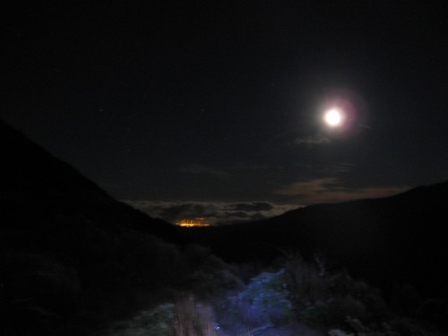
A few minutes before reaching Field Hut darkness encroached as we travelled for our last few minutes in the bushline with the use of our headlamps. Once beyond Field Hut and above the bushline the moonlight provided enjoyable conditions under a beautiful night sky.


With Mike on the trip and his knowledge of astronomy we were able to celestials the prominent celestial body in the sky to our west. All without needing to refer to Wikipedia to pretend to be smart. Now above the bushline we had Venus as a prominent celestial body to the west.


The lack of snow was notable as we walked across Table Top. At this time it was difficult to co-relate with Spencer's crampons recommendation. There were a few patches of firm snow as we crossed Dennan followed by thin layers of snow leading to Kime Hut. There was substantially less snow than when I was here last year, however, on this occasion it was much nearer to frozen and a lot more slippery.


IMG_7757

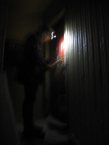
Upon reaching Kime Hut the door was frozen shut, just as Spencer had warned.  Sam used his ice-axe to remove the frozen ice from the large metal latch to gain entry. I was pleased to have thought ahead by carrying extra fluid with the Kime Hut water tank frozen solid, which was always going to be likely at this time of year.


Departing Kime it was onward and over Field Peak (which counter-intuitively is nowhere near Field Hut of course). Once reaching the descent of Field Peak on it's southern side it was icy and slippery. Once again, just as Spencer had advised. My ice-axe has been on many more trips than it's been required in the past. Tonight it was essential to assist my rather less than assured footing on this mixture of ice and rock.

 IMG_7757

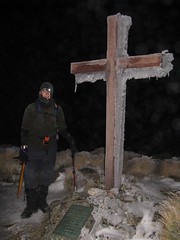
There was some cloud about when we reached the summit of Hector and the memorial cross, but not enough to block the light of the moon, or as Mike would prefer to correct me, the light of the sun reflecting from the moon.


As we descended Hector and made our way through the Beehives, the track itself was a little treacherous having formerly being wet, but now was frozen solid. Where possible we walked on the safer route over the tussock alongside the frozen track. Where rock covered in 'black-ice' was the only option my steps were far more tentative, as I grovelled through with my ice-axe held by clenched iron-fists. This made progress pretty slow. Ideally there would either be lots of snow to make crampons ideal, or no snow at all. The mixture of snow and rock as tricky, particularly on


Once over Atkinson there was a lot less ice around as we continued around the Dress Circle and over Aston, now with Jupiter clearly visible to the south east. Once at the top of Alpha where there was no snow or ice at all. We spent a few moments relaxing on top of Alpha. Enjoying the night sky and the still air which is so rare in the Tararuas Range.


We approached Alpha Hut quietly, but found it empty on this glorious evening.  Without needing to worry about disturbing others, we had a reasonably long rest an a snack before departing a little after 4am. We were already a long way behind our intended, and optimistic time but only had the Marchant Ridge left between us and our destination at Kaitoke.


The Marchant Ridge an area of geography that often subject to much slander among trampers. I have often felt this is this isn't necessarily justified. Many trampers lament the lack of views on this goblin forest coated ridge, yet the goblin forest of the nearby Cone Ridge celebrated. With the Marchant so often described with, well lets just say with many short err, "adjectives". The current topographical map BP33 shows eight spot heights along this ridge, with a mere150m of altitude descended between the first last of these. It certainly seems to be with some justification that many describe this ridge as:

'Uphill in both directions'.

However, I believe that the real reason ridge is so despised is because it is both long and at the end of epic journeys. The Marchant Ridge often being the final stretch of a  Southern Crossing or an 'SK' and it is some 15km long. The mind says you are nearly there, but in reality you are not. The route from Alpha Hut to Kaitoke along the Marchant Ridge covers 40% of the total distance over the Southern Crossing route!

 IMG_7781


On this occasion, I stepped in a hole somewhere near the 'top' of Marchant Ridge. After wincing and limping for a few strides, at which time I felt like rolling over the ground screaming like a girl, I just kept walking. The further we went the more my knee swelled. I was unsure if I had an injury, or if a less ambitious trip would have been more desirable after not having been out tramping for a while.  I just kept on moving. The sun was rising by the time we reached the open area on Marchant that was created by a fire here some years ago.  and eventually we found our way to Kaitoke over 21 hours after leaving the car in Otaki.


This was a much slower trip than we had optimistically anticipated. That said the GPS data that Mike collected suggests we only spent about 13 hours actually moving - the rest of the time Mike and Sam must have been waiting for me? While they *did* spend a lot of time waiting for me, I’m not sure it was quite accurate!


Thankfully about a week later the swelling in my knee came down and I can once again see my knee cap – phew!.

Thanks Mike for the photos and GPX file. You can read more about this trip on Mike’s blog at http://www.windy.gen.nz/index.php/archives/487#more-487

And thankyou for leading the trip Sam :)

Saturday, 17 July 2010

Onslow Tarbabies Individual Time Trial (ITT)


Like the recent OTB Criterium, Mossy again worked his magic and ably assisted by Digger organised a time-trial for our members. Even for those, like me who aren’t quite fast enough to “race” but like to pretend all the same. :).


Whilst great claims can be made about rain-proof courses it is the middle of winter in Wellington right now and I must admit that I had my doubts about the allegedly non-rain affected course.

Event takes place even if wet. The course is not exposed and not affected by rain.
Ride Data:
Distance: 17.6km 821 Calories
Time:

32m 25s

32.6 km/h

39.5 km/h MAX

Heart-rate: Avg: 94% of MAX Max: 98% of MAX
Cadence: Avg: 96 rpm Max: 111 rpm
Ride Data: Garmin Connect / RideWithGPS
Location: Wellington, NZ 17 July 2010

… If only Mossy could organise the weather as well as the races?


This was the first tine I had ever ridden in a time-trial and at 18km it was contrast of extremes both in the weather, as well a the riding from my last event, the Grand Tour: Highland Double Century under the Californian sun.


The course was three laps of a 6km circuit. The first-half was more-or-less flat with a southerly tail-wind, whilst the second-half lap had a few minor bumps to accompany the return head-wind.


My laps got progressively slower, with recorded lap times of 10m29s; 10m51s and 11m05s.


Lap three began with Scott charging past me as if I was at home sitting on a stationery trainer. Perhaps he had thought it was a handicap race? Whether it was time-trial or handicap he certainly left us all in his wake (both figuratively and physically) on this amphibious day.  I could feel my legs as the final lap progressed, and the rain in my eyes after removing my completely fogged sunglasses certainly didn’t during this, my final and slowest lap. Unfortunately toward the end of this lap John F, and John H both passed me to convincingly destroy me against the clock having started 2 and 3 minutes behind me respectively.


Heart-rate Zones:
Zone 1: 0 min
Zone 2: 0 min
Zone 3: 0 min
Zone 4: 1 min
Zone 5: 30 min

Riding the short time-trial was at a vastly higher level of intensity than I usually ride with in the long endurance rides I typically participate in. Hopefully this will help me increase my capacity to ride harder during the pending spring endurance rides. Aside from the first few pedal strokes, I was riding with both high cadence, and heart-rate with the ticker running in “Zone 5” the entire time – great workout!


I recorded a time of 32m25s today for an average speed of 32.5km/hr. ‘twas atrocious weather, but as always I would have liked to have been a little quicker. To achieve that I'm going to have to add a lot more intensity to my training. Hopefully we’ll have another ITT soon so I have an opportunity to seek improvement.


Date 17th July 2010
Weather Steady rain, light southerly,
Temp approx 10deg C
Route Liverton Road, Upper Hutt
Name Start Lap 1 Lap 2 Finish Net Time

Kara

15:13

15.23.28

15:34.33

15:45.37

32:37

Jackie

15:14

15:24.32

15:35.34

15:46.33

32:33

Craig

15:15

15:25.29

15:36.20

15:47.25

32:25

Mike

15:16

15:26.35

15:37.13

15:47.52

31:52

Chris

15:20

15:30.08

15:40.34

15:51.02

31:02

John H.

15:17

15:26.45

15:36.48

15:46.45

29:45

John F.

15:18

15:27.34

15:37.30

15:47.23

29:23

Tim

15:21

15:29.51

15:39.13

15:48.24

27:24

Scott

15:19

15:27.48

15:36.46

15:45.47

26:47

Saturday, 26 June 2010

Let’s make it a double – My first Double Century on The LA Wheelmen’s Grand Tour

Seeking a new challenge, instead of flying straight home after visiting my beautiful Yvette, I spent a short time in California and entered the LA Wheelmen’s Grand Tour: Highland Double Century. This provided an opportunity to enjoy the Californian sun during the New Zealand winter and to ride almost twice as far as I have previously ridden in a single day.


Ride Data:
Distance: 315.92km 15,002 Calories
Time: 13:01:11 (moving)
14:33:31 (elapsed Garmin)
14:40:10 (Official)
24.3 km/h (moving)
21.7 km/h (elapsed)
67.8 km/h MAX
Elevation: Ascent: 2,589m Descent: 2,588m
Cadence: Avg: 78 rpm Max: 166 rpm
Ride Data: Garmin Connect / MapMyRide / RideWithGPS
Location: Malibu, California, USA 26 June 2010

While  many questioned my sanity for my desire to ride 200 miles in a single day, I was determined to take up the challenge. After all, I may as well see the place while I am there.

The Grand Tour is the original double century ride in the United States and began in 1959 when Marge Gall suggested it might be possible to ride 200 miles in one day. You can find more about the origins of the Grand Tour here: http://www.lawheelmen.org/gtorigins.htm.

Today, the Grand Tour consists of options for a 200K (Double Metric Century) ; the Highland Double Century; the Lowland Double Century (a little less hilly) and extensions to make a Triple Century and a Quadruple Century. All courses to be completed within 24 hours.

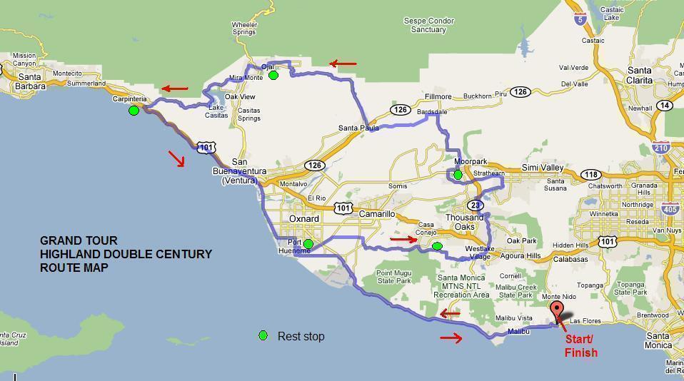
I entered in the Highland Double Century route that would take from Malibu, up the Pacific Coast Highway to Port Huneme and inland through Westlake; Thousand Oaks and Ojai before climbing up past Lake Casistas and back down to Carpentira, and the Pacific Coast Highway to return to Malibu.

Map: Highland Double Century (via www.lawheelmen.org)

Staying only a few miles away in Santa Monica, I had resolved that regardless of the 200 miles in front of me, the most convenient means of transport to the start would be RIDE. The Grand Tour does not have a mass start, but my intention was to start at 4:30am - opening of the starting time window. This was to ensure I had travelled over the inland portions of the course before the heat of the day set in. The coastal sections being about 10 degrees C cooler.

Riding to the start was all fine until the dreaded pssssssst sound screamed out of my front tyre. Riding in the dark I had ridden over something that left a huge gash in the side of the tyre wall. Ironically, I had just been thinking about whether to cable tie the spare tyre in my backpack onto my bike before I started the ride. No need to worry about that now. Time to put it to use already! After a small delay I was moving again and eventually left the start at Webster Elementary School at 4:57am amongst a stream of well lit bicycles.

After the prior frustrations en-route to the start I was well warmed up and feeling strong at the start and regardless of darkness and nerves about not pushing too hard I was easily averaging about 19mph/30km/h when I rode over a rock in the middle of the lane and for the second time of the day I heard that awful sound of pssssssst. I was just about ready to sulk. A mere 22 miles, or ~10% of the way and I’m stopping for a puncture already. Fortunately, I could not find any damage to the tyre wall this time. Some volunteers on their way to Ojay (lunch/rest-stop) pulled up behind to lend me hand with a floor pump – THANKYOU! Surely this was the closest to a team car that I will ever experience. Just 5m14s to check the tyre for damage or embedded debris and change the tube was pretty snappy.

As the sun rose through thick fog my 900 lumen headlamp was no longer necessary, the coastal scenery came into sight at the first check-in/rest-stop at Port Hueneme (~mile 34). After registering my ride number at the check-in I was on my way again amongst a group of about 20 riders. I was looking forward to some pacelines and competitive encouragement up the pending hill of Potrero Rd. Unfortunately, this didn’t quite work out when I turned right with one other ride for the hill whilst the rest carried straight on for the Lowland Double Century route.

In hindsight I had probably over anticipated Potrero Rd, sure the last half-mile is one steep gradient, and no I don’t want to climb it every day. Yes, I did need my 34t chain-ring and 25t cassette granny-gear but, I have climbed far mightier beasts before. While I felt the hill in my legs, conscious of the remaining 150 miles I was probably far more conservative than required. The Highland Double may be hillier than the Lowland Double, but relative to distance is probably still flatter than most rides of this distance.


A little past the summit of Potrero Rd, I stopped in at a rest stop to top up my drink bottles. Spending less time at the rest stop than others I departed among a small group if experienced double century riders (most of them were wearing California Triple Crown jerseys) as we rode around Westlake and through to Thousand Oaks. Unfortunately I lost contact with this group amongst the many traffic lights through Thousand Oaks and spent much time in solitude. Not being used to so many traffic lights on an organised ride I consider it possible that I may have slowed down in frustration. Like the Californian location, travelling through more than two sets of traffic lights was completely new territory for me. I eventually ambled into the Moorpark rest-stop at mile 77 some 5h17m after departing Malibu.

After a little climbing on the way out of Moorpark a long descent offer some rest whilst winding down the Grimes Canyon. Once travelling through Santa Paula there was an eight mile gradual ascent somewhere near mile 100. This may not have been steep but it certainly was persistent. This is certainly an section I would like to travel to faster if I do this ride again. Having ridden this section, it is surprising how much it shows up on the elevation profile. Thankfully after there was a downhill before making it to the lunch stop at Ojay.

The lunch stop at Ojay was serving a mighty feast. Something I have never seen before. Recreational rides are structured quite differently in New Zealand. Not too keen on having a lot of solid food in my stomach I stuck to some watermelon and some fruit juice to make some variation from my diet of Hammer Nutrition gels (Although the new Montana Huckleberry is the best flavoured gel ever!) and sipping on a drink of Perpeteum as my primary food source.

The riding was initially flat and level when leaving the Ojay lunch stop. The climb up Casita’s Pass offered great views of Lake Casita and I have to say, while it barely registers on the elevation profile, I sure felt it having already ridden some 127 miles. The rapid descent back down to sea-level sure was appreciated. Once at the coast we reached the Carpintera rest area, where I well, rested for a bit and ate a few noodles.

The last 60 miles / 100K was mostly flat (thankfully) with a few rollers thrown in at the end. Now back on the Pacific Coast Highway with flat travel and less intersections I was able to pick up the pace for the last two sections. With some pacelines - mostly from a group riding together from Arizona, not riding in solitude sure helped me lift my tempo. It was a bit odd when after a 140 miles three groups merged together form the largest peloton of the day. Unfortunately one slightly dodgy moment as we moved into a left-hand lane to turn left and had a car accelerate rapidly into the gap we were moving into. Thankfully no contact and we were all well as we headed for our final check-in/rest-stop, and our second visit of the day to the Port Huneme rest-stop.

Leaving Port Huneme I tried to hold on the back of a tandem for a while but lost contact going past the naval base and rode the rest of the way in solitude, although I did pass some fellow cyclists on my way to the finish, and others did likewise to me on the way up the rollers approaching the finish. The left turn of the Pacific Coast Highway was difficult manoeuvre to get over two lanes of fast moving traffic into the left turning lane for the lights that didn’t seem to have a great deal of knowledge about the colour green.  It seemed like a long wait, and after analysing my Garmin data it was – five minutes! Once finally over the intersection it was back to Webster Elementary, my first double century complete, and lining up to sign in and get my official time.

Thanks to the LA Wheelmen for organising the event and all those who volunteered that were helping out with the timing, rest-stops and SAG support.

Double Century accomplished. Now, when can I ride another? Or do I make it a TRIPLE? :D
Genuinely epic rides like the PBP do not seem so impossible any more. Who knows what’s next my little worn out legs?

Rough Time Analysis
Time "on the pedals": 13:01:11
Time spent at rest stops & puncture repair: 1:05:31
Time at traffic controls: 0:26:52
Time between Sign-in/start ride & Stop/sign-out: 0:07:07
Total Elasped Time: 14:40:41

Saturday, 15 May 2010

The R4 2010

After last year’s R4, I thought it had to be better weather this year. Well, perhaps not. Friday night’s sleep with interrupted by thunder and lightning and it was pouring down when I left the cabin for the ride. Apparently their fourth successive R4 in the rain! It was one of those days when you just were not sure where the balance between dryness, warmth and over cooking yourself once the ride started was. Thankfully it stopped raining on the start-line so I threw my rain cape to Dad on the side lines and swapped it for a wind vest to keep the chill off.

Ride Data:
Distance: 88.57km 4509 Calories
Time: 2:34:01 34.5 km/h (77km/h max)
Elevation: Ascent: 422m Descent: 702m
Cadence: Avg: 95 rpm Max: 120 rpm
Ride Data: Garmin Connect Player
Location: Rotorua, NZ 15 May 2010

I started near the front with a plan of holding onto the front bunch until the first hill and seeing what happened from there. I didn’t quite make it that far. 42km/h was a really smokin’ pace for me and after about 10km I couldn’t handle it any longer and drifted off the back of the front bunch.

Approaching the first hill after 16km, a large bunch started to form, although disorganised. I sat on the back catching my breath for a moment before hitting  the hill. A little behind at the top I needed a quick descent to get back in touch, during which I lost a water bottle riding over a pothole at about 75km/h. No harm done and I was soon a hundred metres ahead of the bunch prior to the road levelling out. I do find it odd that so few riders at my level try to get low and aero in events like such as this. Even more surprising are those riding on expen$ive, aerodynamic wheelsets worth far more than my entire bike. Surely any aerodynamic gain from the wheelset is lost from sitting up while descending?

A large bunch formed (32 riders finished together according to the results). Unfortunately there was not a lot of enthusiasm to work off the front of the bunch. This is a frustration I may need to used to now that I have improved my fitness. Wanting to improve net time from last time I found myself leading a lot, in a rotation at the front of the bunch with 3 others. No amount of screaming and hand waving was able to get others to come forward. Even when trying to peel off the front to the right, riders behind moved across the road following your wheel. I found this a tad frustrating but looking for net time, not placing I had few options.

Getting nearer the end the four of us leading the pack tried to get a break on in anticipation of what was likely to happen in the final kilometre….. Unfortunately, we could not hold it as the group behind soon closed the gap and most passed us approaching the finish with some dodgy moves over a narrow bridge amongst traffic. The traffic conditions at the time we went through pretty much made a mess of a good sprint finish. Those the did the work and stayed on the left side of the road over the bridge came in the back of the group. This ruined any chance of sprinting at the line, and finishing back of this pack felt completely unjust!

Afterwards another rider commented to me that I was a great tow truck etc. I couldn’t help but feel that we all would have been quicker if all of the group had worked together.

Regardless all that. My 2nd fastest average speed ever in a road funride/event, and my fastest for three years. All managed regardless of horrible weather and an uncooperative bunch.  I finished in 2h34m01s - about 40 minutes quicker than last year. Recently I have been working on smoothing out my pedalling technique.  An average cadence of 95rpm indicates that this has been very successful. This is the best ride I have had for years, felt strong for the entire ride and a higher speed than I have had in ages. The more hilly events in spring will be a greater test I just need to carry my fitness through the winter.

I feel gutted that it is winter already. I’m looking forward to flying to warmer pastures and great company.  And I can’t wait to get back on my bike and find new personal limits for myself.

Saturday, 1 May 2010

Onslow Tarbabies Criterium – May 2010

My local recreational riding group organised a short criterium race for our members in a traffic free, yet to be developed industrial area near Trentham. The stated objective of organising this race was:

to foster better riding skills, better fitness, a chance to try something you'd otherwise be afraid of, but most of all to "flex your muscles" and participate in some friendly rivalry on a quiet road rather than down SH2.

Ride Data:
Distance: 14.14 800 Calories
Time: 23m16s 36.5 km/h
Ride Data: Garmin Connect Player
Location: Trentham, NZ 1 May 2010

For me, just riding without fear those steel cyclist crushing objects known as cars was a huge bonus!


This was my first ride in a criterium style race. I entered the “C” grade race which was set at the same level a those that I typically ride with on Sundays. My work colleague Phil, had been trying to get me to enter the “B” grade race with him. I suspect that this was because he was looking for the satisfaction of beating me head-to-head. With a damp day and limited numbers of participants the “C” & “D” grades were combined as were the “A” & “B”’s.


I had been given advance tips that criterium events can be very tactical and often if you get caught on the front for too long you can use too much energy and get destroyed in the final sprint. With this mind during the race I made sure I wasn’t leading for more than one lap at a time and made sure I was position to follow anyone who thought about making a decisive break. These tactics seemed universal in the “C” grade race with with any gaps the opened quickly sealed to ensure there were no breakaways established. On the couple of laps when I was leading I tried to increase the pace a little to get a feel for where the wind was, which could be critical on the final lap and to see how the riders around me were handling the pace. Ultimately no gaps opened and we increased our average speed and we built to higher speeds each lap around the course.


I was sitting comfortably in 2nd place when the bell went indicating two laps to go and then heading into the final lap assumed the lead. I initially tried a surge as I assumed the lead but the rest of the pack surged with me. I figured with the inside running in the remaining corners, meaning everyone else had to get around me  the biggest risk would be to go for a sprint too early and get run down. I thought the action would most likely occur into the wind on the straight prior to the final corner. I was wrong and Mark found an acceleration with half a lap to go that none of us could match. I possibly dropped as low as 4th as I made maximum use of my ticker into the wind and then down the final straight to take 2nd place with a comfortable margin back to 3rd and nowhere near running down fast finishing Mark. 


I was breathing pretty hard crossing line with my heart pounding. That 221-Age thing maximum heartrate thing is after all just an estimate :D.


The combined “A” and “B” grade race followed a different style altogether. Throughout their race there were various attacks trying to establish breakaways but while breakaways were established, they never actually stuck. By the final lap all the riders were together again with Phil managing a narrow victory in the sprint finish. Thankfully back at work he has contained himself enough to not have reminded us of his result more than 100 times (yet?).


Sunday, 28 March 2010

The Forrest Graperide 2010

After last year’s Graperide I was eager to improve on my time. After the previous weekend’s Kapiti Cycle Challenge I was confident of smashing last years 3h27m25s. In fact, I felt like I could give the 3 hour mark a good nudge. 
Ride Data:
Distance: 100.04km 5,077 Calories
Time: 3:03:28 32.7km/h
Elevation: Ascent: 689m Descent: 689m
Ride Data: Garmin Connect Player
Location: Renwick, NZ 27 March 2010

With the Bluebridge on as sponsors for the ride this year, the discounts for the weekend ferry sailings made it an economical jaunt over to the South Island. The ferry was chocker with cars carrying as many cycles as they could possibly manage. Surprisingly, I was the only person to cycle off the ferry in Picton – just a short 37km ride to Renwick.

Having entered the Graperide a few months earlier, at a time when I had much less fitness I had entered myself in the under 3:30 group (2000 series numbers) rather than the under 3 hour group (1000 series numbers). In hope of leaving with the 1000 series numbers to try and get a bunch riding at good speed, II arrived at the start early and lined up in the start area near the back of the 1000 series numbers. Some of the event marshals observing y 2000 series race number insisted that I drop back to start with the under 3:30 group. There was no convincing them to allow me and some other riders from the Wellington based training group Gear Shifters to advance to the faster starting group :(.

Somewhere between being sent back to the 3:30 group at which we were at the “front” of and finally starting a couple of hundred other 3:30 group riders managed to utilise the tandems starting area and start ahead of us. With a minute or two between each starting bunch of up to 100 riders I eventually left the start line 14 minutes behind the front of the 1000 series (or under 3 hour group).

Keen to break 3 hours, riding out of Renwick I put on as much gas I could to try and both advance to stronger riders and pull some stronger riders with me that might help establish a speedy bunch to aid this cause. With my ticker pumping at 199bpm, a tad over my theoretical maximum heartrate. Phew, no cadiac arrest :D.

Heading toward Picton there were about six of us pulling a large pack. Once hitting the only real hill of the ride, up Queen Charlotte Drive the pack dissipated behind us. Descending back to sea level we were now riding past riders that had predominantly 1000-series (sub-3hr) numbers on their backs that had obviously fallen off the back of their groups in front. The twelve of so of us left from the large pack cycled together as far as Linkwater. I had been feeling far stronger than I have for the past year or two and had done a fair amount of leading. Possibly a little too much? But it feels good to set the pace rather than trying to hold on to the back of a bunch! Near Linkwater, as I rehydrated at the back of the group I missed a crucial break that halved it’s size. With a moderate headwind, I lacked the enthusiasm to jump and chase them. I rode more restfully on the way through to the small climb at Havelock.

At Havelock I got onto the back of a well paced group and found my “second-wind” with the increasing pace. At about 5km to go the strongest rider in the group was off into a sprint for the line. I knew I didn’t have that distance of a sprint in me and hung with the group until we crossed the bridge over the Wairau River and 2km to go. As I increased my pace I had a few riders in my sights as I entered the windy driveway into Forrest Estate where I picked a couple more places from riders with most their energy already spent. No sign of the guy who had left our bunch in his wake a few km down the road though.

On net time I finished in 3h3m28s, a little outside the 3 hour target I had set myself. As convinced I am that I would have ridden a sub-3 if I had started sooner, I can’t be too disappointed after taking almost 24 minutes off my time from last years Graperide!!! I am determined to do a sub-3 next year and I’ll be sure to start with a 1000 series number on my back.

Monday, 22 March 2010

Kapiti Cycle Challenge 2010

I was feeling exciting heading into the Kapiti Cycle Challenge. This is one of, if not my most favourite course over which annual fun ride events are held. With testing hills that will not  completely destroying your spirits, intertwined with the fast flat sections down the Kapiti Coast and up the Hutt Valley in-between it offers a bit of everything.

Ride Data:
Distance: 91.17km 4,649 Calories
Time: 3:09:30 28.9km/h
Elevation: Ascent: 1,096m Descent: 1,087m
Ride Data: Garmin Connect Player
Location: Wellington, NZ 21 March 2010
I went into the ride encouraged with improved hill climbing the previous week during the HospiBikeRide. It had been some while since my last cycling personal best, surely today I could manage one?  My nephew, Jordan had been staying for the weekend. After watching his two consecutive 800m personal bests at the North Island Secondary Schools Athletics Champs he kindly calculated his improvement over the previous twelve months and gave me a time to beat to the nearest second. From memory that was about 8 minutes faster than my 2009 time of 3h31m5s.hew, nailed it with an almost 22 minute improvement in 3h9m30s YAY!!

After the pre-ride safety briefing the mass start went on time at 8:30am. Unfortunately, we came around the first corner and it it was a large peloton hard on the brakes and trying not to make contact with other bikes and riders. The north-bound Overlander train was running a few minutes late. Once the train was through it was over the railway and a brisk pace in the peloton down State Highway 1 to the Paekakariki township before turning left up the Paekakariki hill climb.

This year when ascending Paekakariki there were not masses of riders passing me. I was actually gaining places! Wow! Even on the steep sections. This was a most unusual situation for me and usual lead balloon like approach to hill climbing. The training is paying off. Awesome :). I reached the top of the first climb in a shade over 40 minutes. Wow! 12 minutes ahead of last year in only 20km.

With the help of one other rider we had about a dozen riders in tow from Pahatanui. No amount of encouragement could seem to bring any other riders forward to share the lead. They were just holding on and were only interested in drafting today. By the Haywards Hill summit the rest of the group drop off with just the two of us left for the rapid descent down into the Hutt Valley.

Once into the Hutt Valley we found ourselves in a larger group. Once again lacking in ambition to lead and build good pace. The guy I was riding with up Haywards seemed to be tiring and I found myself oscillating between the front and peeling off to the back until frustration at sub-25km/h pace going straight back to the front. It was difficult to establish any consistent speed along this section as shown in the speed and altitude profile below. I possibly did a bit too much work in this section but my personal goals related to time and not placings. Sitting back and having a rest at 25km/h was not going achieve a significant personal best time. Fortunately shortly before turning for the climb up into to the rides highest point over the Akatarawas a very strong rider in wearing a Marmite jersey took a long strong lead.

Kapiti Cycle Challenge: Elevation and Speed profile

The ascent up the 440m Akatawara Hill begins with natural terraces offering short climbs followed by flattish travel. It doesn’t get very steep until the final push for the the summit. During the climb as is usually the case the group we were riding in broke up. Some strong riders that had taken a ‘breather’ earlier took off from the front. A few of us were left around the middle while those that were just trying to hold on to the group up the Hutt Valley disappeared behind.

After winding up the Akatawara Road and over the summit I was greeted by nice, smooth new ‘hotmix’ tarseal on the descending side. Very nice for riding on compared to the usual ‘chipseal’ style road surfaces on most New Zealand. With a narrow and twisty descent to Reikorangi although nicer to ride on and rolling smoother the turns and in ability to see around corners did not exactly allow any speed records on what is a rapid descent.

I crossed the line reasonably strongly showing improving fitness and durability compared to the start of the cycling season in spring. The remaining question being, can I find sufficient improvement to find a further 9m30s time saving to break the 3 hour mark for the third running of the Kapiti Cycle Challenge next March?