Wednesday, 29 February 2012

Hallucinations in Haast, Overtime and the Kiwi Hunt 1200km

I was relatively late confirming my start for the Kiwi Hunt. I wasn’t sure how the legs would come back after easing my way into mountain biking, completing the 1100km Kiwi Brevet bikepacking event only two weeks prior. With airfare booked, I confirmed I would be there, but not whether I would be riding or helping out with bag drops. Ultimately my legs came back well with mental tiredness and lack of alertness being more of an issue. Possibly relating to the amount of work I was doing between these two epic events. As crazy the proposition may sound, I often believe that in some situations an employee may be deserving of being paid double-time for time spent on annual leave to account for the additional work that must be completed immediately before and after time away from the office.


Ride Data:
Distance: 1,210km
Time: 90h19m
Elevation gain: 10,153m
Ride Data: Garmin Connect
Location: South Island, NZ
February 25-29, 2012
Randonneuring is relatively unknown in New Zealand, but with eight foreign invaders and myself we had nine starters for the first 1200km randonnee in New Zealand. This  made for the most starters I’ve ridden with in New Zealand randonneuring events.

My legs were surprisingly strong and I found myself unusually off the front, rather than off the back for most of the first 70km. While technically a false flat, I am fairly certain that this was the flattest 70km I have ridden in my entire life. The mountains were sure to come on this ride. Just not today. Preferring to chew on my food, I was dropped at the first control - the cafe in Hororata (70km/2h45m). The food was too good to disrespect it by inhaling, so I ensured that I chewed at least a few times on the way down.

After another 110km of mostly level solo riding I arrived at Geraldine (182km/8h05m) for lunch where I had a chat with Duncan who was driving the van in support of the ride whilst gobbling down half a foot-long Subway, saving the second half for later. With 182km in a fraction over eight hours including cafe stops I was very comfortable with how my time was going at this point.

As afternoon became evening, and I had ridden away from the Canterbury Plains and climbed into the more tussocky sub-alpine terrain en-route to Tekapo (270km/13h43m). I seemed to arrive just after closing for most of the local eateries so the second-half of my steak sub came in very handy for dinner.

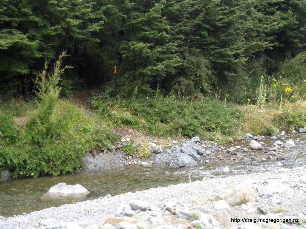
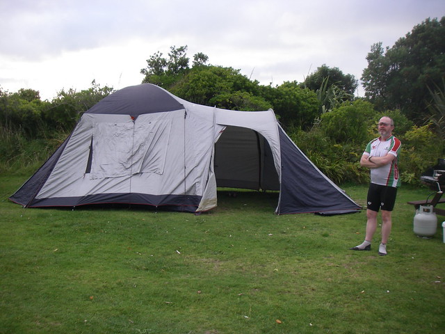
With no moon to light the sky and no artificial light on offer a beautiful night sky overhead lead past Lake Pukaki toward the 3rd control at Omarama (358km/18h30m). I lamented the compulsory helmet laws that made it difficult to see the sky, so with tiredness kicking in and wanting to take advantage of the night sky viewing conditions I had a few short rests on my back looking at the sky along the way. It is no wonder there is a proposal to designate this as a World Heritage Site to establish a reserve for starlight. (See: “Tekapo night sky closer to World Heritage status”). On arrival at Omarama, Duncan and Bruce had setup some tents at the local Top 10 camping ground for us. The tents were easy to find with the assistance of some bicycle tail lights, and a chance for a luxurious five hours sleep for myself.

I was narrowly last away from Omarama at about 6:15am, which was slightly surprising as I thought I heard some other riders arrive a some time after me. Perhaps I would pedalling zombies on my travels? Day two began with a  90km ride up the first serious climb over Lindis Pass (971m.asl) before the descent down to Tarras. I briefly passed Paul & Els until I stopped at a stream to top up on beautiful, fresh mountain water. Julian and I spent a bit of time swapping places with each other on the way up the pass. I was quite hungry by the time I arrived at Tarras and enjoyed my brunch at the cafe, which I finished as Julian was arriving on his stainless steel Moulton bling. It was only another 30-odd kilometres into the next control at Wanaka (471km/30h33m), but I was still starving again when I arrived there shortly before Paul and Els were leaving. I was now starting to get near to the time limits but justified to myself on the basis of the amount of time I stationary and eating, with eating being one of the only things in life that is as much fun as riding a bicycle.

It was very hot afternoon riding up to and around Lake Hawea. It was only a few more kilometres up the road, well 17km actually and it was time to stop for a frozen dairy dessert. It is amazing how hard it can be to lose weight even when riding 1200km! It seemed surprisingly hilly around lake Hawea, but I think it was more the heat making gentle inclines feel like hard work. I found myself slacking and catching a quick break when ever I could find some shade. Once through to Makarora the views of lakes, and barren sun drenched grass and tussock lands were replaced by native forest on both sides of the road. Has it been a few hours earlier the shade would have been appreciated. This was a section of riding I was particularly looking forward to and I wasn’t certainly wasn’t disappointed. I would happily ride this section of road again. I briefly saw Duncan again somewhere near Haast Pass (564m.asl)  as he was driving back to Lake Hawea to camp with Julian who had unfortunately retired from the ride.

In the darkness was affecting my alertness as the sleep wombles began attacking. It turned out that the "zombie" even after five hours sleep last night was myself, which was a surprise as I am a natural nightowl. The sleep wombles were soon followed by the tarseal monsters and tree people. Then further along mailbox people as well. Regardless of my slow pace and generous time allocated to both sleeping and eating I I was now in the middle of the full ultra-cycling hallucination experiences which are more common in the RAAM than in randonneuring. Regardless of the five hours the night before, pre-ride sleep deficit cannot be caught up during a 1200km Randonnee. I fought the sleep wombles and hallucinations through to Haast (618km/42h00m) and oh dear, 45 minutes behind schedule. I had a short nap in Haast before heading for the designated overnight location of Lake Paringa.

I initially felt a little better after a short nap as I departed for Lake Paringa. Unfortunately the sleep wombles were back, along with their group of friends otherwise known as hallucinations. A more dedicated sleep was going to be required. There would be no point sleeping on my bike and riding off the road, or salmoning into oncoming traffic in the opposite lane. I called into the picnic area at Ship Creek and caught 2 or 3 hours sleep before continuing on toward Lake Paringa. I started well but the sleep wombles returned as I carefully continued in a straight(ish) line hoping for an improvement as the sunrise approached. Improved al that never came. I even stopped to call Duncan to retire for a rare DNF, but with a lack of cell-phone coverage I had no choice but to persevere. I arrived at the former pub at Lake Paringa where we had some mattresses to sleep declaring to Bruce that I was I out and would be withdrawing. I stopped for some soup after which I decided that I was here to ride, so advised Bruce that although I was well behind time and could not possibly finish, I may as well continuing riding the scenic route up the West Coast until Duncan gets back from Lake Hawea.

I was riding a lot more strongly after the soup and was making reasonable progress compared to the previous night and earlier in morning. Duncan caught up with me as I hit the hills on the way through to Fox Glacier and loaded me up with Endura, a high magnesium based sports/rehydration drink and I was good to go and set forth for Fox. Thanks Duncan! While I was currently tracking well behind time, we thought it was likely that I would be able to get back under the cut-off time-limit before arriving at Greymouth. Once at Fox I gnawed on a good sized lunch, which unfortunately came a tad too slowly for my liking during an hour long stop.. perhaps the cafe was growing the vegetables for the salad?


Now through to Franz Joseph Glacier (760km/57h20m), I was a massive 3h18m behind the cutoff time, but had 11 hours to cover 170km to get back under the time limit. I stopped very briefly for some chocolate milk before pushing on for the relative flat travel through Whatoroa, Harihari and Ross. Ross was notably warm with a distinct burning smell which I asserted must be related to the mining activity in the town. My headlamp batteries were beginning to fade so I was stoked to see Duncan and Bruce again on my way to Hokitika to collect my spare batteries from the van. They had their share of bags to drop around the country side with riders well spread by this point of the ride. I was getting pretty tired on the way into Greymouth, with the final 20 kilometres from Kumara Junction into Greymouth seeming to take an eternity before I arrived at the campsite at 0330 - about the same time Els was leaving for Otira (do you sleep?).

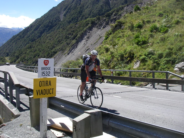
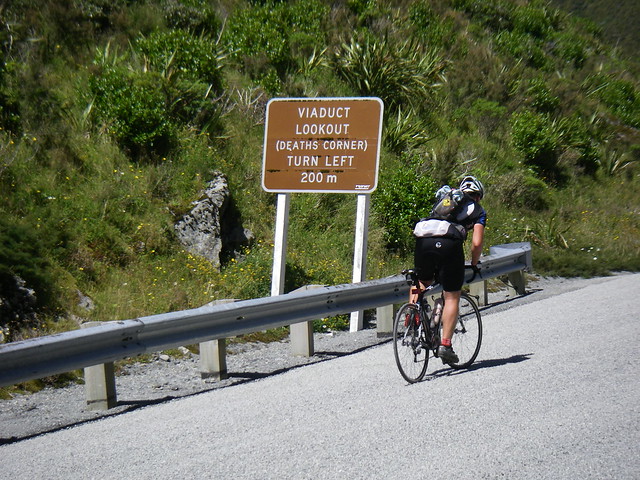
It had taken some effort, after having previously “quit”  but I was finally back under the cut-off times again - yay. I had a three hour kip before heading off again just after dawn. It was pretty slow start to the day. I had some chaffing irritations to take care of but getting my legs moving on the way to Moana (963km) on this morning was proving to be more of challenge than it should have been. Not even the famed meat-pie and chocolate milk at Moana could seem to resolve it. I ambled into Jacksons (995km) for a frozen dairy dessert which placed me good stead climb in front of me, firstly more gently up to Otira, before the more feared Otira Gorge and Viaduct climb with steep pitches over 16%! While this may seem absurdly step on bicycle (or laden truck)  I have previously felt vertigo tramping up the nearby Browning Pass where 19th century surveyors proposed a road between Canterbury and the West Coast could be built! I assure you that the climb up the subsequently discovered Arthurs Pass is much more attainable and on this occasion with the use of some brief pauses in the shade to manage body temperature I succeeded without using the two-foot gear. I was quite ecstatic, this been the first time I had pedalled the whole up this little slope.


I stopped for a well deserved lunch in Arthurs Pass (1029km) where I chatted to Julian who was back riding his Moulton bling, riding the last 200km or so back Christchurch. I felt I made up for slow morning with the climb up the gorge.

But, unfortunately after lunch my progress came to a halt. I should have performed better over this section but for the dual adversaries of a brisk headwind and unbelievably rough gravel (rocks?) chipseal providing no reward for effort over the undulating 60-odd kilometres to Porters Pass. My motivation was waning at this point, and ultimately this is time I should never have lost and likely cost me an official finishing time. Flock Hill seemed to have grown in steepness from what I recalled with my legs spent, I was left without enough gears and a brief section of  push-biking as I struggled through the late afternoon before finally making it to Porters Pass (1093km) and finally a nice long descent.

Back in Canterbury, I made it to the penultimate control in Oxford (1138km/87h06m) exactly on the time limit. The guy who signed my card had seen Els earlier, I didn’t ask how along ago. Was I close behind, or had he been just at the bar for a long time? I was now pretty exhauated as I ate out some miles through to Rangiora, trying to keep with 25km/h to the finish to make the 1am cutoff in Christchurch (1202km/90h19m). I didn't quite make it, arriving 19 minutes late.

Obviously spending more time riding and less time eating, sleeping and resting would make a great deal of difference and while I was a tad disappointed that 90h19m being over 90 hours and thus not an official finish, I felt that in the context of the adversity of exhausted, overdone legs with two massive rides this month - almost making the final cut-off after "quitting" at halfway is still somewhat an “unofficial achievement”. What I do know now, is exactly where my exhaustion and hallucination limits are, which when into future endurance rides well rested will enable me to plan, enjoy and attain some personal records along the way.

Thanks for organising it all Duncan, and driving all that way so that we could all ride our bikes and enjoy the air and the scenery.
Kiwi Hunt 1200km Results 2012
Jan Erik JensenSweden83h14m
Rus HamiltonAustralia85h03m
Rick BlackerUSA85h03m
Mark ThomasUSA85h03m
Peter HealAustralia85h35m
Els VermeulenUK89h10m
Paul CribbAustralia89h17m
Craig McGregorNew Zealand90h19m (Outside time limit)

Saturday, 11 February 2012

Kiwi Brevet 2012: Roadie goes riding and pie-eating in the backcountry

After a huge year on the road in 2011 including qualifying for, and riding the Paris Brest Paris and the Lake Taupo Extreme Enduro, I decided to mix things up by entering the mixed terrain Kiwi Brevet.

There were two slightly problematic issues get in the way which I chose to ignore:
  1. I didn’t own a fat tyre bicycle
  2. I have no off-road biking skill or experience
Ride Data:
Distance: 1,096km
Time: 165h 44m 05s
6 days, 21h 44m
Elevation gain: 16,211m
Ride Data: Garmin Connect
Location: South Island, NZ
February 4-11, 2012
This 1100km ride would provide a great opportunity to “gently ease into” mountain biking. Thus, some while after committing to the ride via a confirmed entry I invested on the "green machine" - a lime green Specialized Stumpjumper Comp 29er. I had confidence in my fitness for going the distance, and knew the camping and navigation would not be issues for me with years of tramping behind me. Thankfully we have mountain bike trials popping up like mushrooms around Wellington, largely thanks large to the work of volunteers from the Wellington Trails Alliance. I had intended to rectify my lack of mountain biking expertise by riding trails via extended commutes home from work over January. I thought that would leave me reasonably well prepared as I knew  I had the fitness, and while Kiwi Brevet had much on gravel and off-road on its route, it is (mostly) not highly technical terrain. Getting to a suitable skill level for that shouldn’t take much effort I surmised. However, during a bikeless Christmas I tore the TFCC cartilage in my hand, and spent January healing instead of learning to mountain cycle. I finally got the all clear from the physio 3 days before the start of the event. No problem, it’s not like I would be doing anything hardcore :).

Saturday: Blenheim to Molesworth Homestead Campground (116km)

Not one to let minor issues like no training, nor having no clue about riding off-road, I joined about 40 other starters at the Blenheim start. With a timed obstruction in the course via the Molesworth road closing at 7pm, the biggest question among many of us was: “Will it  be Molesworth tonight or beyond?” I was happy with either outcome. It was either good progress for non-mountain cycler me, or a great opportunity to bank sleep for the rest of the ride.


Road on the way to Molesworth Homestead

In the early stages I was well ahead of the average speed required to get over the Molesworth tonight. As I said “in the early stages” once the sun, heat and hills arrived in earnest it became obvious I would be camping at the homestead tonight. With this reality accepted, I relaxed, had a few afternoon naps and took it easy while saving my legs for another day. Thankfully I found numerous fresh water sources to keep hydrated throughout the day. I do seem to drink like a fish on endurance rides. I quickly learned that, heavier bike, plus camping gear on gravel required less cadence and more leg pressure than I usually apply for 1000km+ rides. This would make overnight recovery a little more demanding than I am used to. I was most likely the last rider to arrive at the Molesworth Homestead but my spirits remained high and optimistic of a big day tomorrow. Once at camp, it was fun looking at some different camping setups. A swim, followed by setting up camp and a large feed of pasta had me set for a good nights sleep.


Sunday: Molesworth Homestead to Okuku Saddle (188km)

The DOC warden kindly opened the gate at 6am instead 7am which meant not only an hour of time saved for the many breveteers, but there would also be no motorised traffic for most of the ride over the expansive Molesworth Station. Once again, my day started well over Wards Pass (1145m)  and Isolated Saddle. I did lose a cleat bolt on my travels, but thankfully was able to rather permanently "borrow" a spare rack screw from Karin? Thankyou. It fitted perfectly, and the push biking to come soon flattened the end of the screw.

@craigofnz at Wards Pass

Then came far too many moments of deflation. I had three punctures in short succession that had me panicking about being stranded. With three tube changes I was now well and truly off the back of the field. In Hanmer, there were no tubes with presta valves. In a fear of more pop and sizzzzz, I bought a couple of schrader valve tubes that I later threw out for without a drill. the wider valves would never be of any use on my rim! Thankfully I had no more punctures for the rest of the ride, although now running at higher pressure to prevent pinch-flats, I did have a little less traction on the dirt. I vowed to consider a tubeless rim upgrade sometime after the ride.

Whilst the food and facilities of the Hurunui Hotel were tempting, I remained determined to make it through Macdonald Downs Station by the end of the day. In hindsight, this did mean some small redefinitions of the word “day”. Once leaving SH7 for the gravel progress slowed. This was deep unrewarding gravel that required much effort. There was little sign of recent traffic to create a good riding line. Where possible I was riding Paris-Roubaix style in a thin corridor of dirt between the road and the grass verges on its edge. Tyre trails indicated this had been a popular choice also used by numerous riders on front of me.

About an hour before sunset I arrived at MacDonald Downs. With the entrance not quite a described in the route sheet, I thought it best to ensure I followed the correct route as had been agreed with the land owner and cross referenced visual features, the map and my preloaded GPS waypoints before entering the private land of the station. The route across the station was easy to follow, although it was feeling a lot more like McDonald Ups than Downs. Reviewing GPS data, it was in fact a net incline of 330m over 20km.  I reached the southern boundary at about 11pm and regardless of every effort to open the gate quietly, disturbed a two other riders that were camping outside the gate. They were shocked I was riding at this hour, which from a road brevet background seemed quite normal to me. I was keen on a water source for cooking dinner so proceeded over Lees Pass and camped near a ford pn Okuku Saddle for the night. It started drizzling, but I was able to cook wrapped up in my sleeping bag, under my Zpacks fly ;).


Monday: Okuku Saddle – Wharfedale – Lake Lyndon (104km)


Day three began with patching tubes over breakfast before a gentle ride down Lees Valley with Andrew Carman and Dean. Some map cross-referencing was once again needed on the entrance, to the Wharfedale as the access road had a large "Private Property" sign on the gate. This of course, being mildly preferable to a rocking chair on the porch and a sign saying "private property, trespassers will be shot.". Whilst the route was largely straight ahead, I paid close eye to maps and preloaded GPS data as gates through electric fences were not always the most welcoming.

Once hitting the DOC managed land of the Oxford, the familiar sight of orange triangles reminded me of much past tramping , which turned out to be quite handy as that is exactly what I would be doing for the next few hours. While the Wharfedale was originally intended to be a road into the Lees Valley it was long abandoned prior to completion. This track was certainly more tramping track than single track! I was a little surprised so few riders had filled on the intentions book as I rolled into Wharfedale Hut for lunch. I was sure I wasn’t reaching the illustrious heights of third place... While the weather was clear, lunch was an inside affair trying to avoid becoming the lunch for the local sandflies - which were more abundant than even on the West Coast.


After lunch, came plenty of pushbiking up the Wharfedale, and bike carries down into stream beds and up the other sides. The last third or so of the route became much easier from my inexperienced mountain biking perspective.


Once on some semi-familiar roads it was an uneventful road cruise to Springfield, aside from disappointment that there no meals being served at Sheffield pub as I passed through. I indulged in a large meal at Springfield before climbing Porters Pass to Lake Lyndon. Several other riders stayed with the facilities of Springfield for the night. My preference was to get this climb done, so my legs could be rested for another day - without starting the day with a climb. With mud from the Wharfedale now drying in my cassette, the gears jumping and everything making a racket. I was convinced I had greater problems, but was unable to see. With the benefit of hindsight, I should have taken my lights off my handlebars, had a good look and cleaned out the drivetrain. As a roadie, I cannot ride even moderately quickly on such a noisy bicycle. As I climbed Porters Pass (939m), the visibility got less and less and eventually down to about 5m. Setting my Ayup lights to brightest didn’t help as then the light bounced off the cloud straight back into my eyes. With no visibility, I took a preference to push-biking once more. Once over the top, I stayed in the shelter at Lake Lyndon, which would save a little time packing up my shelter in the morning. The local residents were busy scratching and chewing away in the ceiling, but with an agreement reached that I would leave them alone if they they left my stuff alone I got a good nights sleep. It was,a little cool at, this altitude so the bag rated to -2C was handy tonight.


Tuesday: Lake Lyndon to Blackball (166km)

 
I woke to a great view over Lake Lyndon and.down to Canterbury. It was a good spot although the water supply at this location was tricky. I needn’t have worried as I reached a great stream at a rest area a short way down the road. This was also an opportunity to clean and lube my drivetrain for smoother and quieter riding. I really enjoyed the mornings sub-alpine ride, and when nature called spotted a great campsite at Craigieburn which I will likely frequent again in the future. Shortly before arriving at Arthurs Pass Josh & Michele caught up to me and once at Arthurs Pass village a small groupetto of brevet riders that had started their days between Springfield and Castlehill had formed.


After a bite to eat, I was looking forward to riding down the Otira Viaduct with the benefit of disc brakes. My only previous cycling experience here having being utilising the two-foot gear in the opposite direction on my road bike during one of my Paris-Brest-Paris qualifying rides . Alas, caught behind traffic I certainly got to make use of the disc brakes but at a lower speed than I was hoping for :(. Thankfully I found an opportunity to pass some of the traffic after the viaduct as the twisty road pitched sharply downhill. These are circumstances where the superior cornering and handling of a bicycle make them must faster than travelling by motorcar or campervan. A number of brevet riders enjoyed a pie together at pub at Jacksons.

The ride through Bell Hill Scenic Reserve, with its unsealed, yet hardpack surface not only made for great riding conditions, but was a particularly beautiful area to ride. The forest kept much of the heat off and the streams had some of the clearest water that you will ever find. It was a shame later in the day to arrive at the Arnold River with waste from freezing works channelled into the river, and to have the beautiful streams replaced with industrial culverts to prevent road erosion as I rode through to Blackball. I was parched, and regretting not having filled up my water bottles through the streams of the Bell Hill area. I was feeling pretty tired so called it an early day, and headed to "Formerly known as the Blackball Hilton" for my first night of not camping. Also staying here were Josh & Michele, Dean, Paul, Andrew and the tandem of Andy & Tony. While a few others decided to push on to Ikamatua & Waiuta for the night as had been my original intention for the day. A fermented recovery drink went down a little quickly, so was quickly refilled to go with a great meal before bed.

Wednesday: Blackball to Springs Junction (128km)

The day started with a ride up the valley to Ikamatua for a pie and chocolate milk for breakfast before heading for Waiuta. The road into the Waiuta was a scenic forested gravel road which I think is most likely a nicer to ride than drive. After 17km along this road, the next offroad section over the Big River tramping track began. I had initially feared another pushbike grovel like the Wharfedale, but found the track was in in good nick, and generally rideable. By generally rideable, I mean it was a little soft, so if you were on a day trip and not carrying camping gear it was likely to be mostly rideable. With my wheels sinking into the leaves and soft soil, the increased the effort to maintain forward momentum made pushbiking a better return relative to effort. The track was generally pleasant, aside from the noise from the drilling of the mining operations (and thus unease at drinking from the streams) in this alleged "conservation area".


Once through to the more historical and abandoned historical mining operations near Big River Hut, it was onto Military Road, which was a four-wheel drive track made up of fairly large rocks making uphill travel difficult, and downhill travel fun but bouncy. I briefly chatted to Allen and Sue from the tramping club who were exploring the area before bouncing my way down to Reefton - aggravated my TFCC cartilidge injury in the process. I applied rule no5 and kept on riding -  no way I was stopping now,  aside from an interlude in Reefton for shark and chips before heading up to Springs Junction for the night.


Without management onsite, I was lucky to find catch the manager of the Alpine Motor Inn driving in to collect something they had forgotten, which enabled me to get a room for the night. I would have happily camped but I suspected we would be passing through a lot of farmland with unknown camping opportunities for the next few hours. An hour or so later, David arrived and I offered him some motel room floor in the absence of any management to provide another room. A few other riders passed through a bit later and passed up this offer, possibly worried about disturbing my sleep and chose to bivvy at an unknown location for the night instead.


Thursday: Springs Junction to Golden Downs (170km)

With the week progressing, my intention was to pull out a big day to give myself a chance of finishing in under seven days. I optimistically thought I could make Wakefield, or perhaps even Nelson for the day, leaving myself a day to make my way back to Blenhiem. Thursday started well with elevation assistance through farmland on my way to Mariua, before briefly joining SH65 and avoiding oncoming cars passing other cars. It would seem that recycled bicycles would be ideal material from which to make stealth bombers – no one will ever see them! Soon it was off the highway for the gravel through to the Matakitaki, with the scenic highlights being on the Murchison side of Mariua Saddle. I was  finding gravel roads to be my friend by this point, and any tentativeness I had earlier in the ride on such terrain was now non-existent. I felt I made good time as I dropped in the Murchison for flavoured milk, sandwiches and unexpected lost property recovery in the form of forgotten spectacles from a rider in front of me.


After lunch the ride through the Braeburn was pleasant. Nelson Lakes is a beautiful part of the world and I have probably spent weeks tramping in this area in the past. However, once through to Lake Rotoroa I came to what I found to be the most soul destroying part of the entire Kiwi Brevet – push-biking in the afternoon heat up the Porika Track. I love Nelson Lakes. There are many scenic spots in this National Park. I'm just not sure that the Porika Track is one of them. Two brief glimpses of the Lake Rotoroa, no streams and a 4WD track that is more boulderdash that a track. I lost a lot of time up this climb, and no manner of bouncing down the other-side would make up for it. Once down the other side there was a 20km dead straight false flat from Howard Junction up to St Arnaud. It had been a few years since I had been through St Arnaud, but I looking forward to stopping by at “Elaine's Cafe”. Unfortunately it had long since disappeared with it seemed the entire town now being owned by the Alpine Lodge. In protest, I cooked my own meal with allegedly 6-servings of pasta for myself at the Kerr Bay camping area. While cooking I was thinking a lot about  whether to stay in St Arnaud, or to push on into the night.


I felt stronger after the feed – should be expected after six-servings? Having struggled for space to cook among car-camping tourists with goodness knows how much gear with them I decided to push on. A drizzle here didn’t bother me. The skies looked clearer to the north which was conveniently where I was heading. So, over Tophouse and Kerr Hill I went. As the rain returned, I waited for the road to flatten a little before finding a camping spot under the pine trees. I wasn’t the first to have this idea, with the site I camped in looking like it had previously had been well used for many days of camping recently. With the rain falling heavier now, I was pleased to be under the pines. There is seldom anywhere drier than under the pines afterall. I had only made a further 30km beyond St Arnaud and would have liked to have a made a bit more ground but stopping dry and warm would leave me in a better position for a big push the following day.


Friday: Golden Downs to Blenheim (223km!)

With rain and drizzle stopping shortly after I woke, I had a big day ahead of me. I had previously aimed to get the day down to 160-180km left to travel to make sure I would finish today, with a day to spare.  After cutting last night short, it turned out I had 223km ahead of me., which would make for my biggest day of the brevet.

I packed up my shelter, and headed down 88 Mile Valley into to Wakefield in good time. As had become the standard brevet breakfast for me, spotted a bakery and downed some meat pies and flavoured milk. Then it was a quick ride into Nelson where I briefly caught up Chris Charles who was taking photographs of the riders coming through before calling into McDee's for second breakfast.


A lack of concentration on part led to a little double tracking on the way up Matai Valley as I managed to pass through Smith Ford Bridge at a moment with road closed gates open and signs obstructed. A very silly navigation error on my part as I was looking for a ford, even though on all maps and route sheets it was clearly marked as “Smiths Ford Bridge”. Now in a mountain bike park the ride up Dun Mountain was a breeze compared to the tramping tracks, and bouldery 4WD tracks I had been riding on this week. I feared another horrid pushbike up the Maungatapu (following yesterdays Porika grovel). All of these fears proved to be unfounded. For whilst it was steep and did require some push-biking, it was much much easier travel than the Porika Track. How this 4WD track was "closed" and Porika's 4WD track was "open" was completely lost on me. Once over the saddle it was a rapid descent, where it was probably best that my luggage prevented my seeing any heat related colour changes in my disc brake rotors.


<RANT>
Unfortunately there had been a recent stock movement on Mt Richmond Road, and I was unfortunately covered in s#%t on my way down to Pelorous Bridge. This did me think of the ridiculous over reaction the recent "freedom camping" legislation is, when stock are s#&$#ing everywhere, and where they're not, they are transported by stock trucks that spill or dump the effluent everywhere else. Surely this is a much greater problem than a few campers not following good etiqutte? how about handing out free poo bags instead?
</RANT>

Pelorous Bridge, is of course the location of fabulous gourmet pies. This of course meant it was compulsory location for stopping and eating more pies before heading around the tarmac of the Queen Charlotte Drive en-route to Picton.


I had never ridden Queen Charlotte Drive in this direction, but it was just as I had remembered from the road bike. Flat across Linkwater and twisty and undulating through to Picton. It started raining cats and dogs while I loaded up on chocolate milk at the service station in Picton. I convinced myself that another 70km couldn’t be that hard and wore every layer of clothing I had, including my Macpac Event raincoat which had thus far been carried for over 1000km without use.

The first few kilometres to Waikawa came quickly and without effort. This was perfect for granting myself entirely false optimism for how quickly I would make it back to Seymour Square in Blenheim.. As turned I into the southerly with rain and light impenetrable mist the effort required for forward momentum became extreme. In the dark, the undulations on the way to Port Underwood were like the Alps and I was soon experiencing a sufferfest. Using the excuse of lack of visibility and jumping gears due to dust and moisture I became lazy and hoofed it a fair bit.. There were good descents, or at least they would have been if I  could see where I was going. I was definitely a broken rider at this point, and illusions granted to self of cruising along the coast and through Rarangi, all at sea level for a flat cruise to Blenheim were soon proven to be the fallacy they were with one final brute of climb. Port Underwood is an area I had not previously ridden, and I must say it is very mountainous for such a popular cycle touring route. But then, most cycle tourists would not attempt this in a single evening.

I crawled along the flats into Blenheim any finally made it to Seymour Square at 5:50am. It was somewhat of an anti-climax with no-one to greet me and worse still no cafes open for a much deserved big breakfast.


  • Was it fun?
    • Absolutely! The mountain cycle provides a whole load of new places to explore and that is what keeps cycling fresh and exciting for me.
  • Did it hurt?
    • Not so much. The eight day time-limit is generous, and without mechanicals is easily obtainable - even with limited MTB experience.
  • Am I a mountain biker?
    • Certainly not before this little adventure. Am I now? Not so sure. I have much to learn for mountain biking through technical terrain. But I do know it is fun and there are plenty of adventures to be had.
  • Would you do it again?
    • Certainly. Where do I sign up?

Kiwi Brevet 2012–Just my daily stats

I’ll get my photos and more short stories together over the week. But, here are GPS stats to start off with. Yes, I put in a huge push on day 7 to finish in under seven (elapsed) days – finished in 6d20h50m. Part of this was miscalculation, part was weather. Once it started raining heavy I decided to camp under the pines – always dry on pine needles. That way I would still be warm when I went to sleep.

It’s interesting how hard it can be to get statistics to add up correctly. As it was with my Kiwi Brevet. My Etrex30 is clearly showing 1100km travelled with a total ascent of 20004m – twenty kilometres. When riding it was roughly holding 2500m+ per day. However, when loading the data in Garmin connect the totals only come to around 16km ascended whether using raw, or “corrected” data. This indicates that more points are being summed up into the dashboard view, than are stored in the GPX files relating to this multiday bikepacking adventure. My data comparisons are showing the the raw data in the Etrex30 to be more accurate than the Garmin Connect corrected elevation data.

Note these distances include smidgens of extras for finding, food, campsites, accommodation and cue-sheet double-takes.


Distance
Total Ascent (GC - Corrected)
Total Ascent (raw)
Day 1 - Blenheim to Molesworth Homestead
116.13km
2180m
2466m
Day 2 - Molesworth Homestead to Okuku Saddle
188.42km
1751m
2126m
Day 3 - Okuku Saddle to Lake Lyndon
104.2km
1578m
1704m
Day 4 - Lake Lyndon to Blackball
165.81km
1631m
1739m
Day 5 - Blackball to Springs Junction
128.4km
2396m
2089m
Day 6 - Springs Junction to Golden Downs
170.05km
2411m
2585m
Day 7 - Golden Downs to Blenheim
222.91km
4206m
3539m
1095.92km
16153m
16248m