Sunday, 21 February 2010

Tramp: Pirongia Mountain Loop


After the prizegiving from The Rev 120 (I still haven’t won the bike. The law of averages must be on my side soon?) I drove around to Pirongia and left the Grey Road-end just after 7pm. It was a beautiful clear evening so I started strolling quickly to maximise use of the limited light. On a clear evening under the stars there really wasn’t anything better to do.


Trip Statistics:
Distance: 20.05km  
Time: 9:07:51 2.2km/h
Elevation: Ascent: 1576m Descent: 1576m
Trip Data: Garmin Connect Player
Location: Waikato, NZ 20-21 February 2010

The track was good and climbed steadily until Mahaukura (899m). Following this it become muddy, with the odd-patch of juicy knee-deep mud. This wasn’t too pleasant in the dark as it was getting quite late. From Mahaukura, the steady rise changed to undulating terrain with many “false climbs” prior to finally reaching the climb to Pirongia (959m). There was a large steel viewing platform at the top, but the starry night had clouded over shortly before I reached it. It seemed to take an age to get here from Mahaukura late at night, having already ridden in a 120km cycle race earlier in the morning. Starting fresh, this section may well have been faster?


5h36m after leaving the road-end I reached Pahautea Hut covered in mud which I needed to rinse off before bed. Around the hut there were a number of well drained bark-filled platforms for camping, all of which were in use. I quietly pulled out my sleeping mat and sleeping bag and made myself at home under the porch of the Pahautea Hut to ensure I did not disturb the occupants who were sleeping.


On Sunday morning I had a lazy 10am start and 15 minutes after leaving Pahautea Hut I was back up to the clouded over steel lookout on top of Pirongia Mountain. Regardless of the fact it was now light did not enable any photography because of a flat camera battery. It was on charge before I left so obviously needs replacing. The camera had become un-useful dead-weight to drag along on the trip.


The track to the Ruapane Lookout (723m) from Pirongia Mountain summit was much drier than the Mahukara Track/swamp I had walked through the night before. The track was very good on the whole and I passed a lot of day walkers who were making the walk as far as the Ruapane Lookout from either of the Corcoran Rd or Grey Rd entrance points to the Pirongia Forest Park.


The last half-hour of the walk joined onto the pleasant and well graded Mangakara Nature Walk. This was approximately the point where my SPOT Messenger found a satellite dead spot and stopped reporting my position. This was also true when left in sending “I am OK”  with it placed on my car roof as I got changed and loading my things in the car.


It was a seven-hour drive home and my cell-phone had also failed due to the keyboard not working because of sweat in my pocket, and with the SPOT turned off now I was driving there were no messages getting through to my parents. About half an hour before I made it home my parents had called search and rescue to report me as late out. I of course was terribly embarrassed about this when I spoke to the search and rescue co-ordinator. All technology has its failings but the main lesson I learnt from this is to more clear with instructions to those acting as contact persons about how late out you should be before they raise the alarm.


With all the tramping I have done over the years, while not obvious from Google maps I did find a certain amount in humour for being reported missing on a family accessible nature walk that was virtually next to the car-park.


Track times:
Grey Rd -> Wharauroa: 1h52m
Grey Rd -> Mangakura: 2h22m
Grey Rd -> Pirongia Summit: 5h08m
Summit -> Pahautea Hut: 28 mins
Pahautea Hut –> Pirongia Summit:

15 mins

Pirongia Summit –> Ruapane Lookout

2h13m

Ruapane Lookout –> Grey Rd

1h02m

Times shown in this table and inline blog text above are indicative only. Travel times in the backcountry are variable depending on fitness, terrain, the size of your party, weather conditions and stopping times for snacks, photography, your interest in botany and such like.
You can find more information on the Pirongia's Tramping Tracks at DOC's website.

Saturday, 20 February 2010

The Rev120 in 2010

The Rev 120 is a 120km cycle event, following less used roads around a loop to the east of Hamilton.  Whilst the state highways 1, 26 and 27 servicing Hamilton, Cambridge, Matamata and Morrinsville form a wider loop just outside the The Rev 120's perimeter on very flat roads the area in the middle is very undulating and forms an interesting ride on roads with very little traffic.

Ride Data:
Distance:118.97km6022 Calories
Time:4:21:1427.3 km/h
Elevation:Ascent: 1253mDescent: 1251m
Ride Data:Garmin Connect Player
Location:Hamilton, NZ20 February 2010

With an almost flat opening 30km it makes for a fast start in large bunches. I started on the "second wave". There seemed to be much more than normal levels of middle-of-the-bunch braking. This seemed to mostly be occurring from fellow cyclists moving forward, but not to the front of the bunch. The result was some interval work with the speed of bunch making sudden changes 38km/h / 44km/h / 38km/h / 31km/h / 43km/h without changes in road surface, nor incline. I wasn't quite getting on the gas as other riders and was slowly drifting backward among the large bunch with each rapid surge. While this surge and hold approach was not my preference I remained with the whole bunch at the base of French Pass with an average speed a shade over 35km/h - a good speed for very average me at my current fitness level.

Climbing non-performance is certainly something I need address. Although steep, French Pass is still only 170m high as I saw the bunch disappear over the hill in front of me. I'm not sure how it is that I seem glued to the road when climbing hills recently. Living in Wellington provides plenty of practice after all! Surely I should be better than this? Now isolated and riding alone, I had a lot of time to mull over the significant improvement needed from me uphill.

I was in a small group again at about the half way point but fell 200m behind them trying not to choke on an insect that I had swallowed after about 64km. For some 30km or so I was almost exactly the same distance behind and never caught them. Heading up the last hill a small group caught up to me and and we worked together toward to the finish. As we caught up to other riders the group expanded a little before increasing pace with 5km to go saw us dwindle to just three as we reached 3km to go.

Aaron (also from Wellington) pulled in front of me with about 1km to go. I was appreciating the breather as I contemplated the best time to dash for the line. Eyeing the left-hand bend 300m from the line I bolted out of the corner pretending I was a sprinter and crossed the line traveling around 42.5km/h, and five second lead built over that final 300m. Thanks for the lead out Aaron :).

Sunday, 7 February 2010

Day walk: Ruapehu Crater Lake

I was in Ohakune for the Ruapehu Classic which I cycled yesterday. Earlier in the week at work when I was looking at the weather maps and said I would go up Mt Ruapehu’s Crater Lake, my friend and colleague Mike said he would like meet me on Sunday and come along too, well it was more up than along actually :D.


When arriving at Iwikau Village at “the top of the Bruce”, the Bruce Road being the road up to the ski-fields of the Whakapapa side of Mt Ruapehu it was less familiar than it should have been for both of us, considering that we had been here many times before - in winter for snowcraft courses and mid-winter alpine trips with the Wellington Tramping & Mountaineering Club. On this occasion the volcanic rocks were not covered in snow and ice. This side of the mountain, with all the ski-field infrastructure had a relatively industrial appearance.


We followed a route up the Rock Garden underneath the Rock Garden and Waterfall Express chair-lifts with the occasional conversation heard above us as others had chosen use the chair-lifts instead a pleasant one hour walk to begin the day. Actually, we must have been the only self-respecting trampers on the mountain today as we did not see anyone else walking from the car-park to the top of the Waterfall Express chair-lift. When we reached the top of the chair-lift it was an industrial looking site with a digger present and construction of a new cafe for the pending winter ski season underway. This is part of the effort to repair damage from arson attacks in early 2009.

As documented by DOC there is no official marked route to the summit. No problem, Mike and I had our brand-new Topo50 BJ34 Ruapehu maps and about three sentences of vague route information from one of Mike’s books. The three vague sentences were especially “useful” since each place name mentioned was not named on the Topo50 BJ34 Ruapehu map. After the trip I checked the older 260 series T20 Ruapehu map and they were not named on that map either. This wasn’t a problem. I took a very rough bearing to where we needed to go. Actually, it was such a rough bearing that Mike mocked me for moving the map as I rotated the compass dial. This sent us following the Knoll Ridge t-bar and approximately along the Knoll Ridge route from Mike’s book. With no official route to follow we had no problem complying with Craig’s three rules for off-track travel:

  1. Travel in the correct direction
  2. Choose a easy route - we’re tramping not rock-climbing!
  3. Avoid bluffs and other insurmountable obstacles

Having not done a lot of tramping recently I certainly was not able to travel as quick as Mike. No problem, I know that Mike likes to play with his camera, so this allowed him plenty of time :D.


Being the height of summer, with the exception of a couple of snow filled gullies there wasn’t any snow to travel over.


As we approached Glacier Knob, we most likely chose the harder route by going directly up a scree slope when we could have sidled around it, to ultimately arrive at the same saddle. from the saddle a worn path around to Dome Shelter Equipment Shed. That said, our higher route provided a splendid view of the Summit Plateau and Cathedral Rocks before it was obscured from incoming cloud. Sidling around the side of a hill always feels a bit unnatural to me and when in doubt I always take a spur or ridge straight to the top.


Now at over 2600m a conversation ensured about the highest places we had been and how we got there.

  • Craig: This is the highest altitude that I have been at except in a aircraft.
  • Mike: Having been over the Andes in a bus, this is the highest I have been unless in an aircraft, or a bus

Following the worn path from the saddle below Glacier Knob we arrived at Dome Shelter and the sat above a view of the Crater Lake. Not that we could tell this immediately, since the cloud had moved in and surrounded us. As we nibbled our lunch, and some less deliberate high protein insect garnishes the cloud drifted in and out revealing excellent views over the Crater Lake and across to the Cathedral Rocks.


This is when we met Graham and Jane who were on holiday from the UK. From what

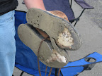
we could gather, they had arrived here via Te Heuheu after following the east-most t-bar (if I were a skier I may know what this one is called), and joining Pinnacle Ridge at some point above the pinnacles from which the ridge is named. Graham’s boots were falling apart. The small hole developing in mine was no contest for his complete adhesive failure on the soles of both boots! The grippy part was gone and he was now wearing our the squishy bit before getting down to the inner-soles and then his bare feet. Jane mentioned that it would be nice to know that were some other people around on their way down. I think she was a little more exhausted than I realised at the time.


On the way down we picked up a trail from the saddle below Glacier Knob that led down the Restful Ridge route. We caught up to Jane as she was slightly nervously descending a snow filled gully. This is by no means unusual for people who have descended snow a lot. Mike and I assisted her down the snow section as both Graham and Jane were becoming concerned with reaching the chair-lift before it stopped operating at 4pm.


After the snow section Mike and I ended up a little ahead, and following our noses headed further eastward to get back to the Waterfall t-bar that leads toward the Waterfall Express chair-lift. Having now lost sight if our British visitors we turned to see which route they were taking. They appeared to be moving toward a different chair-lift that was not operating, and also in a direction that was not  a direct-line toward the car-park. While the conditions were good and their should have been sufficient time and light for them to change their direction and reach the car-park, knowing that they were tired and now probably suffering from a case of get-there-itice, it did seem prudent to assist them back to the Waterfall Express chair-lift. It wasn’t until we arrived home to Wellington that we read the media reports of a Greek tourist who had spent the previous night on the mountain. We scrambled down the moraine to where they were and assisted them in the direction of the chair-lift. Mike went ahead to let the chairlift operator know that we were coming and not to stop it. We were scampering over moraine less straight forward than where we had been but we were travelling in the right direction and managed to thread our way between the undesirably steep sections before crossing the stream, and onto a track in front of mound hosting the Alpine Club Hut. Form here there was a more worn route directed us to the Waterfall Express chairlift.


Once at the chairlift, the friendly chair-lift operator, Jane and Graham convinced Mike and I to take the lift instead of walking as we had intended. Incidentally, the chairlift operator was also a marshal from the Ruapehu Classic cycle event the day before :).  About 13 minutes down via the Waterfall Express and Rock Garden chair’s was probably saved us about half an hour of walking.


Once back at the carpark, Jane and Graham kindly made us some coffee in their campervan which we enjoyed before the long drive back to Wellington. Thanks for the coffee, I hope you found some boots and that you are enjoying the rest of your holiday.

Saturday, 6 February 2010

Chasing the Lanterne Rogue – The Ruapehu Cycle Classic 2010

After a gorgeous night sky sleeping under the stars near Ohakune I was amped up for the Ruapehu Classic. It was a cracker of day. My only concern was the potential for a long “time-trial” with limited opportunities for drafting with a smallish field. In the end it was an unusual and eventful day for me out on the course.

Not far out of the start in Ohakune, I found myself in a small group of 6-8 riders. Regardless of jittery beginnings with different approaches to operating as a bunch we were soon all taking our leads and then peeling off for a rest at the back of the group. My legs felt good and we were travelling well along the Desert Road with views of Mt Ruapehu dominating the landscape.

BANG!!! It sure did sound like a firearm, but no, it was not from the live firing military site beside us. That was my back tyre. So loud and echoey, my initial reaction was not ohno, I have a puncture but do I still have a tyre to continue on? SIGH!
Ride Data:
Distance: 143km* 6,214 Calories*
Elevation: Ascent: 1715m* Descent: 1714m*
Ride Data: Garmin Connect Player
Location: Ohuakune, NZ 6 February 2010
* Some missing data due to short ride with SAG etc.
Surveying the damage, the bead that holds the tyre to the rim was, well, holding onto the rim. However, the bursting explosion, (or in this volcanic area should I say eruption?) of my inner tube had pushed the a large section of tyre away from the bead. Hence, the bead was holding onto the rim, but the tyre was not holding onto the bead :(.

Conventional wisdom suggests that a tube failure of this nature occurs when the inner-tube is not correctly located within the tyre walls, and the explosion occurs from part of the tube being exploded outside the tyre wall or from pressure from the tyre bead. With some 1000km since my previous puncture, including events over the previous three weekends of 150km, 110km and 152km without incident it is hard to understand how this could have been.

[[I would have an impressive photo of the tyre to go here if I had remembered to collect it from SAG after the event]]

With no sign of the SAG Wagon or any mechanical support I pursued the futile endeavour of replacing the inner-tube and attempting to mount the tyre. Nope. I just proved it was broken like I already knew! About 40 minutes later the St John Ambulance came by. The had lots of bandages but no tyres and told me that the SAG Wagon was still a further 20 minutes behind. The SAG Wagon arrived 58 minutes after my tyre went BANG!. Unfortunately no spare tyres were on offer so I reluctantly loaded my bicycle into the van after a mere of 31km of riding. It seemed all over for me today.

Travelling in the SAG Wagon (well van actually) we followed and accounted for the last few riders in the event as we travelled up and down this section of the Desert Road a few times before following them into the first relay changeover point at Tukino. While I was shaking my head, musing about only riding 31km and quite possibly sulking in disappointment, I was offered the use of one of the relay riders bikes. The sizing didn’t look too good for me and I negotiated to borrow a tyre. Thankyou #359! The only condition was that I put it back on her bike afterwards :). After swapping the tyres over and getting my things back together I was soon back on the course, but being substantially behind last place I was now the new lanterne rouge. It would be a handicap race now and a matter of how many places I good make up.

Excited to back on the road after a two hour delay I was travelling well along the Desert Road as the dominant views moved from Mt Ruapehu to Mt Ngauruhoe considering the unavailability of any other riders to draft. Following the twists and turns through the Three Sisters I had to wait about five minutes for the oncoming traffic before I was able to make my way through the road works. Waiting with a rider here, once we were through I lost the title of lanterne rouge.

Soon through to Rangipo, it was time for what I believe is the worst climb of this route up past Ketetahi. It is not steep, but it does keep coming and the road surface is not particularly smooth with very large stones used in the chipseal here. I must have been doing okay as I picked up another 3 or  4 places on the way over this hill.

By the time I was on the set of hills that make the climb past Mangatapopo, I was certainly slowing. I think this was some combination of some over enthusiasm as I rejoined the event, not seeing any riders ahead of me to aim for and well, far enough ahead of the SAG Wagon now to not get caught slacking :>. In fact it wasn’t until about 9km to go that I picked up a further two places. I finished with another ride in sight sight that I was unable to reel in, even with a big sprint at the line. The event timing had my finishing time as 7h38m40s, which didn’t seem too bad with a two hour delay and a lot of riding by myself.

I had a lot of fun today. Certainly the day did not unfold how I expected, and paying for new parts is never fun. Beautiful weather and a scenic course. Back again next year for hopefully a less eventful ride.

The Ruapehu Classic takes place over a beautifully scenic course. I think that riding across the Desert Road, where many drivers often appear to think that speed limits do not apply puts many cyclists off entering this event. With a 7am start, and blowouts excepted leaving the Desert Road by 10am doesn’t make this as much of a problem as is perceived due the distance from here to the major cities.

A big thanks to the people in the SAG for rescuing me, sorry forgotten your names now, and to #359 for loaning me the tyre that enabled me to make it through to the finish. Hope you are enjoying the sunglasses that you won today.